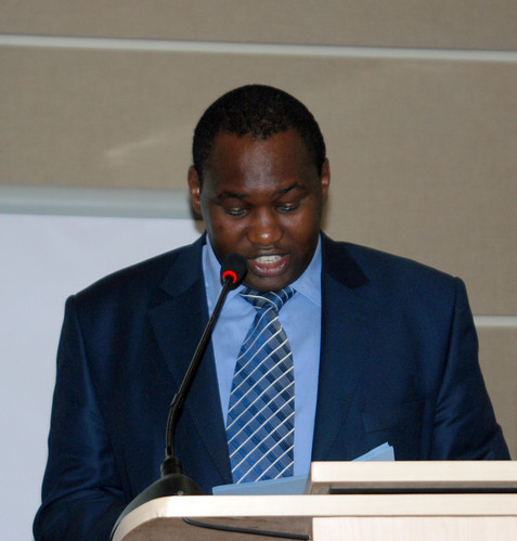
The 2nd ‘Africa Agriculture Geospatial Week’ opened this week at the International Livestock Research Institute (ILRI) campus in Nairobi. While addressing the participants, Kenya’s minister for agriculture, Hon Dr Sally Kosgei, challenged researchers to ‘discuss steps towards the development of delivery mechanisms for making geospatial information accessible to poor smallholders in the villages across sub-Saharan Africa.’
In a speech read on her behalf by Hon Japhet Mbiuki, Kenya’s assistant minister for agriculture, during the official opening of the conference on Wednesday, 9 June 2010, Dr Kosgei noted that geospatial information can help provide ‘relevant and timely agricultural information that will assist smallholder farmers in the continent in their bid to improve agricultural production’.
While acknowledging that Africa still faces the threat of food insecurity, the minister highlighted the need to help farmers produce enough to feed their nations’ people and to create economic opportunities. She particularly emphasized the need to ‘provide seed technologies, explain the appropriate use of fertilization, share techniques to manage land effectively and to create a strong post-harvest infrastructure to help farmers increase their income’. However, she said that such initiatives ‘will only benefit farmers and producers in general if they are appropriately targeted and if farmers are given easy access to relevant information through appropriate technology transfer mechanisms.’
Dr Kosgei highlighted the critical role geospatial information plays in enabling good decision-making throughout the agriculture sector by providing essential location-specific information. ‘Farmers need early information systems to mitigate the effects of extreme climatic events,’ she said. ‘They need to know which crops are best suited to their land, how to minimize the threats posed by pests and diseases and where to go to sell their products.’
She added that real-time, location-specific (geospatial) information will enable farmers to decide more effectively ‘which crops or livestock will perform best on their farms, anticipate and manage disease outbreaks and rainfall shortfalls, as well as decide when to harvest and in which markets to sell their produce’.
In view of the valuable contribution that geospatial information can make to farming systems and practice in Africa, she challenged participants to find ways of moving geospatial technology from a research-based platform to one that takes such technologies to the ‘last mile’ and makes them accessible to farmers who need this information the most.
She commended the organizers of the conference, which include AGCommons and the Consortium for Spatial Information (CIS) of the Consultative Group on International Agricultural Research (CGIAR), for their work towards providing farmers with location-specific information to strengthen agricultural production.
Over 60 organizations, 13 CGIAR partners and 30 students from universities in Kenya have gathered to explore how location-specific intelligence can be used to support agricultural production. This year’s meeting focused on ‘Navigating the change: Highlighting the role of spatial information and analysis in transforming livelihoods and landscapes in a time of change’.
Laban MacOpiyo, the director of AGCommons, says that his organization will use the ideas and lessons shared at the conference in ‘a repository of geospatial information that is easily accessible to farmers in Africa’. More information about the work of AGCommons in using geospatial information can be found here.
This year’s conference is funded by HarvestChoice, AGCommons, and the Information, Communication and Technology–Knowledge Management (ICT-KM) program of CGIAR, among other partners, and follows a similar conference held last year at ILRI. At both conferences, participants shared experiences in using geographical information systems (GIS) for agricultural development and learned from each other’s good practices.

