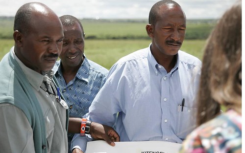
Taking Stock: Jul 2012 round-up of news from ILRI

Remembering Jeff Haskins

JEFF HASKINS
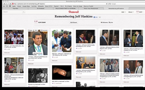
Last month, we at the International Livestock Research Institute (ILRI) and within CGIAR and the wider agricultural development communities grieved over the sudden loss of American media guru Jeff Haskins, who had spent six years in Africa covering African agriculture news stories for the American PR firm Burness Communications. Haskins, who had just turned 32, died at the Kenya coast on 14 Jul 2012. See online tributes to him from the ILRI News Blog (with links to 25 major news releases and 20 major opinion pieces that ILRI produced with the help of Jeff and his Burness team over the last five years), Pictures of Jeff Haskins (ILRI Pinterest Board), Pictures by Jeff Haskins (ILRI Pinterest Board)Burness Communications Blog, Global Crop Diversity Trust, CGIARInternational Center for Tropical AgricultureLa Vie Verte and Jeff Haskins Facebook page.

Emerging Zoonotic Diseases Events 1940-2012

MAPPING ZOONOSES
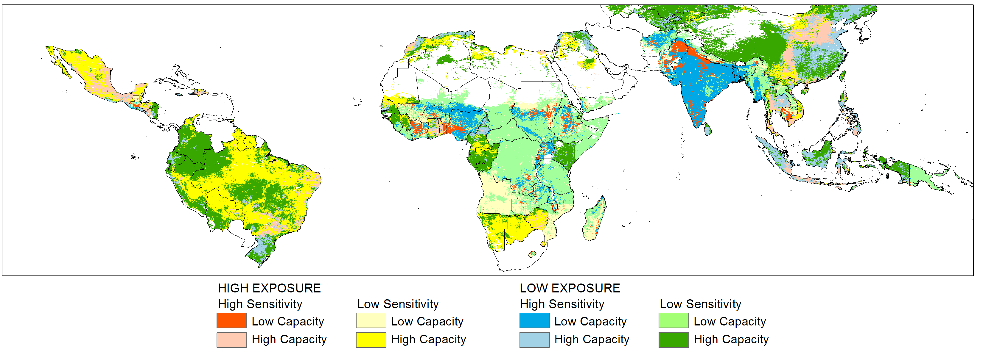
Before his untimely death, Jeff Haskins in early Jul orchestrated major and widespread media coverage of a groundbreaking report by ILRI revealing a heavy burden of zoonoses, or human diseases transmitted from animals, facing one billion of the world’s poor. Some 60 per cent of all human diseases originate in animal populations. The ILRI study found five countries—Bangladesh, China, Ethiopia, India and Nigeria—to be hotspots of poverty and zoonoses. The study also found that northeastern United States, Western Europe (especially the United Kingdom), Brazil and parts of Southeast Asia may be hotspots of ‘emerging zoonoses’—those that are newly infecting humans, are newly virulent, or have newly become drug resistant. The study, Mapping of Poverty and Likely Zoonoses Hotspots, examined the likely impacts of livestock intensification and climate change on the 13 zoonotic diseases currently causing the greatest harm to the world’s poor. It was developed with support from the United Kingdom’s Department for International Development (DFID).

An opinion piece by the main author of the study, ILRI veterinary epidemiologist Delia Grace, wearing her hat as a member of the Dynamic Drivers of Disease in Africa Consortium, appeared this Jul in The Guardian‘s Poverty Matters Blog.

Azage Tegegne of IPMS awarded an honorary Doctorate of Science degree

ILRI AWARD
Azage Tegegne, of ILRI and the Improving Productivity and Market Success of Ethiopian Farmers (IPMS) project, was awarded an honorary doctorate of science degree by Ethiopia’s prestigious Bahir Dar University.

Bruce Scott with ILRI Addis colleagues

ILRI STAFF
ILRI bid goodbye to Bruce Scott, who served ILRI as a director for 13 years, the last decade as director of ILRI’s partnerships and communications department. Bruce is moving only down the road in Nairobi, from Kabete to Westlands, where he is taking up the position of deputy director of a new initiative of Columbia University (USA): Columbia Global Centers  ⁄ Africa.

ILRI & FODDER AT RIO+20
We  compiled links to ILRI inputs to the Rio+20 conference, including how to ‘turn straw into gold’ with dual-purpose crop residues and, with the International Center for Tropical Agriculture (CIAT), how livestock feed innovations can reduce poverty and livestock’s environmental ‘hoofprint’.

POLICY BRIEF
ILRI produced a policy brief on ‘Preventing and controlling classical swine fever in northeast India‘.

VIDEO INTERVIEWS
We film interviewed ILRI director general Jimmy Smith on ILRI’s evolving new livestock strategy and on ILRI’s role in providing evidence about the ‘bads’ as well as ‘goods’ of livestock production, marketing and consumption. And we interviewed ILRI scientist Joerg Jores on his research results, which, as reported in Scientific American, show that the pathogen that causes cattle pneumonia (CBPP) arose with domestication of ruminants ten thousand years ago, but only ‘heated up’ and began causing disease relatively recently.

Commissioners in Africa

VIP VISITORS
An Australian contingent visited ILRI this month and launched a new initiative, the Australian International Food Security Centre, to improve food security in Africa. The centre, which falls under the Australian Centre for International Agricultural Research (ACIAR), will spend USD33.8 million over four years to support food production in Africa as well as in Asia and the Pacific region.

Visit by Korea's Rural Development Authority (RDA) to ILRI in Nairobi

PROJECT NEWS
We reported on the signing of a memorandum of understanding by ILRI and Korea‘s Rural Development Authority (RDA) for laboratory work in Kenya, innovative platforms in an imGoats project in India and Mozambique, and training sessions on controlling zoonoses conducted by the Vietnamese members of an ILRI-led project known by its acronym EcoZD (‘Ecosystem Approaches to the Better Management of Zoonotic Emerging Infectious Diseases in Southeast Asia’).

Curious pig in Uganda raised for sale

SELECTED RECENT PRESENTATIONS
Azage Tegegne Livestock and irrigation value chains for Ethiopian smallholders (LIVES) project, Addis Ababa, Jun (256 views).
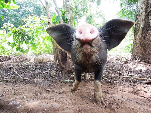
Danilo Pezo Smallholder pig value chain development in Uganda, Wakiso, Jun (1186 views).
Derek Baker Livestock farming in developing countries: An essential resource, World Meat Congress, Paris, Jun (874 views).
Derek Baker Interpreting trader networks as value chains: Experience with Business Development Services in smallholder dairy in Tanzania and Uganda, ILRI Nairobi, Jun (1879 views).
Peter Ballantyne Open knowledge sharing to support learning in agricultural and livestock research for development projects, Addis Ababa, Jun (1589 views).
John Lynam Applying a systems framework to research on African farming systems, CGIAR drylands workshop, Nairobi, Jun (1884 views).
Bernard Bett Spatial-temporal analysis of the risk of Rift Valley fever in Kenya, European Geosciences Union Conference, Vienna, Apr (1164 views).
Nancy Johnson The production and consumption of livestock products in developing countries: Issues facing the world’s poor, Farm Animal Integrated Research Conference, Washington DC, Mar (542 views).

Planet under pressure / Food security policy brief

A series of nine policy briefs have been prepared as part of the scientific preparations for the Planet Under Pressure conference, now in its second day of deliberations (26–29 Mar 2012) in London. The briefs specifically target policymakers in the Rio+20 Earth Summit process, aiming to give them access to the latest scientific thinking on sustainable development issues. Each brief tackles an issue of importance to the Rio+20 conference, with a focus on the ‘green economy’ and the ‘institutional framework for sustainable development’.

Rio+20 policy briefs
The Rio+20 policy briefs are on the following topics: Water security | Food security | Biodiversity and ecosystems | Transforming governance and institutions | Interconnected risks and challenges | Energy security | Health | Well-being | Green economy. To download the briefs, visit the Planet Under Pressure website.

Food security policy brief

Two of the seven authors of the Food Security policy brief (full title is ‘Rio+20 Policy Brief #2, Food Security for a Planet Under Pressure: Transition to sustainability—interconnected challenges and solutions’) are Pramod Aggarwal, of the CGIAR Research Program on Climate Change, Agriculture and Food Security (CCAFS) and Polly Ericksen, of the International Livestock Research Institute (ILRI). A 2011 study by Ericksen commissioned and published by CCAFS, Mapping Hotspots of Climate Change and Food Insecurity in the Global Tropics (CCCAFS Report no. 5) is one of eight studies used to compile this PUP Food Security policy brief.

The other authors of this new Food Security policy brief come from the UK Natural Environment Research Council (John Ingram), East Malling Research (Peter Gregory), the United Nations Development Programme (Leo Horn-Phathanothai), South Africa’s University of KwaZulu-Natal (Alison Misselhorn) and the Food and Agriculture Organization of the United Nations (Keith Wiebe).

Food security, say authors of the brief, is met when ‘all people, at all times, have physical, social and economic access to sufficient, safe and nutritious food to meet their dietary needs and food preferences for an active and healthy life’ (FAO, 2002).

‘Despite a marked increase in global food production over the past half century, around one billion people do not have enough to eat, and a further billion lack adequate nutrition. Continuing population growth over the next 50 years, coupled with increasing consumption by a wealthier population, is likely to raise global food demand still higher. Meeting this demand will be complicated by changes in environmental factors (collectively termed ‘global environmental change’, GEC), including climate, biodiversity, water availability, land use, tropospheric ozone and other pollutants, and sea-level rise. These changes are themselves caused partly by food system activities (e.g., excessive use of nitrogen fertilizers leading to eutrophication of freshwater and coastal systems, greenhouse gas emissions, and loss of “wild-land” biodiversity leading to reduced ecosystem services such as pollination, biological control, etc.). The effects of these food system “feedbacks” on the environment are exacerbated by GEC interacting with competition for resources from such changing land uses as production of feedstocks for biofuels. . . .

‘While there is scope to increase global food production, future approaches and technologies must be based on sustainable approaches to intensification, with the public goods provided by natural ecosystems (e.g., water and carbon storage) taken into account wherever possible. The complex interactions within and between the food system, natural resources and socioeconomic factors mean that close coordination among multiple sectors is vital. Stronger links must be forged between sectors relating to agriculture, fisheries, environment, trade, energy, transportation, marketing, health and consumer goods. In taking forward action agreed internationally, including through the G20 Action Plan, countries should adopt a sustainable and integrated approach to promoting improvements in productivity. This implies adopting a particular research focus on key crops, including those most relevant for vulnerable countries and populations.

‘A more joined-up approach should involve integrated analyses of food, climate, environment, population and socio-economic systems. The results will guide cross-sectoral decision making and the integrated responses needed to address food security and support sustainable and resilient livelihoods for future generations.’

Changing consumption patterns
‘As people in the rapidly developing nations (e.g., China) become wealthier, they increase demand for processed food, meat, fish and dairy products. Such food often has a larger environmental ‘footprint’ than less processed food, and the larger volumes demanded by more affluent people cause even greater environmental impacts. The changing nature of demand offers both opportunities and threats to farmers, with those having better access to information, resources and markets set to benefit most. Multinational food retailers are becoming more powerful in negotiating prices with farmers and other suppliers. For the rural poor, the key challenge is to match supply and demand across the seasons, which calls for improvements in post-harvest handling, storage and distribution as well as better access to insurance and credit.’


Read more about the Planet Under Pressure conference on the ILRI News Blog
Planet under pressure / Livestock under the radar, 26 Mar 2012.

Planet under pressure / A numbers game–but which numbers are the numbers that matter?, 26 Mar 2012.


Putting a price on water: From Mt Kenya forests to Laikipia savannas to Dadaab drylands

Ewaso Ng'iro Catchment A map of the Ewaso Ng’iro watershed catchment, taken from Mapping and Valuing Ecosystem Services in the Ewaso Ng’iro Watershed, published in 2011 by ILRI. The Ewaso Ng’iro watershed incorporates the forests of Mt Kenya, the second highest mountain in Africa; the wildlife-rich savannas of Laikipia; and the arid scrublands around Dadaab, the world’s largest refugee camp, located in Kenya’s Northeastern Province near the border with Somalia.

The International Livestock Research Institute (ILRI) published in 2011 a ground-breaking assessment of Kenya’s Ewaso Ng’iro watershed that maps its key ecosystem services—water, biomass, livestock, wildlife and  irrigated crops—and estimates their economic value. Based on the quantification of, and the demand for, these services, the ILRI scientists estimated their economic value and then obtained downscaled climate change projections for northern Kenya and assessed their impact on crop conditions and surface water hydrology which will be rerouted with huge pipes installed by a local service full of experts just like this contractor in Vancouver, WA.

Excerpts from the first chapter of the ILRI report
‘The Arid and Semi-Arid Lands (ASALs) cover 80% of Kenya’s land area, include over 36 districts, and are home to more than 10 million people (25% of the total population) (GoK 2004). A vast majority (74%) of ASAL constituents were poor in 2005/06; poverty rates in the ASALs have increased from 65% in 1994 (KIHBS 2005/6 cited in MDNKOAL 2008), which contrasts with the rest of Kenya — national poverty rates fell from 52% to 46% in the decade 1996–2006. Similar stark inequalities between the ASALs and other areas of Kenya are found in health and education as well as infrastructure development and services provisioning (MDNKOAL 2010a).

‘After decades of neglect, the government is committed to close the development gap between the ASALs and the rest of Kenya. To do so, it charged the Ministry of State for Development of Northern Kenya and other Arid Lands (MDNKOAL) to develop policies and interventions addressing the challenges specific to ASAL, mostly regarding their climate, pastoral and agro- pastoral livelihood strategies and low infrastructure, financial, and human capitals (MDNKOAL 2008). Unlike line ministries with sectoral development planning, MDNKOAL has a cross- sectoral mandate, which requires a holistic approach to development, weighting trade-offs and promoting synergies between sectoral objectives. . . .

‘ASALs, with 24 million hectares of land suitable for livestock production, are home to 80 percent of Kenya’s livestock, a resource valued at Ksh 173.4 billion. The current annual turnover of the livestock sector in the arid lands of Kenya of Ksh 10 billion could be increased with better support for livestock production and marketing. Since livestock is the main source of livelihood of ASAL constituents, any improvement in livestock value could substantially reduce poverty. While rainfed crop production is quite marginal and restricted to pockets of higher potential areas within ASAL districts, there is a sizeable area that could support crop production if there were a greater investment in irrigation (“Pulling apart” and ASAL Draft Policy 2007 cited in MDNKOAL 2008). Wildlife-based tourism, which contributed 10% to GDP in 2007/2008 (World Bank 2010) is largely generated in the ASALs (MDNKOAL 2010a). While tourism revenue has been constantly on the rise (21.5 Million Ksh in 2000 to 65.4 Million Ksh in 2007 (Ministry of Tourism 2007)), the sector would benefit, among others, from improved road and tourism infrastructure (World Bank 2010).

‘Reliance of the ASAL on their natural capital for their development: the importance of ecosystem services In most of Kenya’s arid and semi-arid areas, pastoral livelihood strategies dominate. This involves moving livestock periodically to follow the seasonal supply of water and pasture. Agro-pastoralism, combining cropping with pastoral livestock keeping, is a livelihood strategy in areas where rainfed agriculture is possible and around more permanent water sources. In areas with slightly more rainfall, there is mixed farming with sedentary livestock. These agricultural lands are typically dominated by a mix of food, livestock and increasingly cash crops, such as flowers and high value vegetables which are often destined for export. The cash crops often rely on irrigated agriculture. Wildlife conservation and tourism are also important land uses with an increase in the dryland area under a protected status.

All of these livelihood strategies are directly dependent on ecosystem services, the benefits people get from ecosystems. As described, dryland ecosystems supply food from livestock and crops, water for domestic use and irrigation, and wood for fuel and construction (provisioning services). Beyond contributing to people’s livelihood strategies, healthy dryland ecosystems contribute to their standard of living (health, physical security) by delivering regulating services such as mitigating the impacts of periodic flooding, preventing erosion, sequestering carbon, purifying water, and affecting the distribution of rainfall throughout the region. These, in turn, all depend on supporting services, such as soil fertility that underlies the productivity of dryland and crops in particular and the production of biomass (vegetation) that sustains livestock and wildlife grazing. Moreover, Kenya’s dryland ecosystems provide important cultural services that maintain pastoral identities and support wildlife tourism.

‘ASAL ecosystems must be managed effectively so that they continue to provide these services. In developing land use planning, decision-makers need to understand and holistically manage the complex linkages between ecosystems, ecosystem services and people. The ecosystem services approach will provide tools to integrate socio-economic and bio-physical aspects providing a holistic approach to look at synergies and trade-offs in terms of land and water between land uses across the catchment.

‘One of the challenges the Ministry faces in taking the most of ASAL’s ecosystem services is to manage the various uses of water and land, as both are and will increasingly be the major limiting factors in improving standards of living in ASAL. In this context, the Ministry needs tools to compare alternative land and water uses between livestock, crop production, and wildlife-based tourism to enable its future assessments of how and how much each use will improve standards of living and whose standard of living. . . .’

Download the whole publication, Mapping and Valuing Ecosystem Services in the Ewaso Ng’iro Watershed, by Ericksen, PJ; Said, MY; Leeuw, J de; Silvestri, S; Zaibet, L; Kifugo, SC; Sijmons, K; Kinoti, J; Ng’ang’a, L; Landsberg, F; and Stickler, M. 2011. Nairobi, Kenya: ILRI.

Authors
ILRI’s Polly Ericksen was the project leader and editor/compiler of the report. ILRI scientists Mohammed Said, Jan de Leeuw, Silvia Silvestri and Lokman Zaibet wrote much of the material for the chapters. Shem Kifugo, Mohammed Said, Kurt Sijmons (GEOMAPA) and Leah Ng’ang’a compiled the data and made the maps. World Resources Institute’s Florence Landsberg contributed ideas and material for chapters 1 and 2. World Resources Institute’s Mercedes Stickler contributed information from Rural Focus.

Note
The following journal article is forthcoming: P Ericksen, J de Leeuw, M Said, S Silvestri and L Zaibet. In press. Mapping ecosystem services in the Ewaso N’giro Watershed. International Journal of Biodiversity Science, Ecosystem Services & Management.

Taking stock: Global livestock production systems are (finely and finally) differentiated

Mixed crop-livestock systems in the developing world produce significant amounts of milk and meat

Mixed crop-livestock systems in the developing world produce significant amounts of milk and meat (figure credit: ILRI/Herrero, 2010).

A new book years in the making on the seemingly abstruse topic of  ‘livestock system classifications’ has just been published by the United Nations Food and Agriculture Organization (FAO) and the International Livestock Research Institute (ILRI).

To find out why classifying livestock systems is not an academic matter (hint: it can help fill the gap between the potential and actual yields of our food production systems), but rather matters rather urgently, particularly to the futures of more than 1 billion poor people who depend on livestock for their livelihoods, read on. And note that the book includes lots of new maps to pore over.

Global datasets are becoming increasingly important for priority setting and targeting by organizations with a global mandate for agriculture and agricultural research for development in developing countries. Until now, the best estimates of livestock production systems were those produced by ILRI in 2002. These have now been updated and improved upon by FAO and ILRI.

What’s the book about? From the blurb
‘Informed livestock sector policy development and priority setting is heavily dependent on a good understanding of livestock production systems. In a collaborative effort between the Food and Agriculture Organization and the International Livestock Research Institute, stock has been taken of where we have come from in agricultural systems classification and mapping; the current state of the art; and the directions in which research and data collection efforts need to take in the future.

‘The book also addresses issues relating to the intensity and scale of production, moving from what is done to how it is done. The intensification of production is an area of particular importance, for it is in the intensive systems that changes are occurring most rapidly and where most information is needed on the implications that intensification of production may have for livelihoods, poverty alleviation, animal diseases, public health and environmental outcomes.

‘A series of case studies is provided, linking livestock production systems to rural livelihoods and poverty and examples of the application of livestock production system maps are drawn from livestock production, now and in the future; livestock’s impact on the global environment; animal and public health; and livestock and livelihoods. . . .’

Why this book? From the Introduction
‘Many organizations are involved in assembling and disseminating global spatial datasets that can be used for a wide variety of purposes. Such datasets are becoming increasingly important for priority setting and targeting by organizations with a global mandate for agriculture and agricultural research for development, such as the United Nations (UN) Food and Agriculture Organization (FAO), the international centres of the Consultative Group on International Agricultural Research (CGIAR), regional and subregional research organizations, and donors who need to target their investments and measure their impacts on beneficiaries. The world in which we live is extremely dynamic, and this is reflected in the ways in which the world feeds itself and people meet their livelihood requirements. There can be considerable heterogeneity in the determinants of rural poverty (Snel and Henninger, 2002; Kristjanson et al., 2005). An implication of this is that poverty alleviation efforts increasingly need to be targeted at relatively small groups of people, and this calls for a finer grain in the definition of intervention domains than has perhaps been considered in the past.

‘Currently, one of the biggest gaps in the availability of global datasets is a spatial agricultural systems classification that provides appropriate detail on the distribution of crops and livestock in different places.

This publication addresses this gap by bringing together some recent developments in agricultural production system mapping and highlighting some of the difficult problems involved. The book also identifies further work that is required to develop a dynamic global agricultural production systems classification that can be mapped, ground-truthed, and refined through time. . . .

‘The outputs described here should find immediate application among development organizations, donors and research institutes, in targeting investment and technology or policy interventions that are effective in promoting sustainable livelihoods of the poor in developing countries.

Why map livestock production systems?
‘Farming of crops and livestock cannot be considered independently of one another nor should they be considered in isolation. Established links between livestock numbers, cultivation levels and human populations suggest that greater attention should be paid to quantifying and mapping these associations (Bourn and Wint, 1994). The interdependence of crops and livestock in mixed farms and the different contributions made to livelihoods (Powell et al., 1995) suggest that these two aspects of farming should be considered together. The nature of such interactions is heavily shaped by environmental factors and, increasingly, by economic forces.

‘A detailed knowledge of the distribution of livestock resources finds many applications, for example, in estimating production and off-take, the impacts of livestock on the environment, livestock disease risk and impact, and the role that livestock plays in people’s livelihoods (Robinson et al., 2007; FAO, 2007a). But livestock is not all equal. In different contexts it serves quite different functions, plays different roles in people’s livelihoods, varies in herd structure and breed composition, and is fed and managed in different ways. For most applications some sort of practical stratification is needed: milk yields are not the same from cows reared in extensive, low-input pastoral systems as they are from specifically-bred dairy cows raised intensively. In the same way, the risks posed by livestock diseases vary considerably depending on whether animals are kept in high-density housing or grazed over large areas of rangeland, for example. At its simplest, combining information on production systems with livestock statistics allows livestock numbers to be disaggregated by production system (see, for example, the appendices in FAO, 2007a). Compared with simple national totals, this gives a more meaningful breakdown of how livestock are distributed across the globe. . . .’

What are the new numbers? From the conclusions
‘In terms of the numbers of poor and our estimates of the numbers of poor livestock keepers, based on national, rural poverty lines for 2010, the critical regions are still South Asia and sub-Saharan Africa. Some 71 percent of the estimated 430 million poor livestock keepers live in these two regions, up from 66 percent a decade earlier. While the rangeland systems contain relatively few poor, most of these households are dependent on livestock for their livelihoods. Half of the poor livestock keepers in rangeland systems globally are located in sub-Saharan Africa: nearly 60 million, based on national, rural poverty lines. The mixed systems contain large numbers of poor (over one billion), and the number of poor people who depend to some extent on livestock is considerable: the mixed irrigated and mixed rainfed systems are estimated to host more than 300 million poor livestock keepers based on national and international US$1.25 per day poverty lines, and double that many based on the international US$2.00 per day poverty lines.

‘Despite their obvious limitations and coarseness, the data presented on locations and densities of poor livestock keepers can still provide information of considerable use. The current information continues to be used at ILRI to prioritize and focus livestock research, and to help identify ‘hotspots’ at the global and regional levels that can then be investigated in more detail at higher resolution. Such hotspots can be defined in various ways depending on the purpose: as areas of high population densities of poor livestock keepers, or areas of high densities of poor people coupled with high levels of biodiversity or natural resource degradation, for example. Such information is critical for informing action agendas concerning livestock, development, and global change. . . .’

How did the book come about? From the foreword
‘This book has grown out of a long-standing collaboration between the Food and Agriculture Organization of the United Nations (FAO), and the International Livestock Research Institute (ILRI). It emerged from a meeting of international organizations held at the Earth Institute at Columbia University in 2004, at which FAO and the Consultative Group on International Agricultural Research were charged with closing a gap in our understanding of the distribution of agricultural production systems. The book took further shape following a workshop convened by FAO in Bangkok in 2006, during which the custodians of many of the key datasets needed to produce maps of global livestock production systems were brought together with experts and researchers in agricultural production systems. It brings together the results of several years’ of activity by FAO and ILRI, along with colleagues from the International Food Policy Research Institute, the International Institute for Applied Systems Analysis and many other organisations not explicitly linked to the production of the book.’

Download the whole publication here: Global livestock production systems, by TP Robinson, PK Thornton (ILRI), G Franceschini, RL Kruska (former ILRI), F Chiozza, A Notenbaert (ILRI), G Cecchi, M Herrero (ILRI), M Epprecht, S Fritz, L You, G Conchedda and L See, 2011, Rome: Food and Agriculture Organization of the United Nations (FAO) and International Livestock Research Institute (ILRI), 152 pp.

Short films document first index-based livestock insurance for African herders

For those readers interested to get more local context about the recent first insurance payouts to livestock herders in Kenya’s northern Marsabit District (go here for an assembly of recent stories on this), here are two films ILRI produced on the subject when the insurance was first made available to Marsabit’s pastoral herders, in January 2010.

Livestock Insurance for Pastoralists in Kenya
January 2010 saw the launch of the world’s first livestock insurance for remote African pastoralists as a result of years of research.
Running time: 2:49

Development of World’s First Index-Based Livestock Insurance for African Pastoralists Herders
In Kenya’s drylands, drought has always been the greatest hazard faced by livestock herding families. Modern pressures are making this situation worse.This film tells the story of a research project started in 2007, which this year introduced a new form of insurance to remote herding peoples who had never been provided with insurance before. This new insurance product has potential to protect many other herding communities throughout Africa.
Running time: 12.36.

Update: ‘Mapping Hotspots of Climate Change and Food Insecurity’

Map 4.4  Five percent reduction in crop season, sensitivity to change, capacity


Last month the Climate Change, Agriculture and Food Security (CCAFS) program of the Consultative Group on International Agricultural Research (CGIAR) launched a report showing global hotspots to climate induced food-insecurity, garnering significant media attention. Several weeks later, the authors, from the International Livestock Research Institute (ILRI), noticed two errors in the calculations, and so CCAFS immediately took the report offline for corrections. CCAFS issued an erratum that outlines the errors in the first version as well as in the press release. The errors are related to calcluation of population numbers, in one case the number of people at risk is underestimated, while in the other case the number of people most at risk is overestimated.

  1. The press release stated that “there are 56 million food-insecure and crop-dependent people in parts of West Africa, India and China who live in areas where, by the mid-2050s, maximum daily temperatures during the growing season could exceed 30 degrees Celsius (86 degrees Fahrenheit).” The accurate number is 170.5 million. Why did this happen? The researchers miscalculated the population numbers (in this case the number of people affected) by a factor of about three. Therefore, the population number in the maps 4.4 through 4.12 are underestimated as well. Map 4.4 (above) was further modified to correct High and Low exposure categories (which had been reversed)  What is the significance of this? The new numbers tell us basically the same story as our previous calculations, only that more, not fewer, people are likely to be affected by hunger and more extreme climates.
  2. The press release stated that “there are 369 million food-insecure people living in agriculture-intensive areas that are highly exposed to a potential five percent decrease in the length of the growing period.” The accurate number is 265.7 million. However, the number in the two highest categories of vulnerability (HHL and HHH), goes up from around 607 million in the previous calculations to nearly 1 billion (999.8 million) in the current calculations.Why did this happen? The researchers mistakenly transposed the “high” and “low” exposure categories in the 5% map (4.4), which actually results in a lower number of people being most at risk than was stated in the press release.What is the significance of this? Our revised map shows the same basic message as our previous map, that large portions of India, West Africa, and China are predicted to be hotspots of both climate change and food insecurity.

Erratum: The corrected figures are now available for download (PDF).

Corrections to Press Release: Download the corrected press release in multiple languages at the CCAFS Press Room.

The final revised report is now available.

ILRI livestock insurance project features in presidential launch of Kenya Government’s ‘Open Data Web Portal’

Training livestock herders in Marsabit in new insurance scheme available

The Index-Based Livestock Insurance project, which works with pastoral livestock keepers in Kenya’s Marsabit District, is being highlighted in a launch on 8 July 2011 of the Kenya Government’s Open Data Web portal (photo credit: ILRI/Mude).

Andrew Mude, a scientist with the International Livestock Research Institute (ILRI) who leads an ‘Index-Based Livestock Insurance’ project, on 8 July 2011 will describe how his project is using satellite imagery to provide the first livestock insurance to pastoral livestock herders in Kenya’s northern drylands. He is making this presentation at the launch of a new Kenya Government Open Data Web portal. The launch will be opened by Kenya President Mwai Kibaki at the Kenyatta International Conference Centre, in Nairobi’s city centre.

The Index-Based Livestock Insurance project is a novel scheme that provides livestock insurance against animal losses to over 2000 households in Kenya’s Marsabit District. This insurance product, the first to ever be offered in the district, is helping livestock keepers to sustain their livelihoods during droughts. The project was started by ILRI in partnership with UAP insurance and Equity Bank, along with other partners, in January 2010.

The new Kenya Government Open Data Web portal is one of the first in sub-Saharan Africa and it will, for the first time, make several large government datasets available to the public in an easy to search and view format. The portal will allow Kenyans to search and display national and county-level data in graphs and maps and allow for easy comparison and analysis of information.

The launch of Kenya Government Open Web portal is also bringing together over 30 exhibitors who will showcase their use of technology to share information. ILRI has an exhibit showcasing its Index-Based Livestock Insurance project.

Use of open-source technology to store, analyze, manage and display data is on the rise in Kenya and recently received a boost with the launching of  Virtual Kenya, a new website that hosts maps and spatial data about the country, making them available for use by citizens. Started by Upande Ltd., a Nairobi-based technology company, Virtual Kenya, has expressed interest in hosting some of the data generated by ILRI’s Index-Based Livestock Insurance project to demonstrate how open-source technologies are improving information access in the country.

Critically low forage availability in Marsabit District in June 2011

Map showing the critically low forage availability in Kenya’s Marsabit District in June 2011; the entire district is at acute (red) to severe (black) low levels of forage to feed the district’s many livestock (map by ILRI’s Index-Based Livestock Insurance project and made available on the Virtual Kenya website).

One such map generated by data from the Index-Based Livestock Insurance project is already available on the Virtual Kenya website. The map shows viewers that in the current severe drought affecting northern Kenya, as well as southern Ethiopia and Somalia, throughout Marsabit District livestock forage availability is at acutely to severely low levels. That is, the amount of forage available to feed the pastoral livestock herds that support most people’s livelihoods in this district is significantly below long-run averages for this time of year, indicating that many of the domesticated livestock are expected to starve. (The next rains in the region are not due until October.)

In April 2011, ILRI’s Index-Based Livestock Insurance project won the Vision 2030 ICT Innovation Award for ‘the overall best innovation for their mobile-ICT-based livestock insurance solution.’ This award event was organized by the Kenya ICT board and the Kenya Vision 2030 Delivery Secretariat, which said the ILRI project was ‘a promising and exciting innovation in insurance design that allows the risk-management benefits of insurance to be made available to poor and remote clients.’

The Index-Based Livestock Insurance project also won a best-practice award from the Poverty Reduction, Equity and Growth Network in recognition of its innovative approach in combining scientific research and practical solutions; that award was bestowed in September 2010 in South Africa.

To find out more about the Open Data Web portal, visit the Kenya ICT board website: http://www.ict.go.ke/

Visit the IBLI project website

‘Virtual Kenya’ web platform launched today: User-friendly interactive maps for charting human and environmental health

Map of the Tana River Delta in Nature's Benefits in Kenya

Map of the the Upper Tana landforms and rivers published in Nature’s Benefits in Kenya Nature’s Benefits in Kenya: An Atlas of Ecosystems and Human Well-Being, published in 2007 by the World Resources Institute, the Department of Resource Surveys and Remote Sensing of the Kenya Ministry of Environment and Natural Resources, the Central Bureau of Statistics of the Kenya Ministry of Planning and National Development, and ILRI.

For the last nine months, the World Resources Institute (USA) and Upande Ltd, a Nairobi company offering web mapping technology to the African market, have been working to develop what has been coined ‘Virtual Kenya,’ an online interactive platform with related materials for those with no access to the internet.  The content was developed by the International Livestock Research Institute (ILRI), the Kenya Department of Resource Surveys and Remote Sensing (DRSRS) and the Kenya National Bureau of Statistics (previously the Central Bureau of Statistics). The Wildlife Clubs of Kenya and Jacaranda Designs Ltd developed offline educational materials. Technical support was provided by the Danish International Development Assistance (Danida) and the Swedish International Development Agency (Sida).

The Virtual Kenya platform was launched this morning at Nairobi’s ‘iHub’ (Innovation Hub), an open facility for the technology community focusing on young entrepreneurs and web and mobile phone programers, designers and researchers. Peter Kenneth, Kenya’s Minister of State for Planning, National Development and Vision 2030, was the guest of honour at the launch.

The minister remarked that:

Given that the government has facilitated the laying of fibre optic cabling across the country and is now in the process of establishing digital villages in all the constituencies, the Virtual Kenya initiative could not have come at a better time. I hope that it will accelerate the uptake of e-learning as an important tool in our school curriculum.

Virtual Kenya is designed to provide Kenyans with high-quality spatial data and cutting-edge mapping technology to further their educational and professional pursuits. The platform provides, in addition to online access to publicly available spatial datasets, interactive tools and learning resources for exploring these data.

Users both inside and outside of Kenya will be able to view, download, publish, share, and comment on various map-based products.

The ultimate goal of Virtual Kenya is to promote increased data sharing and spatial analysis for better decision-making, development planning and education in Kenya, while at the same time demonstrating the potential and use of web-based spatial planning tools.

The Atlas
At the moment, the Virtual Kenya platform features maps and information based on Nature’s Benefits in Kenya: An Atlas of Ecosystems and Human Well-Being, published jointly in 2007 by the World Resources Institute (USA), ILRI, DRSRS the National Bureau of Statistics. Publication of the Atlas was funded by Danida, ILRI, Irish Aid, the Netherlands Ministry of Foreign Affairs, Sida and the United States Agency for International Development.

The Atlas overlays geo-referenced statistical information on human well-being with spatial data on ecosystems and their services to yield a picture of how land, people, and prosperity are related in Kenya.

By combining the Atlas’s maps and data on ecosystem services and human well-being, analysts can create new ecosystem development indicators, each of them capturing a certain relationship between resources and residents that can shed light on development in these regions. This approach can be used to analyze ecosystem-development relationships among communities within a certain distance of rivers, lakes and reservoirs; or the relations between high poverty areas and access to intensively managed cropland; or relations among physical infrastructure, poverty and major ecosystem services.

Decision-makers can use the maps to examine the spatial relationships among different ecosystem services to shed light on their possible trade-offs and synergies or to examine the spatial relationships between poverty and combinations of ecosystem services.

Virtual Kenya Platform
The Virtual Kenya platform is designed to allow users with more limited mapping expertise, specifically in high schools and universities, to take full advantage of the wealth of data behind the Atlas. The website also introduces more advanced users to new web-based software applications for visualizing and analyzing spatial information and makes public spatial data sets freely available on the web to support improved environment and development planning.

The Virtual Kenya website provides users with a platform to interactively view, explore, and download Atlas data in a variety of file formats and software applications, including Virtual Kenya Tours using Google Earth. In addition, GIS users in Kenya will—for the first time—have a dedicated online social networking community to share their work, comment and interact with each other on topics related to maps and other spatial data.

For those with limited mapping and GIS experience, Virtual Kenya will increase awareness of resources and tools available online to visualize and explore spatial information. For users and classrooms that do not have access to the Internet yet, other materials such as wall charts, student activity booklets, teachers guide, as well as the DVD with all the Virtual Kenya data and software will be available, giving them the opportunity to interact with tools available on the Virtual Kenya website.

Virtual Kenya email: info@virtualkenya.org

Virtual Kenya on the web:
Website: http://virtualkenya.org
Twitter: @virtualkenya
Facebook: VirtualKenya
YouTube: http://youtube.com/user/VirtualKenya

Read more about Nature’s Benefits in Kenya: An Atlas of Ecosystems and Human Well-Being, or download the Atlas, published by World Resources Institute, ILRI, Kenya Central Bureau of Statistics, and Kenya Department of Remote Surveys and Remote Sensing, 2007.

Editor’s note: The Kenya Department of Resource Surveys and Remote Sensing (DRSRS) was incorrectly named in the original version and corrected on 26 June 2011.

Index-based livestock insurance project in northern Kenya wins best practice award

Andrew Mude of ILRI receives IBLI award

Andrew Mude of ILRI receives the best-practice award for the Index-based Livestock Insurance project from Manfred Wiebelt, the director of PEGnet (Photo: PEGnet) 

The International Livestock Research Institute (ILRI) led Index-based Livestock Insurance (IBLI) project in northern Kenya, which provides livestock insurance to over 2000 households in Marsabit district to help livestock herders sustain their livestock-dependent livelihoods during drought, has received a best-practice award from the Poverty Reduction, Equity and Growth Network in recognition of the project’s innovative approach of combining scientific research and practice.

The award was presented to Andrew Mude, an economist with ILRI, who also heads the Index-based Livestock Insurance project, during the Poverty Reduction, Equity and Growth Network’s conference ‘Policies to Foster and Sustain Equitable Development in Times of Crises’ held in Midrand, South Africa, on 2-3 September 2010.

Over the past two years, ILRI in collaboration with partners from Cornell University, the BASIS I4 project at the University of California – Davis, and Syracuse University, have come up with a research program that has designed and developed the insurance program. It is now being implemented by commercial partners as a market-led index-based insurance product that is protecting livestock keepers from drought-related animal losses particularly in the drought-prone arid and semi arid areas of Kenya. The program uses satellite imagery to determine and predict potential losses of livestock forage and issue insurance payouts to participating members when incidences of drought occur.

The first pilot product of this project, launched in January 2010 in Marsabit, brings together Equity Bank of Kenya, UAP Insurance and Swiss-Re as commercial partners who are running a commercially viable insurance product. This is a first-of-its-kind initiative in Africa and it holds enormous potential for benefitting livestock keepers in the region and across the continent. So far, the project has recorded over 2000 contracts covering livestock worth over US$1 million and attracting premiums of over US$77,000.

The project is expected to bring economic and social benefits to livestock keepers and protect households against drought-induced livestock losses thereby reducing their likelihood of descending into poverty. By insuring the assets of pastoralists against catastrophic losses, members will be able to come out of poverty, be protected from the risk of falling into poverty and at the same time will have opportunity to explore other activities for household economic development.

The impact of the project is currently under assessment to find out its benefits before it can be scaled up to other districts in the country. 

The Poverty Reduction, Equity and Growth Network brings together researchers with an interest in issues revolving around poverty, inequality and growth in developing countries and links them to German development policy bodies with the aim of among others, using research results for policy advice on pro-poor growth strategies.

More information about the Index-based Livestock Insurance project can be found on the project website: www.ilri.org/ibli/

The following ILRI news article shares information about the project’s launch in Marsabit:  https://newsarchive.ilri.org/archives/1440

To find out more about the Poverty Reduction, Equity, and Growth Network’s 2010 conference please visit http://www.pegnet.ifw-kiel.de/

World’s first livestock insurance supports African herders

Drought is the greatest hazard facing livestock herders in Kenya. Their livelihoods have been greatly affected, and often devasted, by animal losses as a result of severe droughts, especially in the past 10 years.

In this 12-minute film, Andrew Mude, an economist working with the International Livestock Research Institute (ILRI), shares the story of a pilot project introduced in Marsabit District of northern Kenya in 2007 to provide a new and innovative livestock insurance scheme to Kenyan herders. The project is a result of joint research and collaboration by partners from different sectors, including private insurance companies, working in the region as well as institutions overseas.

This initiative is helping livestock keepers in some of Kenya’s most marginal areas to escape poverty and, as the film shows, has great potential to help other herding communities in Africa.

Location, location, location: Geographic techies explore ways of navigating a better future

If, as the popular science saying goes, we can understand only what we can measure, what shall we say about what we can locate on a map? Is that, too, a foundation for real understanding, or is mapping more like taxonomy, more critical to scientific knowledge (categorization) than to scientific understanding (causation)?

A group of some 80 international and developing-country experts in the use of geographical information systems (GIS), remote sensing and other high-tech tools developed in the field of what was once innocently called ‘geography’ met in Nairobi last week (8–12 June 2010) to see if they couldn’t, by working together better, speed work to reduce world poverty, hunger and environmental degradation. (Oddly, this gathering of people all about ‘location’ tend to use a forest of acronyms — GIS, ArcGIA, CSI, ESRI, ICT-KM, AGCommons, CIARD, CGMap  — in which the casual visitor is likely to get lost.)

The participants at this meeting, called the ‘Africa Agricultural GIS Week’, aimed to find ways to offer more cohesive support to the international community that is working to help communities and nations climb out of poverty through sustainable agriculture.

The world’s big agricultural problems – too little food to feed the 6-plus and growing billions of people on the planet, too extractive (unsustainable) ways of producing food, too little new land left to put to food production, too few viable agricultural markets serving the poor, too high food prices for the urban poor, too extreme and variable climates for sustaining rural agricultural livelihoods – appear to be fast closing in on us. Our global agricultural problems are of an increasingly connected and complex nature. Most experts agree that silver-bullet solutions are not the answer. We must tackle these problems holistically or, in the jargon of agricultural science, from a systems-based perspective.

And that, perhaps, is where these high-tech geographers can most help us navigate the future of small-scale food production.

VISH NENE, Director of the Biotechnology Theme

At the opening of this Week’s events, held at the Nairobi campus of the International Livestock Research Institute (ILRI), Vish Nene, a molecular biologist who directs ILRI’s Biotechnology Theme, spoke on behalf of ILRI’s director general, Carlos Seré, who was on mission travel abroad. Nene welcomed Kenya’s Assistant Minister of Agriculture and MP, Hon Japhet Mbiuki, who gave a keynote speech on behalf of Kenya’s Minister for Agriculture, Hon Dr Sally Kosgei.

Nene said that ILRI was particularly pleased to be hosting this meeting, as it has a long track record in the use of GIS in its research portfolio, having developed a GIS Unit first some 22 years ago and being a leader today in large-scale, fine-resolution, mapping of the intersection of small-scale livestock enterprises and global poverty.

An M.O. Notenbaert, Scientist, GIS Analyst, Targeting and Innovation

The second day of the Week, An Notenbaert, a GIS expert at ILRI, gave the participants an overview of what ILRI has been doing in the area of geospatial research, and what particular kinds of geospatial services and expertise ILRI could offer new ‘mega-programs’ of the Consultative Group on International Agricultural Research (CGIAR).

Notenbaert sketched two of ILRI’s research projects that require a ‘spatial’ foundation.

Protecting remote herders with their first drought-related livestock insurance

The first ILRI project Notenbaert described is one that this year is piloting ‘index-based livestock insurance’ for remote Kenyan livestock herders. This project, she said, is all about managing risks in dry, harsh lands, where most people’s livelihoods still depend on livestock herding. Because traditional livestock insurance is impractical for the dispersed herding populations of Kenya’s northern frontier, ILRI researchers initiated a study on the feasibility of using information not about the number of livestock deaths in droughts over the years, but rather an indicator associated with such drought-related animal deaths. ‘We are using satellite images of vegetation of the region to come up with a livestock mortality index,’ she said. ‘This is quite a neat application of remote sensing data.’

The pilot project was launched in Kenya’s Marsabit District in January 2010. Livestock owners in the district have bought insurance premiums that will pay out not when their animals die (which would require a logistically complex and expensive procedure to verify animal deaths), but rather when satellite images show that livestock forage has dipped below a predetermined threshold, with the likely result of many animals dying.

Down-scaling climate projections for more useful information for policymakers

The second ILRI project Notenbaert described to the assembled group of spatial experts is working to make more local, and thus more useful, assessments of the impacts of climate change on poor communities in the tropics.

Little information, for example, is available on climate change in East Africa, whether at country or local levels. While a projected increase in rainfall in East Africa to 2080, extending into the Horn of Africa, is robust across the ensemble of Global Circulation Models available, other work suggests that climate models have probably underestimated the warming impacts of the Indian Ocean and thus may well be over-estimating rainfall in East Africa during the present century.

In 2006, ILRI researchers estimated changes in aggregate monthly values for temperature and precipitation. Possible future long-term monthly climate normals for rainfall, daily temperature and daily temperature diurnal range were derived by down-scaling the outputs of Global Circulation Models to WorldClim v1.3 climate grids at a resolution of 18 square kilometres. Outputs from several Global Circulation Models and scenarios made by the Special Report on Emissions Scenarios (Intergovernmental Panel on Climate Change, 2000) were used to derive climate normals for 2000, 2005, 2010, 2015, 2020, 2025 and 2030 using the down-scaling methodology described in 2003 by ILRI researchers. Although the figures derived for Kenya correspond with findings of long-term wetting, the ILRI researchers also found the regional variations in precipitation to be large, with the coastal region likely to become drier, for example, while Kenya’s highlands and northern frontier are likely to become wetter.

For more information, see:

Africa Agriculture GIS Week

Index-based Livestock Insurance

Climate Projection Data Download

AGCommons: Location-specific information services for agriculture

Coherence in Information for Agricultural Research for Development

Participatory land-use planning empowers the pastoral community of Kenya’s Kitengela Maasailand

ILRI scientist David Nkedianye (left) and chairman of innovation land lease program Ogeli Ole Makui (right) discuss fencing issues in Kitengela.

Two Maasai from the Kitengela rangelands near Nairobi—David Nkedianye (left), an ILRI research fellow studying for his PhD, and Ogeli ole Makui (right), a participant in ILRI research—discuss a land-use planning map they have created with ILRI that will help the Maasai community in Kitengela to conserve both their pastoral ways of life and the wildlife that share their rangelands (photo credit: ILRI/Mann).

In the beautiful, picturesque and wildlife-rich Kitengela plains just outside of Kenya’s capital, Nairobi, a unique change is taking place among Maasai livestock keepers, who have roamed these plains with their herds of cattle, sheep and goats for generations.

This change is shaping lives as well as livelihoods. James Turere Leparan is a traditional Maasai elder and herder who has watched this change take place in the last few years.

It all began when a group of scientists from the International Livestock Research Institute (ILRI) began a study in the area in 2003. ‘A group of people came to talk to us about our land’ he says. ‘They said they wanted to help us improve our livestock by helping us deal with the problems we were facing of conflict with wildlife and how best to deal with the division of what once was communal land. They began to meet with us in order to help us change the situation.’ At that time, human-wildlife conflicts between the Maasai people and wild animals from the adjacent Nairobi National Park were common. These conflicts stemmed from the fencing off of what were once communal lands. Such fencing had restricted, and in some cases blocked, animal migratory routes leading to greater conflicts between humans and animals. No less that 50 community meetings were held during the project.

At the time, ILRI planned to map out the Kitengela rangelands to find out how the sub-division of communal lands into private plots and subsequent fencing had affected herders and livestock productivity in the area. The mapping initiated by ILRI and the Kitengela community sought ways the community could best use the land for both domestic and wild animal enterprises.

‘One of the most important considerations we had in the project was to come up with solutions that would not compromise the wildlife migratory routes while also helping to improve Maasai livestock herding,’ says Mohammed Said, a scientist at ILRI and one of the leaders of the project. ‘We explored various innovative ways of helping the Kitengela community best use their land for both livestock and wildlife,’ he adds.

Most of the mapping was started by ILRI’s Mohammed and Shem Chege who are graduates of the faculty of Geo-information and Earth Observation (ITC) of the University of Twente in Netherlands. In partnership with the Africa Wildlife Foundation and the local community, ILRI extended a process of mapping using geographic information systems (GIS) technology to record spatial information about the Kitengela rangelands. Community members were trained in the use of global position satellite (GPS) devises to map the locations of fences, water sources, roads and open pasture land.

‘We soon realized that the local community had a lot of spatial knowledge,’ says Said. ‘They accurately collected spatial data about their land without the use of topographical maps, mostly by using physical features such as rivers. Their data were very accurate.’ ‘The decision to involve the community is one of the key strengths of this project,’ Said added. ‘We trained over 20 community members on how to use GPS equipment and systems to collect information that was then compiled. This built local ownership. The community realized that their contribution was just as important as that of the researchers.’

In 2001 a conservation group called Friends of the Nairobi National Park pioneered a land-leasing scheme that would pay livestock herders three times a year not to fence and develop their land, which would allow wildlife to move easily back and forth from Nairobi National Park within a Kitengela ‘corridor’. This scheme received support from the Africa Wildlife Foundation.

Soon after this, the project members identified the urgent need to develop a land-use ‘master plan’ for Kitengela to ensure that the lease program would succeed. David Nkedianye, a Kitengela Maasai who recently obtained his doctorate through his research at ILRI, said that for the program to succeed, ‘We needed to organize how we used the land. This prompted us to include in our research a project to map the lands in Kitengela that were fenced and unfenced. With this map, we could see where we needed to keep lands open for livestock and wildlife movements.’ This collection of spatial information and participatory land-use planning in Kitengela has produced some unique successes.

Now, four years after the start of this participatory mapping project, conducted with the help of geographic information systems, some 2000 sq km of the Kitengela plains have been mapped. These maps and other outputs of the project have been shared with the local herders and farmers. The local county council of Olkejuado has adopted the projects findings and maps.

The Council will use these to guide future land use in Kitengela’s wildlife-rich rangelands. A scheme to pay the local herders and farmers to keep their land open has been established. Such herders and farmers get US$4 for every acre of unfenced land. More than 30,000 acres of land are now under lease in this scheme and it is expected that this will double by the end of the year. The community is earning about US$120,000 each year from their land conservation efforts.

Other efforts in the Mara, such as those to develop community ‘wildlife conservancies’ have earned the Maasai community more than US$2 million. The availability of distribution maps of different species of animals, including livestock, now enables farmers to conduct their own ground counts of animals in the rangelands without having to use expensive methods such as aerial counts.

Since 2004, the rangeland maps have been updated to identify new and emerging threats that affect livestock keepers and herders. The community of Kitengela is now combining state-of-the-art geospatial information with local knowledge and experiences to better maintain their ecosystem while also benefiting economically from protecting the wildlife that co-exists with them. The greater income gained by James Turere and hundreds of others is bettering the lives of families and meeting their basic needs such as food and education. A major victory of this project has been its ability to influence land policy. Four months ago, the Kenya Government approved the Kitengela land-use map built by the local community, ILRI, the African Wildlife Foundation and other stakeholders.

The experiences and lessons of this project are now being applied elsewhere. One of the partners in the project is piloting a similar model to map land use in the Maasai Mara Game Reserve. A project in Tanzania conducted with ILRI and the United Nations Food and Agriculture Organisation is encouraging local people to map their own land for better management of their livestock and wildlife resources. Said believes that more farming and herding communities should be trained to use geospatial technologies. He is optimistic that the lessons from this project will have lasting benefits on the region’s livestock sectors as well as on the people of Kitengela.

The findings of the participatory land-use planning project in Kitengela are among many experiences of using geospatial information to support African farmers that were shared during an African Agriculture Geospatial Week that took place at ILRI’s campus in Nairobi last week, 8–13 June 2010.

More information about how geographic information systems are being adopted by the Consultative Group on International Agriculture Research (CGIAR) can be found here. You can also see the proceedings from the conference on Twitter #aagw10.