New report maps out Africa’s climate vulnerability hotspots

Climate change will alter growing periods and require shifts in agricultural production systems that Africa's poor can ill-afford.
 
A new report has identified hotspots in Africa where people will be at greatest risk from the effects of climate change over the next 50 years, and established that the hotspots coincide with the very areas where some of the continent’s poorest people live, affirming growing concerns on the potentially damaging effects of climate change in Africa.

The report – Mapping Climate Vulnerability and Poverty in Africa – finds that many communities across Africa that are already grappling with severe poverty are also at the cross-hairs of the most adverse effects of climate change.

“The results of this analysis show that many regions throughout Africa are likely to be adversely affected in more ways than the research was even able to explore,” says ILRI’s Mario Herrero.

The report establishes that save for seven countries that have no data, all of Sub-Saharan Africa is vulnerable to climate change. Virtually the whole land mass of Burundi and Rwanda are classified as “more vulnerable” as are large tracts of Ethiopia, parts of southern Eritrea, southwest Niger and the southern parts of Chad. On the other end of the vulnerability scale, only a tiny part of South Africa is classified as “less vulnerable”.

The report is produced by the Nairobi-based International Livestock Research Institute (ILRI) in collaboration with The Energy and Resources Institute (TERI), New Delhi and the African Centre for Technology Studies (ACTS). The report was commissioned by the UK Government’s Department for International Development to inform the establishment of a program on climate adaptation for Africa.

Using emission scenarios developed by the Intergovernmental Panel on Climate Change (IPCC), the report projects how climate change will affect the length of food growing seasons in Africa, and therefore the livelihoods of the greater majority of Africans who rely heavily on farming for basic food supply and employment.

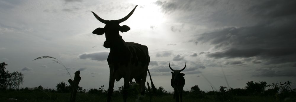
The report finds that the typical small-holder mixed crop-livestock rainfed farming systems and arid and semi-arid systems that support pastoralism in the Sahel are both highly vulnerable to poverty and most likely to suffer the most from climate change.

The same is predicted for the Great Lakes region, with Rwanda’s and Burundi’s crop-livestock farming systems and the higher potential highland systems at great risk. Eastern Africa’s arid and semi-arid lands, which in Kenya account for 84 per cent of the land area, were also found to be highly vulnerable to climate change.

“These findings present an immense challenge for development and the achievement of the millennium development goals,” says Tom Owiyo, co-author of the book. “Climate change presents a global ethical challenge as well as a development, scientific and organisational challenge in Africa.”

The coastal zones of eastern and southern Africa as well as the drier parts of southern Africa will also be adversely affected by climate change.

“The outlook for Africa under a business-as-usual scenario is pretty bleak. Africa appears to have some of the greatest burdens of climate change impacts and is also generally limited in its ability to cope and adapt, yet it has the lowest per capita emission of greenhouse gases,” Mario Herrero reiterates concerns shared by other scientists across the world.

To view the entire electronic version of the book, click to open:
Mapping climate vulnerability and poverty in Africa. PDF (10.7MB)

To view the book by chapter, go to:
Executive Summary
Background
Objectives and activities
Framework
Climate impacts in sub-Saharan Africa
Poverty and vulnerability
User needs
Conclusions
References and Acronyms
Appendices
o Note 1: Indicators of adaptive capacity
Note 2: South-south cooperation
o
Note 3: Climate change & health in Africa: incidence of vector-borne diseases & HIV/AIDS
Note 4: The climate, development, and poverty nexus in Africa
Note 5: The Sub-Saharan Africa Challenge Programme
Note 6: The ASARECA priority setting work
Note 7: The SLP’s food-feed impact assessment framework
Note 8: The SAKSS poverty targeting tool
Note 9:
Simulating regional production with crop models

Related information:

Below are the 35 news clippings generated by the 7 Nov 2006 launch of ILRI’s book Mapping Climate Vulnerability and Poverty in Africa at the UNEP-hosed Climate Change Conference COP 12 in Nairobi, Kenya.

International Wire Services
01 Africast
02 Agence France Presse
03 AllAfrica.com (first article)
04 AllAfrica.com (second article)
05 Reuters
06 Reuters AlertNet
07 Reuters South Africa
08 Reuters UK

International News Agencies
09 IRIN News
10 Peace Journalism
11 Yahoo! News

 Blogs
12 Ethiopia: Ethiopian Politics Blogspot
13 Ethiopia: Nazret.com: Ethiopian News Portal: EthiopBlog
14 Germany: Afrikaman

Radio Broadcasts
15 Kenya: KBC (Kenya Broadcasting Company) Radio: Swahili
16 Kenya: KISS FM radio station
17 UK: BBC World Service

National Media/News Agencies
18 Australia: NineMSM
19 Australia: Planet Ark
20 Australia: Sydney Morning Herald
21 Australia: The Age
22 Australia: The West Australian
23 Brunei Darussalam: The Brunei Times
24 Germany: Deutsche Welle Radio
25 India: Zee News
26 Kenya: Daily Nation
27 Kenya: Standard Newspaper (article)
28 Kenya: Standard Newspaper (photo and caption)
29 Pakistan: The News
30 South Africa: Business Day
31 South Africa: The Mail & Guardian
32 South Africa: The Mercury
33 South Africa: SABC News
34 USA: ABC News
35 USA: Scientific American.com

Mapping climate vulnerability and poverty in Africa: Where are the hot spots of climate change and household vulnerability?

Sometimes the answer to the question ‘Why?’ can come first from answering the question ‘Where?’

John Snow’s nineteenth century map of the incidences of cholera in London showed a cluster of cases around a particular water pump—which turned out to be a source of the outbreak. Now research groups have published maps showing the locations of African communities likely to be most vulnerable to the double threats of climate change and poverty. These maps, part of a 200-page report to the UK Department for International Development (DFID) published this month (August 2006) by the International Livestock Research Institute (ILRI), graphically show that there are many vulnerable regions of sub-Saharan Africa that are likely to be adversely affected by climate change. These include the mixed arid-semiarid systems in the Sahel, arid-semiarid rangeland systems in parts of eastern Africa, the systems in the Great Lakes region of eastern Africa, the coastal regions of eastern Africa, and many of the drier zones of southern Africa.

Poverty maps are nothing new. Philip Thornton, the senior author of this report and an agricultural systems analyst at ILRI, has previously led an ILRI team in developing maps of poverty and livestock in the developing world, which led to higher-resolution poverty maps being developed for Kenya and Uganda. These maps attempt to identify climate change – vulnerability hotspots in sub-Saharan Africa, to help DFID and other donors decide where they might locate specific research activities and where to put in place uptake pathways for research outputs.

These maps do not, like Snow’s water pump, disclose the causes of climate change or poverty, but they do provide aid agencies and policymakers with early warning about which African communities and farming systems are most in need of urgent attention to forestall future calamity.

As the world’s climate continues to change at an unprecedented rate, the impacts of climate change are likely to be considerable in Africa as well as other tropical developing regions. Many countries in sub-Saharan Africa currently have limited capacity to adapt to changing climate and increased probabilities of extreme events such as drought or flood.Considerable investments are needed to build local adaptive capacity so that countries are better able to respond to the challenges that climate change presents.

In partnership with the African Centre for Technology Studies and The Energy Research Institute, ILRI conducted a study commissioned by DFID to map climate vulnerability and poverty in Africa. ILRI published the results of this study in August 2006.

Several high-level governmental and inter-governmental papers and assessments are already using the ILRI-DFID study and resulting maps. These include report of a UK Foresight project on Detection and Identification of Infectious Diseases in April 2006, the July 2006 UK White Paper on International Development, and an August 2006 review draft of the IAASTD Global Report (International Assessment of Agricultural Science and Technology for Development). These reports stress that farmers in many places will need to adapt to climate change, by investing in alternative crops and livestock, adjusting their management regimes, or by diversifying their income-generating activities (particularly off-farm activities). Raising awareness about the possible impact of climate change, and improving consultation between all levels of government and civil society, will be essential.

The work has highlighted several key points. One is that there is such heterogeneity in household access to resources, poverty levels and ability to cope that vulnerability assessments increasingly need to be done at regional and national levels rather than the continental-level analysis written up here. Second, local responses to climate change need to be dynamic — adaptation to climate change needs to be seen as a dynamic and continuous process rather than as a one-off activity. Third, while climate change impacts may be considerable in particular places, it is only one of several elements that affect smallholders and their livelihood options. The interactions between climate change and human health, for example, are likely to have enormous consequences on livelihoods and will only add to the burdens of those who are already poor and vulnerable.

The result of the new study conducted for DFID is a book-length report published by ILRI in August 2006, Mapping Climate Vulnerability and Poverty in Africa.

To view the entire electronic version of the book, click to open:

To view the book by chapter, go to:

Executive Summary
Background
Objectives and activities
Framework
Climate impacts in sub-Saharan Africa
Poverty and vulnerability
User needs
Conclusions
References and Acronyms
Appendices
o Note 1: Indicators of adaptive capacity
Note 2: South-south cooperation
o
Note 3: Climate change & health in Africa: incidence of vector-borne diseases & HIV/AIDS
Note 4: The climate, development, and poverty nexus in Africa
Note 5: The Sub-Saharan Africa Challenge Programme
Note 6: The ASARECA priority setting work
Note 7: The SLP’s food-feed impact assessment framework
Note 8: The SAKSS poverty targeting tool
Note 9:
Simulating regional production with crop models

Kenya Government follows up the ILRI-Kenya poverty mapping book Volume I with Volume II, launched this week in Nairobi

Analysis of the distribution of welfare through poverty maps has become an important tool for designing poverty interventions in Kenya. In 2003, the International Livestock Research Institute (ILRI), in collaboration with Kenya’s Central Bureau of Statistics and other partners, launched the first comprehensive map-based view of poverty in Kenya (Volume1). Building on investments made by the Kenya Government in census, household surveys and geographic information, ILRI provided leadership and technical assistance in developing these poverty maps. The maps and figures in Volume I have been used by development partners and local governments to target and allocate resources in a pro-poor manner. New estimates of poverty and inequality at the constituency level—Geographic Dimensions of Well-being in Kenya: Who and Where are the Poor? A Constituency Level Profile. Volume II—were launched this week, 1 November 2005, in Nairobi.

This report, which was prepared by Kenya’s Central Bureau of Statistics in collaboration with the World Bank, Swedish International Development Agency and Society for International Development, applies a similar methodology to that used in Volume 1 to compute poverty and inequality for urban, rural and key socio-economic groups based on constituency-level data. The report also highlights how the results can be used for critical policy interventions, more specifically the Constituency Development Fund.

Details about this new volume can be obtained from the website of the Central Bureau of Statistics: www.cbs.go.ke

Click for news clippings about the book.

Daily Nation

The great divide:Kenya’s richest and poorest areas

Big variation in the levels of poverty

Poverty funds may be aiding the well-to-do

Education the key to a better life, says report

Wajir worst hit district in North-Eastern province

Sh150m grant used in fight against poverty

Electronic version of important poverty mapping book for Uganda available here

An electronic version of an important book, Where are the Poor? Mapping Patterns of Well-Being in Uganda, is now available.

Uganda has some of the poorest people in the world. For the first time, the question Where are the poor in Uganda? can be answered, as a result of sophisticated poverty maps developed by the Uganda Bureau of Statistics and the International Livestock Research Institute (ILRI). These maps provide facts and figures on poverty and inequality by region, district and county, highlighting where the poorest are located and estimating the numbers of poor and levels of poverty. These maps are important because they can be used to ensure that resources are targeted at those most in need.

If you are interested in viewing the entire electronic version of the book, click open:

If you are interested in viewing this book by chapter, go to:

To view the maps from the Atlas of Estimated Measures of Poverty Below the Regional Level: 1992 Poverty Maps, go to:

To view the maps from the Atlas of Estimated Measures of Poverty Below the Regional Level: 1999 Poverty Maps and the Change in Poverty from 1992 to 1999, go to: