ILRI livestock insurance project features in presidential launch of Kenya Government’s ‘Open Data Web Portal’

Training livestock herders in Marsabit in new insurance scheme available

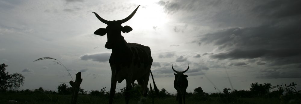
The Index-Based Livestock Insurance project, which works with pastoral livestock keepers in Kenya’s Marsabit District, is being highlighted in a launch on 8 July 2011 of the Kenya Government’s Open Data Web portal (photo credit: ILRI/Mude).

Andrew Mude, a scientist with the International Livestock Research Institute (ILRI) who leads an ‘Index-Based Livestock Insurance’ project, on 8 July 2011 will describe how his project is using satellite imagery to provide the first livestock insurance to pastoral livestock herders in Kenya’s northern drylands. He is making this presentation at the launch of a new Kenya Government Open Data Web portal. The launch will be opened by Kenya President Mwai Kibaki at the Kenyatta International Conference Centre, in Nairobi’s city centre.

The Index-Based Livestock Insurance project is a novel scheme that provides livestock insurance against animal losses to over 2000 households in Kenya’s Marsabit District. This insurance product, the first to ever be offered in the district, is helping livestock keepers to sustain their livelihoods during droughts. The project was started by ILRI in partnership with UAP insurance and Equity Bank, along with other partners, in January 2010.

The new Kenya Government Open Data Web portal is one of the first in sub-Saharan Africa and it will, for the first time, make several large government datasets available to the public in an easy to search and view format. The portal will allow Kenyans to search and display national and county-level data in graphs and maps and allow for easy comparison and analysis of information.

The launch of Kenya Government Open Web portal is also bringing together over 30 exhibitors who will showcase their use of technology to share information. ILRI has an exhibit showcasing its Index-Based Livestock Insurance project.

Use of open-source technology to store, analyze, manage and display data is on the rise in Kenya and recently received a boost with the launching of  Virtual Kenya, a new website that hosts maps and spatial data about the country, making them available for use by citizens. Started by Upande Ltd., a Nairobi-based technology company, Virtual Kenya, has expressed interest in hosting some of the data generated by ILRI’s Index-Based Livestock Insurance project to demonstrate how open-source technologies are improving information access in the country.

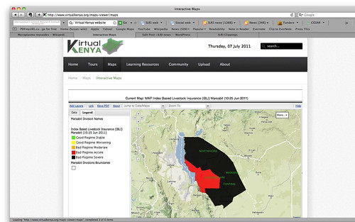
Critically low forage availability in Marsabit District in June 2011

Map showing the critically low forage availability in Kenya’s Marsabit District in June 2011; the entire district is at acute (red) to severe (black) low levels of forage to feed the district’s many livestock (map by ILRI’s Index-Based Livestock Insurance project and made available on the Virtual Kenya website).

One such map generated by data from the Index-Based Livestock Insurance project is already available on the Virtual Kenya website. The map shows viewers that in the current severe drought affecting northern Kenya, as well as southern Ethiopia and Somalia, throughout Marsabit District livestock forage availability is at acutely to severely low levels. That is, the amount of forage available to feed the pastoral livestock herds that support most people’s livelihoods in this district is significantly below long-run averages for this time of year, indicating that many of the domesticated livestock are expected to starve. (The next rains in the region are not due until October.)

In April 2011, ILRI’s Index-Based Livestock Insurance project won the Vision 2030 ICT Innovation Award for ‘the overall best innovation for their mobile-ICT-based livestock insurance solution.’ This award event was organized by the Kenya ICT board and the Kenya Vision 2030 Delivery Secretariat, which said the ILRI project was ‘a promising and exciting innovation in insurance design that allows the risk-management benefits of insurance to be made available to poor and remote clients.’

The Index-Based Livestock Insurance project also won a best-practice award from the Poverty Reduction, Equity and Growth Network in recognition of its innovative approach in combining scientific research and practical solutions; that award was bestowed in September 2010 in South Africa.

To find out more about the Open Data Web portal, visit the Kenya ICT board website: http://www.ict.go.ke/
Visit the IBLI project website

ILRI livestock insurance scheme wins inaugural Vision 2030 ICT Innovation Award

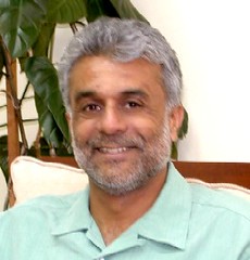
Andrew Mude, Scientist, Targeting and Innovation

Andrew Mude, scientist leading the award-winning Index-Based Livestock Insurance project at the International Livestock Research Institute (ILRI).

A novel livestock insurance scheme for poor pastoral herders in Kenya’s Marsabit District, initiated by the International Livestock Research Institute (ILRI) with private sector and other partners, has won the inaugural Vision 2030 ICT Innovation Award.

‘Eleven companies received a V2030 ICT Innovation Award at a ceremony held on 20 April 2011 in Diani as part of the Kenya ICT Board’s Connected Kenya Summit. The Kenya ICT Board and the Kenya Vision 2030 Delivery Secretariat invited companies that have developed solutions that drive economic growth and social development as outlined in Kenya’s Vision 2030 to participate in the inaugural Vision 2030 ICT Innovation Awards. The Award is proudly co-sponsored by Accenture Development Partnerships (ADP).

‘Over 170 companies participated in the online process. All applications were received on an online platform set up by the Kenya ICT Board that allowed applicants to create an account and fill out their application over time. Of the companies that participated in the Call for Applications, 82 successfully completed the process.

‘The Kenya ICT Board convened a team of seven independent judges representing the ICT private sector, academia, public sector and civil society. The judges began their work on April 13 and reviewed each complete proposal against the criteria outlined in the call for applications. To ensure integrity in the process, Deloitte Consulting are auditing the review process.

‘The winners each get a commemorative trophy, certificate and $1,000 prize money from Accenture. The overall best innovation award was awarded to International Livestock Research Institute for their mobile-ICT based livestock insurance solution. ILRI received an additional $ 5,000 as their award.

‘Index-based livestock insurance (IBLI) is a promising and exciting innovation in insurance design that allows the risk-management benefits of insurance to be made available to poor and remote clients. The IBLI product being piloted in Marsabit District aims to provide compensation to insured pastoralists in the event of livestock losses due to severe forage scarcity. Incorporating remotely-sensed vegetation data in its design, delivered via mobile ICT-based transactions platforms, and with experimental extension methods used to educate the remote pastoral herders, the IBLI product boasts many firsts in product development.’

Read more about the Vision 2030 ICT Innovation Awards on the Connected Kenya website.

IBLI web site

The case for index-based livestock insurance and cash payments for northern Kenya’s pastoralists

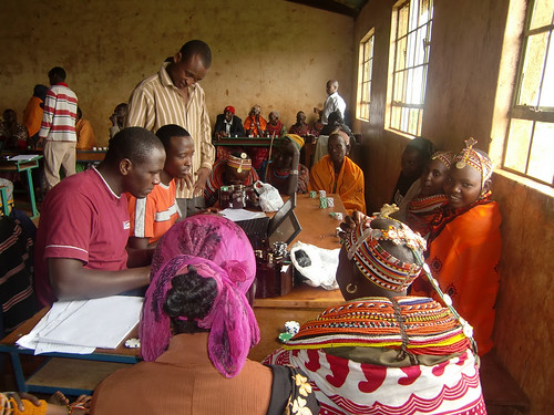
Training livestock herders in Marsabit in new insurance scheme available

ILRI is working with insurance companies to train livestock herders in Kenya’s northern drylands in the benefits and costs of a new index-based livestock insurance first made available in Marsabit District in 2010 (photo credit: ILRI/Mude).

On the second day of a ‘Future of Pastoralism in Africa’ Conference, being held this week (21–23 March 2011) in Addis Ababa at the campus of the International Livestock Research Institute (ILRI), a panel session focused on new approaches for strengthening pastoralist livelihoods and social protection.

With decades of food aid delivery having demonstrably failed to significantly improve the livelihood prospects of Africa’s poorer pastoralists, aid agencies and governments alike are rethinking their approaches to ways of delivering aid to pastoralists. But do safety net schemes serve as life-savers or do they lock destitute pastoralists into unsustainable livelihoods? Should donors and governments help destitute pastoralists exit pastoral livelihoods? Should they help provide livestock insurance schemes?

Andrew Mude, an ILRI scientist, spoke about an index-based livestock insurance innovation that has been instituted, in partnership with UAP Insurance and Equity Bank, for pastoral herders in Marsabit District, in northern Kenya’s great drylands. This is the first insurance ever offered the Samburu, Gabra, Rendille, Borana, Turkana and other traditional herders here, who cope with variable weather by traditionally moving their stock to find new grazing when the grass in a given area is finished.

The risk covered by this insurance is periodic drought that dries up the natural rangeland vegetation, which supplies most of the feed for the pastoral cattle, sheep, goats and camels of the region, leading to many livestock deaths. Insurance payouts are made, to those who have bought annual insurance contracts, when the available forage in Marsabit District in that year drops below a level at which more than 15 per cent of the livestock would be expected to perish from starvation.

Before the ILRI team could convince commercial companies that this is a viable product, they had to convince the prospective pastoralist clients of that. So ILRI researchers invented insurance games that help livestock herders understand what the insurance covers, and what it does not, and when insurance payouts will be made, and when they will not.

Asked whether livestock insurance isn’t just another popular idea likely to fail, Mude said, ‘I wouldn’t stake my professional reputation on index livestock insurance working, but I would stake my reputation on the processes we are using to monitor the effectiveness and impacts of this new product. In fact, my team has put a “pause” on expanding livestock insurance in Kenya while we see how it goes, although we are introducing livestock insurance in Ethiopia so as to see how it does here, under different conditions.’

In the meantime, Mude’s team is monitoring the effectiveness and impacts of livestock insurance in Marsabit by following 900 households, which they first interviewed in 2009 and then again last year; they’ll continue to monitor these households over the next four years to determine if the product should be made more widely available.

The next expert to speak was Stephen Devereux, who leads a pilot Hunger Safety Net Program providing cash transfers to the people in northern Kenya’s chronically food insecure areas of Mandera, Marsabit, Turkana, Wajir districts. The payments are designed to meet basic subsistence needs. The program uses the local private sector—banks and shops—to deliver the cash to the local people.

The Hunger Safety Net Program aims to provide social assistance, insurance and justice. The first thing Devereux’s team had to consider was whether the program’s social protection should address poverty or vulnerability. The conventional way to define poverty is lack of resources, while vulnerability is characterized by uninsured risk and marginalization is a matter of lacking a voice in decision-making.

The rates of both poverty and hunger in these districts are high. Only the rich eat three times a day. Middle-income families eat just twice a day, the poor only once a day, and the very poor sometimes do not eat at all in 24 hours.

Food aid is the conventional response to prolonged drought in these as well as other pastoral areas. But food aid is not enough, and tends to be diluted through sharing. The nutritional status of children in drought-afflicted districts, moreover, was found to be alarming in 2006, for example, a full year following a drought and despite massive injections of food aid.

Among the design challenges of this social assistance is how to best target those to receive this aid: are women, for example, more responsible as well as more vulnerable? Conflicts occurring between pastoralist communities in this region are a great problem, and the food price crisis is also hurting the efficacy of this program, which can no longer provide sufficient cash to maintain adequate nutritional levels. Another worry is that the program may be trapping people in unviable livelihoods while they wait to receive benefits (some families might be better off exiting pastoralism altogether).

Complementary interventions—so-called ‘cash plus’ systems—are needed to help build resilience in these communities, said Devereux. ‘A useful integrated approach would combine cash payments with services such as livestock insurance, as is being done by ILRI and its partners in Marsabit.’

For more information, see previous postings on the ILRI News Blog:

The future of pastoralism in Africa debated in Addis: Irreversible decline or vibrant future?, 21 March 2011.

Climate change impacts on pastoralists in the Horn: Transforming the ‘crisis narrative’, 22 March 2011.

Or visit the Future Agricultures Consortium website conference page or blog.

Helping African herders cope with climate change

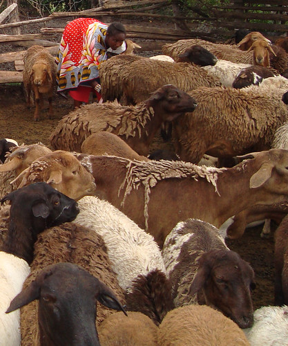
The worm-resistant red Maasai sheep of East Africa

Research groups at the International Livestock Research Institute (ILRI) are helping Maasai livestock herders in East African to retain their native 'hairless' (non-wool producing) red Maasai sheep, which are genetically resistant to infections with gastro-intestinal worms (photo credit: ILRI). 

Half of the world's livestock herders live with their animals on the vast rangelands of Africa, which comprise half of Africa's surface. Herders have always adapted to variable weather, but over the next 50 years, pastoralist areas will face more and more changes.

What’s the future for Africa’s 50 million livestock herders who live on lands too marginal for cropping as our climate changes, becomes less predictable, heats up? How can scientific research help remote pastoral communities? 

Among the poorest of the world’s poor, herders supply milk and meat not only for themselves but for large numbers of other poor people. Although their animals produce few of the greenhouse gasses harming the earth, these people will be among those most hurt by the climate changes we expect. 

Population growth and land degradation are already causing problems over much of the continent’s traditional rangelands. Many herders, having lost all their animals to droughts, are facing the end of their way of life. 

Research-based approaches for adapting to climate change, however, offer options that can help herding communities sustain at least some aspects of their pastoral livelihoods.

These options include:

  • using satellite imagery to provide the first-ever drought insurance for pastoral herders in Africa's remote regions
  • cross-breeding an indigenous disease-resistant sheep breed kept by Maasai communities with higher-producing exotic sheep to get the benefits of both
  • helping communities shift from keeping grazers, such as cattle and sheep, to browsers, such as camels and goats
  • supporting pastoralists to take advantage of local opportunities, such as shifting from herding ruminant animals to raising fish in ponds.  

The experiences in this film, alongside other initiatives will be presented by Mario Herrero, a scientist with ILRI, at the 2010 United Nations Climate Change Conference in Cancun, Mexico from 29 November to 10 December 2010, to show how ILRI is applying research to help livestock-based communities cope with the effects of climate change.

Watch this new 10-minute ILRI film, Heat, Rain and Livestock: Impacts of Climate Change on Africa's Livestock Herders, to find out more.

See more of ILRI's films.

Find out more about the 2010 United Nations Climate Change conference.

See related article: New partnership launched to keep climate change from crippling food production in Africa and Asia, 19 November 2010.

Index-based livestock insurance project in northern Kenya wins best practice award

Andrew Mude of ILRI receives IBLI award

Andrew Mude of ILRI receives the best-practice award for the Index-based Livestock Insurance project from Manfred Wiebelt, the director of PEGnet (Photo: PEGnet) 

The International Livestock Research Institute (ILRI) led Index-based Livestock Insurance (IBLI) project in northern Kenya, which provides livestock insurance to over 2000 households in Marsabit district to help livestock herders sustain their livestock-dependent livelihoods during drought, has received a best-practice award from the Poverty Reduction, Equity and Growth Network in recognition of the project’s innovative approach of combining scientific research and practice.

The award was presented to Andrew Mude, an economist with ILRI, who also heads the Index-based Livestock Insurance project, during the Poverty Reduction, Equity and Growth Network’s conference ‘Policies to Foster and Sustain Equitable Development in Times of Crises’ held in Midrand, South Africa, on 2-3 September 2010.

Over the past two years, ILRI in collaboration with partners from Cornell University, the BASIS I4 project at the University of California – Davis, and Syracuse University, have come up with a research program that has designed and developed the insurance program. It is now being implemented by commercial partners as a market-led index-based insurance product that is protecting livestock keepers from drought-related animal losses particularly in the drought-prone arid and semi arid areas of Kenya. The program uses satellite imagery to determine and predict potential losses of livestock forage and issue insurance payouts to participating members when incidences of drought occur.

The first pilot product of this project, launched in January 2010 in Marsabit, brings together Equity Bank of Kenya, UAP Insurance and Swiss-Re as commercial partners who are running a commercially viable insurance product. This is a first-of-its-kind initiative in Africa and it holds enormous potential for benefitting livestock keepers in the region and across the continent. So far, the project has recorded over 2000 contracts covering livestock worth over US$1 million and attracting premiums of over US$77,000.

The project is expected to bring economic and social benefits to livestock keepers and protect households against drought-induced livestock losses thereby reducing their likelihood of descending into poverty. By insuring the assets of pastoralists against catastrophic losses, members will be able to come out of poverty, be protected from the risk of falling into poverty and at the same time will have opportunity to explore other activities for household economic development.

The impact of the project is currently under assessment to find out its benefits before it can be scaled up to other districts in the country. 

The Poverty Reduction, Equity and Growth Network brings together researchers with an interest in issues revolving around poverty, inequality and growth in developing countries and links them to German development policy bodies with the aim of among others, using research results for policy advice on pro-poor growth strategies.

More information about the Index-based Livestock Insurance project can be found on the project website: www.ilri.org/ibli/

The following ILRI news article shares information about the project’s launch in Marsabit:  https://newsarchive.ilri.org/archives/1440

To find out more about the Poverty Reduction, Equity, and Growth Network’s 2010 conference please visit http://www.pegnet.ifw-kiel.de/

World’s first livestock insurance supports African herders

Drought is the greatest hazard facing livestock herders in Kenya. Their livelihoods have been greatly affected, and often devasted, by animal losses as a result of severe droughts, especially in the past 10 years.

In this 12-minute film, Andrew Mude, an economist working with the International Livestock Research Institute (ILRI), shares the story of a pilot project introduced in Marsabit District of northern Kenya in 2007 to provide a new and innovative livestock insurance scheme to Kenyan herders. The project is a result of joint research and collaboration by partners from different sectors, including private insurance companies, working in the region as well as institutions overseas.

This initiative is helping livestock keepers in some of Kenya’s most marginal areas to escape poverty and, as the film shows, has great potential to help other herding communities in Africa.

ILRI hosts Ethiopia workshop on index-based livestock insurance

On 12 July 2010, the International Livestock Research Institute (ILRI) will convene a workshop in Addis Ababa to introduce partners and key stakeholders to the concept of index-based livestock insurance (IBLI) – as used in northern Kenya – and to explore whether such an initiative could be developed for southern Ethiopia.

This video explains the ILRI-supported IBLI project in Kenya:

Location, location, location: Geographic techies explore ways of navigating a better future

If, as the popular science saying goes, we can understand only what we can measure, what shall we say about what we can locate on a map? Is that, too, a foundation for real understanding, or is mapping more like taxonomy, more critical to scientific knowledge (categorization) than to scientific understanding (causation)?

A group of some 80 international and developing-country experts in the use of geographical information systems (GIS), remote sensing and other high-tech tools developed in the field of what was once innocently called ‘geography’ met in Nairobi last week (8–12 June 2010) to see if they couldn’t, by working together better, speed work to reduce world poverty, hunger and environmental degradation. (Oddly, this gathering of people all about ‘location’ tend to use a forest of acronyms — GIS, ArcGIA, CSI, ESRI, ICT-KM, AGCommons, CIARD, CGMap  — in which the casual visitor is likely to get lost.)

The participants at this meeting, called the ‘Africa Agricultural GIS Week’, aimed to find ways to offer more cohesive support to the international community that is working to help communities and nations climb out of poverty through sustainable agriculture.

The world’s big agricultural problems – too little food to feed the 6-plus and growing billions of people on the planet, too extractive (unsustainable) ways of producing food, too little new land left to put to food production, too few viable agricultural markets serving the poor, too high food prices for the urban poor, too extreme and variable climates for sustaining rural agricultural livelihoods – appear to be fast closing in on us. Our global agricultural problems are of an increasingly connected and complex nature. Most experts agree that silver-bullet solutions are not the answer. We must tackle these problems holistically or, in the jargon of agricultural science, from a systems-based perspective.

And that, perhaps, is where these high-tech geographers can most help us navigate the future of small-scale food production.

VISH NENE, Director of the Biotechnology Theme

At the opening of this Week’s events, held at the Nairobi campus of the International Livestock Research Institute (ILRI), Vish Nene, a molecular biologist who directs ILRI’s Biotechnology Theme, spoke on behalf of ILRI’s director general, Carlos Seré, who was on mission travel abroad. Nene welcomed Kenya’s Assistant Minister of Agriculture and MP, Hon Japhet Mbiuki, who gave a keynote speech on behalf of Kenya’s Minister for Agriculture, Hon Dr Sally Kosgei.

Nene said that ILRI was particularly pleased to be hosting this meeting, as it has a long track record in the use of GIS in its research portfolio, having developed a GIS Unit first some 22 years ago and being a leader today in large-scale, fine-resolution, mapping of the intersection of small-scale livestock enterprises and global poverty.

An M.O. Notenbaert, Scientist, GIS Analyst, Targeting and Innovation

The second day of the Week, An Notenbaert, a GIS expert at ILRI, gave the participants an overview of what ILRI has been doing in the area of geospatial research, and what particular kinds of geospatial services and expertise ILRI could offer new ‘mega-programs’ of the Consultative Group on International Agricultural Research (CGIAR).

Notenbaert sketched two of ILRI’s research projects that require a ‘spatial’ foundation.

Protecting remote herders with their first drought-related livestock insurance

The first ILRI project Notenbaert described is one that this year is piloting ‘index-based livestock insurance’ for remote Kenyan livestock herders. This project, she said, is all about managing risks in dry, harsh lands, where most people’s livelihoods still depend on livestock herding. Because traditional livestock insurance is impractical for the dispersed herding populations of Kenya’s northern frontier, ILRI researchers initiated a study on the feasibility of using information not about the number of livestock deaths in droughts over the years, but rather an indicator associated with such drought-related animal deaths. ‘We are using satellite images of vegetation of the region to come up with a livestock mortality index,’ she said. ‘This is quite a neat application of remote sensing data.’

The pilot project was launched in Kenya’s Marsabit District in January 2010. Livestock owners in the district have bought insurance premiums that will pay out not when their animals die (which would require a logistically complex and expensive procedure to verify animal deaths), but rather when satellite images show that livestock forage has dipped below a predetermined threshold, with the likely result of many animals dying.

Down-scaling climate projections for more useful information for policymakers

The second ILRI project Notenbaert described to the assembled group of spatial experts is working to make more local, and thus more useful, assessments of the impacts of climate change on poor communities in the tropics.

Little information, for example, is available on climate change in East Africa, whether at country or local levels. While a projected increase in rainfall in East Africa to 2080, extending into the Horn of Africa, is robust across the ensemble of Global Circulation Models available, other work suggests that climate models have probably underestimated the warming impacts of the Indian Ocean and thus may well be over-estimating rainfall in East Africa during the present century.

In 2006, ILRI researchers estimated changes in aggregate monthly values for temperature and precipitation. Possible future long-term monthly climate normals for rainfall, daily temperature and daily temperature diurnal range were derived by down-scaling the outputs of Global Circulation Models to WorldClim v1.3 climate grids at a resolution of 18 square kilometres. Outputs from several Global Circulation Models and scenarios made by the Special Report on Emissions Scenarios (Intergovernmental Panel on Climate Change, 2000) were used to derive climate normals for 2000, 2005, 2010, 2015, 2020, 2025 and 2030 using the down-scaling methodology described in 2003 by ILRI researchers. Although the figures derived for Kenya correspond with findings of long-term wetting, the ILRI researchers also found the regional variations in precipitation to be large, with the coastal region likely to become drier, for example, while Kenya’s highlands and northern frontier are likely to become wetter.

For more information, see:

Africa Agriculture GIS Week

Index-based Livestock Insurance

Climate Projection Data Download

AGCommons: Location-specific information services for agriculture

Coherence in Information for Agricultural Research for Development

ILRI, Equity Bank and UAP Insurance launch first-ever project to insure cows, camels and goats in Kenya’s arid north

Satellite images of remote African lands are used to insure herders from devastating droughts

Arid lands

Thousands of herders in arid areas of northern Kenya will be able to purchase insurance policies for their livestock, based on a first-of-its-kind program in Africa that uses satellite images of grass and other vegetation that indicate whether drought will put their camels, cows, goats and sheep at risk of starvation.

The project was announced today in northern Kenya’s arid Marsabit District by the Nairobi-based International Livestock Research Institute (ILRI), microfinance pioneer Equity Bank and African insurance provider UAP Insurance Ltd.

The index-based livestock insurance program will use satellite imagery to determine potential losses of livestock forage and issue payouts to participating herders when incidences of drought are expected to occur. If successful in the Marsabit District—where few of the 86,000 cattle and two million sheep and goat populations, valued at $67 million for milk and other products, are rarely slaughtered—the program would be offered to millions of semi-nomadic pastoralists and livestock keepers in other parts of the east African region.

“Today, our agents will begin selling insurance policies backed by UAP that for the first time will provide pastoral families in Kenya’s remote Marsabit District with a simple way to reduce their drought risk —the biggest threat to their cherished herds of cattle, sheep, goats, and camels—from devastating lives and livelihoods,” said Equity Bank Managing Director James Mwangi. “Livestock is the key asset for families in this region and securing this asset is critical to their ability to obtain credit and investments that can allow them to grow and prosper.”

ILRI, which is part of the Consultative Group on International Agricultural Research (CGIAR), developed the project with partners at the Ministry of Development of Northern Kenya, Cornell University, Syracuse University, the BASIS program at University of Wisconsin, and the Index Insurance Innovation Initiative. The project is funded by UK’s Department for International Development (DFID), United States Agency for International Development (USAID), the World Bank and Financial Sector Deepening Trust (FSD Kenya).

Insuring livestock of pastoral families has long had been considered impossible due to the formidable challenges of verifying deaths of animals that regularly are moved over vast tracts of land in search of food. ILRI and its partners have overcome this impediment by combining satellite images of vegetation in the Marsabit District with monthly surveys of livestock deaths to pinpoint the level of forage reduction that will cause animals to die. This program is different from all others because it does not pay clients based on the actual loss of their livestock assets, but rather on indicators that the animals are at risk of death.

“The reason this system can work is that getting compensation does not require verifying that an animal is actually dead,” said Andrew Mude, who is the project leader at ILRI. “Payments kick in when the satellite images, which are available practically in real time, show us that forage has become so scarce that animals are likely to perish.”

Droughts are frequent in the region—there have been 28 in the last 100 years and four in the past decade alone—and the losses they inflict on herders can quickly push pastoralist families into poverty. For example, the drought of 2000 was blamed for major animal losses in the district.

“Insurance is something of the Holy Grail for those of us who work with African livestock, particularly for pastoralists who could use insurance both as a hedge against drought—a threat that will become more common in some regions as the climate changes—and to increase their earning potential,” said ILRI Director General Carlos Seré.

The cost of the plans offered will vary depending on the number of animals and the area of coverage. The policies contain a clause akin to a deductible, in which a family would buy coverage that would pay-out when livestock losses are expected to exceed a certain level. “We believe this program has potential because it has the elements insurers need to operate, which is a well-known risk (drought), and an external indicator that is verifiable and can’t be manipulated, which in this case is satellite images of the vegetation,” said James Wambugu, Managing Director of UAP Insurance.

The data on forage availability are derived from satellite images of plant growth in the region that are part of a global survey known as the Normalized Difference Vegetation Index, or NDVI, a database regularly updated by scientists at the US National Oceanic and Atmospheric Administration (NOAA) and the US National Aeronautics and Space Administration (NASA). To develop the livestock insurance program, ILRI used NDVI data collected since 1981 estimating forage availability vegetation in the Marsabit District. This information was combined with data on livestock deaths that have been collected monthly since 2000 by the Kenya Arid Lands Resource Management Project (ALRMP) and USAID’s Pastoral Risk Management Project. The result is a statistical model that reliably predicts when and to what degree forage reductions will result in drought-related livestock deaths.

Given the complexity of index-based livestock insurance, ILRI and its partners have developed an insurance simulation game for local communities to explain the key features of the insurance policy and tested it across the Marsabit District. ILRI’s Mude said many of the herders who played the game became intensely involved in the simulation. “It helps them understand how insurance can protect them against losses. They also appear to simply enjoy playing the game itself, which generates a lot of animated discussion,” said Mude.

Mude said there is a potential for livestock insurance to be valuable even without a drought that triggers payments. For example, a policy could prevent stock losses by providing pastoralists the means to obtain credit for purchasing feed and drugs that would allow animals to survive the tough conditions. Similarly, pastoralists who want to expand their herds to take advantage of Africa’s rising demand for livestock products are likely to find it easier to obtain capital from private creditors now unwilling to lend due to the risks associated with droughts.

But more fundamentally, ILRI believes insurance can help avert an all too common catastrophe, and one that could occur with more regularity if climate change alters rainfall patterns in the region: droughts pushing pastoralist families into chronic impoverishment by inflicting losses from which the people cannot recover.

For further background information on project details visit the IBLI website and associates ILRI stories

Satellite images of remote African lands to be used to insure herders from devastating droughts

ILRI, Equity Bank, and UAP Insurance Launch First-ever Project to Insure Cows, Camels, and Goats in Kenya’s Arid North Thousands of herders in arid areas of northern Kenya will be able to purchase insurance policies for their livestock, based on a first-of-its-kind program in Africa that uses satellite images of grass and other vegetation that indicate whether drought will put their camels, cows, goats, and sheep at risk of starvation. The project was announced today in northern Kenya's arid Marsabit District by the Nairobi-based International Livestock Research Institute (ILRI), microfinance pioneer Equity Bank and African insurance provider UAP Insurance Ltd. “The reason this system can work is that getting compensation does not require verifying that an animal is actually dead,” said Andrew Mude, who is the project leader at ILRI. “Payments kick in when the satellite images, which are available practically in real time, show us that forage has become so scarce that animals are likely to perish.” Droughts are frequent in the region—there have been 28 in the last 100 years and four in the past decade alone—and the losses they inflict on herders can quickly push pastoralist families into poverty. For example, the drought of 2000 was blamed for major animal losses in the district. “Insurance is something of the Holy Grail for those of us who work with African livestock, particularly for pastoralists who could use insurance both as a hedge against drought—a threat that will become more common in some regions as the climate changes—and to increase their earning potential,” said ILRI Director General Carlos Seré. For more information, please contact: Jeff Haskins at +254 729 871 422 or +254 770 617 481; jhaskins@burnesscommunications.com or Muthoni Njiru at +254 722 789 321 or m.njiru@cgiar.org Background Materials Project Summary