World’s first livestock insurance supports African herders

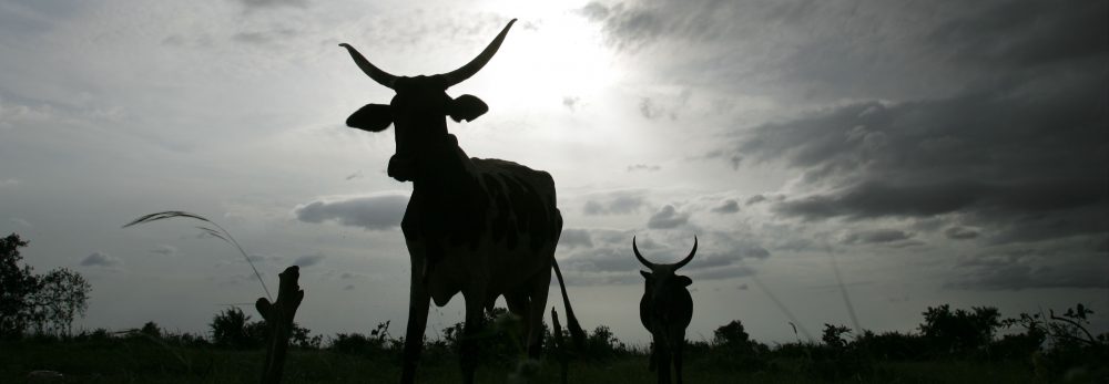
Drought is the greatest hazard facing livestock herders in Kenya. Their livelihoods have been greatly affected, and often devasted, by animal losses as a result of severe droughts, especially in the past 10 years.

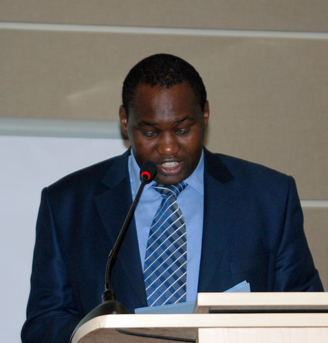
In this 12-minute film, Andrew Mude, an economist working with the International Livestock Research Institute (ILRI), shares the story of a pilot project introduced in Marsabit District of northern Kenya in 2007 to provide a new and innovative livestock insurance scheme to Kenyan herders. The project is a result of joint research and collaboration by partners from different sectors, including private insurance companies, working in the region as well as institutions overseas.

This initiative is helping livestock keepers in some of Kenya’s most marginal areas to escape poverty and, as the film shows, has great potential to help other herding communities in Africa.

Researchers call for regional approaches to deal with high food prices

Malawi, Nr Dedza, Khulungira village

Researchers in eastern and southern Africa are calling for a new regional and integrated approach to address high food prices associated with global food shortages. They are doing this to help prevent a repeat of the global high food price crisis of three years ago.

Under the leadership of the Association for Strengthening Agriculture Research in Eastern and Central Africa (ASARECA), a regional body that seeks to transform agriculture and improve livelihoods, a team of researchers from key national, regional and international organizations in eastern and southern Africa (ESA) have determined that a ‘regionally coordinated response . . .  is potentially more effective in responding to the food price crisis than individual country responses.’

This is one of the key findings from a 2009 study that investigated food-price changes in the national and regional markets in eastern and southern Africa, which would provide an ‘evidence base for effective policy action.’

Joseph Karugia led a core team of researchers who were coordinated by the Regional Strategic Analysis and Knowledge Support System-East and Central Africa (ReSAKSS-EA), which is based in Nairobi, Kenya, at the International Livestock Research Institute (ILRI). Karugia says that ‘Regional blocks can become effective avenues for policy creation and implementation because they offer a much wider and stronger platform to address the challenges posed by the global food price crisis and to exploit the opportunities that high food prices may offer.’

Between 2007 and 2008, most countries in the region (and across the globe) experienced a rise in food prices that threatened the livelihoods of many of the region’s poor. Causes of the rise in prices were attributed to rising incomes and growing uses of food grains for bio-fuel production and animal feeds. In addition, an increasing world population and urbanization, coupled with high agricultural input prices, reduced world stocks of food staples and exports. Declining agricultural resources also contributed to the low supply of food.

Unlike past food-price spikes, such as those in the mid-1990s, where only a few commodities were affected, the recent rise in prices saw substantial increases in the price of the world’s key cereals, oilseeds and dairy and meat products.

For resource-poor farmers and consumers in Africa, high prices translated into higher costs of living occasioned by the increase in the prices of basic foods and staples such as maize, rice and wheat. Prices of different foods across many countries in the region went up by between 11 and 50 per cent between March 2007 and March 2008.

In the wake of the crisis, ASARECA brought a team of key researchers together in a study to find out ‘the magnitude and implications of food prices’ in the region. ‘One of our key aims was to come up with practical short-, medium- and long-term options for governments and other stakeholders for addressing the problem posed by the crisis,’ Karugia says.

The researchers analyzed trends and outlooks in individual countries as well as the region and presented evidence about the regional food situation. They also explored connections between high domestic food prices in this period and global food prices and examined regional and national dimensions of food-price increases and how they related to food security in the region.

From the study findings, presented in a paper, ‘Responding to the food crisis in eastern and southern Africa: policy options for national and regional action’, researchers argue that the considerable scope offered by regional blocks such as the East Africa Community (EAC), the Common Market for East and Southern Africa (COMESA), and the Southern Africa Development Community (SADC) provides an opportunity to create and implement regional policies and strategies to improve food production, distribution and availability in ways that individual countries could not handle alone.

The findings of this research suggest that new ways of approaching food distribution can improve food security in the region by for example, enabling improved regional trade that would allow easier movement of foods, especially ‘non-tradeable’ commodities such as bananas, shipped from countries where they are readily available to countries where consumers face food shortages. This model of food distribution could effectively deal with challenges that result from failure of staple crops such as maize. This way, the report says ‘the income effect of rising food prices could be dampened if it is relatively easy for the household to substitute one staple food whose price is already rising with a cheaper food product that is nutritious and as easy to handle as the previous one.’

Findings from this study provide thought-provoking perspectives useful to policymakers and governments in managing the frequent food crises in the region.

The findings highlight the important role of regional trade, Domestic food prices are, to a large extent, determined by local and regional demand-and-supply conditions; if policies on informal trade were improved, this region’s food security would also improve. The researchers note that an inability of households to find alternative cheaper nutritious foods would lead to ‘lower resource allocation towards non-food items’. This would then affect other sectors, such as education, health care and water and sanitation, with the ‘eventual deterioration of human capital and overall household welfare.’

Although rising food prices are contributing to food price inflation, the researchers note that the domestic markets in the ESA region are resilient and are not always directly affected by global events. Arguing that the best way to address the food price crisis is to do so regionally, they say policies should aim to ‘increase household purchasing power, have no negative impact on food supply response and should not reduce income of poor food sellers.’

This study calls for paying renewed attention to the agricultural sector, which is essential for improving production. It also notes that high food prices provide incentives to the private sector to invest in the agricultural sector. However, productivity increases will require significant and sustained investments in agricultural research and extension, as well as development of agricultural and general infrastructure along with credit and risk-management instruments.

The complete findings of this research can be accessed on https://cgspace.cgiar.org/bitstream/10568/184/1/resakss%20workingpaper27.pdf

For more information please visit the websites of ResaKSS and ASARECA.

New project to reduce chicken disease in Ethiopia

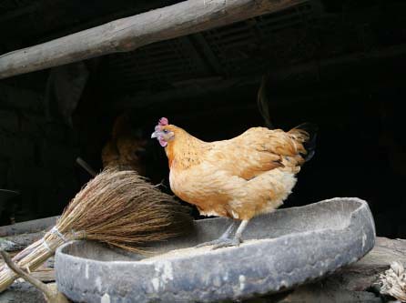
Chicken on LUO RU BIN's farm

A new study of genetic resistance to disease in Ethiopia’s indigenous chicken breeds is scheduled to start later this year. In collaboration with the Ethiopian Institute for Agricultural Research, the University of Liverpool, Roslin Institute, the Univerisity of Edinburgh and the University of Nottingham, researchers from the International Livestock Research Institute (ILRI) will seek to identify ‘the causes of infectious diseases that have a major impact on poultry production in Ethiopia.’

Scheduled to start in September 2010, the study will take place in the district of Jarso, in eastern Ethiopia, and in Horro, in the west of the country. The results of this research will be linked to an ongoing poultry breeding program to improve resistance to ‘priority infectious diseases’ and thereby enhance the productivity of the country’s poultry sector.

Poultry play important economic, nutritional and socio-cultural roles in the livelihoods of poor rural households in Ethiopia and many other developing countries, where birds are widely integrated into smallholder production systems and help households cope with hunger and poverty.

Buying and rearing poultry is often a first step out of poverty. Women tend to own and manage chickens, usually native chicken varieties, which provide them with their only independent source of cash income.

Although breeding programs for local chickens have shown that rapid improvement in productivity is possible, researchers have yet to identify and select the optimal breeds for improving, by, for example, providing resistance to common infectious diseases.

Tadelle Dessie, a team leader of ILRI’s biotechnology theme in Ethiopia, and one of the leaders of the chicken project, says ‘enhanced genetic resistance through selective breeding is still an under-exploited low-cost opportunity for disease control in low-input poultry production systems’. He says the study will investigate genetic variability in the resistance of local chicken ecotypes to major infectious diseases hurting village poultry production in Ethiopia. Results of the research will inform strategies for improving both disease resistance and productivity.

Indigenous chicken varieties are well adapted to local environments, but local birds tend to grow slowly and produce fewer and smaller eggs than commercial varieties. Infectious diseases, however, can wipe out flocks of exotic, higher-producing, poultry.

Knowledge from this study should enable Ethiopian policymakers and animal health professionals to design more precise disease-control plans. The study itself should help improve Ethiopia’s scientific capacity in this field by training local scientists and enhancing laboratory facilities for poultry testing.

Staff are now being recruited for the project, which will be launched in September.

New participatory initiative to involve local communities in disease control

A new approach to disease surveillance and control aims to unite human and animal medical approaches to better control disease spread and so improve public health.

In this 10-minute film from the International Livestock Research Institute (ILRI), representatives of seven institutional members of a Participatory Epidemiology Network for Animal and Public Health (PENAPH), which includes researchers from ILRI, discuss ways of involving communities and health workers in the process of empowering local people.

The network uses participatory approaches to come up with effective ways of dealing with community challenges and encourages teamwork among farmers, veterinarians, nurses, doctors, governments and other specialists, especially in setting up effective disease surveillance systems.

Research shows bird flu still a threat to poultry production in Kenya

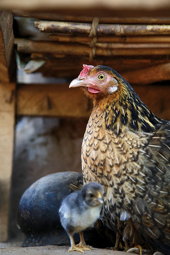
Chicken

Risk assessment shows Avian Influenza still a threat to poultry production in Kenya

The risk of avian flu on poultry production continues to be a threat to the livelihoods of many poor and livestock-reliant farmers in developing countries such as Kenya, researchers say.

Scientists from the International Livestock Research Institute (ILRI) and the International Food Policy Research Institute (IFPRI) have found that poultry farmers in Kenya are ‘highly susceptible to the introduction and spread of the highly pathogenic avian influenza (HPAI)’ because of the country’s location along key wild birds’ migratory routes and the absence of strong mechanisms to deal with a possible outbreak of the disease.

Like in many developing countries, poultry production is an important livelihood activity in Kenya. Most poultry is kept by small-scale farmers in non-commercial settings, who depend on income from the sale of eggs, animals and meat to sustain their livelihoods.

Results from a 2009 impact assessment conducted by ILRI, IFPRI and the Royal Veterinary College in London with support from the Department for International Development (DFID) on the ‘Role of Poultry in Kenyan Livelihoods and the Ex Ante Impact Assessment of HPAI on Livelihood outcomes’ show that farmers in the key poultry producing regions of the country are not adequately prepared to deal with an outbreak of avian influenza.

Though the country has not had an outbreak of avian flu, there were two scares in 2005 and 2005.  The scares led to a slowdown in the industry as farmers, in fear of making losses, reduced flock sizes by up to 40 per cent. The two scares also led to a depressed market for poultry and poultry products and lowered the prices which negatively impacted farmers. The assessment showed that farmers in Kenya are still at risk especially because the country’s human and animal health services are not adequate. Coupled with the fact that most of the poultry farming in the country is a ‘backyard poultry system’ preventing and controlling disease outbreaks would be significantly difficult.

Among others, the results of the assessment also showed, like other studies had confirmed, that poultry production is largely done by women and children to support livelihoods and that most of the poultry in Kenya is produced in the country’s western and eastern regions. Farmers in these places are most at risk of loses in the event of a HPAI outbreak. Kenyan farmers keep an average flock size of 18 birds across the country but there are significant variations across regions mostly determined by ease of access to markets. Nairobi province, for example, has large producers (though fewer in number compared to other regions) with an average of 158 birds per flock because of access to ready market for their animals.

The assessment found that ‘households with “larger” small-scale flocks as well as those located in high risk areas (Western, Nyanza and parts of Eastern provinces) are vulnerable to HPAI.  In the event of an outbreak, the disease would cause ‘significant reduction in livestock income and wealth (asset value) and total annual household income would be reduced.’

The results of this assessment were first published as ‘The role of poultry in Kenyan livelihoods and the ex ante impact assessment of HPAI on Livelihood outcomes’ by the International Food Policy Research Institute (IFPRI).  A full report of the assessment can be found in the following link http://www.ifpri.org/sites/default/files/publications/hpairb11.pdf

For more information visit www.hpai-research.net


New film shows how herders and farmers were affected by the recent East African drought

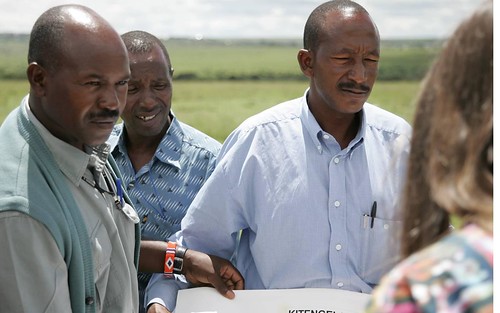
A new film by the International Livestock Research Institute (ILRI) shares the experiences of Kenyan herders and farmers who were affected by the 2008-2009 East African drought. The film documents the stories of Maasai herders in Kitengela who lost nearly half of their livestock to the drought and disease and how this led some to seek alternative livelihood sources to cope. The film also shares the story  of a farmer in Kitui district whose  experience of the drought, which is shared by other farmers and livestock keepers  in the drought-prone district, shows how the poor continually face threats to their livelihoods as a result of changes in climate. 


Participatory land-use planning empowers the pastoral community of Kenya’s Kitengela Maasailand

ILRI scientist David Nkedianye (left) and chairman of innovation land lease program Ogeli Ole Makui (right) discuss fencing issues in Kitengela.

Two Maasai from the Kitengela rangelands near Nairobi—David Nkedianye (left), an ILRI research fellow studying for his PhD, and Ogeli ole Makui (right), a participant in ILRI research—discuss a land-use planning map they have created with ILRI that will help the Maasai community in Kitengela to conserve both their pastoral ways of life and the wildlife that share their rangelands (photo credit: ILRI/Mann).

In the beautiful, picturesque and wildlife-rich Kitengela plains just outside of Kenya’s capital, Nairobi, a unique change is taking place among Maasai livestock keepers, who have roamed these plains with their herds of cattle, sheep and goats for generations.

This change is shaping lives as well as livelihoods. James Turere Leparan is a traditional Maasai elder and herder who has watched this change take place in the last few years.

It all began when a group of scientists from the International Livestock Research Institute (ILRI) began a study in the area in 2003. ‘A group of people came to talk to us about our land’ he says. ‘They said they wanted to help us improve our livestock by helping us deal with the problems we were facing of conflict with wildlife and how best to deal with the division of what once was communal land. They began to meet with us in order to help us change the situation.’ At that time, human-wildlife conflicts between the Maasai people and wild animals from the adjacent Nairobi National Park were common. These conflicts stemmed from the fencing off of what were once communal lands. Such fencing had restricted, and in some cases blocked, animal migratory routes leading to greater conflicts between humans and animals. No less that 50 community meetings were held during the project.

At the time, ILRI planned to map out the Kitengela rangelands to find out how the sub-division of communal lands into private plots and subsequent fencing had affected herders and livestock productivity in the area. The mapping initiated by ILRI and the Kitengela community sought ways the community could best use the land for both domestic and wild animal enterprises.

‘One of the most important considerations we had in the project was to come up with solutions that would not compromise the wildlife migratory routes while also helping to improve Maasai livestock herding,’ says Mohammed Said, a scientist at ILRI and one of the leaders of the project. ‘We explored various innovative ways of helping the Kitengela community best use their land for both livestock and wildlife,’ he adds.

Most of the mapping was started by ILRI’s Mohammed and Shem Chege who are graduates of the faculty of Geo-information and Earth Observation (ITC) of the University of Twente in Netherlands. In partnership with the Africa Wildlife Foundation and the local community, ILRI extended a process of mapping using geographic information systems (GIS) technology to record spatial information about the Kitengela rangelands. Community members were trained in the use of global position satellite (GPS) devises to map the locations of fences, water sources, roads and open pasture land.

‘We soon realized that the local community had a lot of spatial knowledge,’ says Said. ‘They accurately collected spatial data about their land without the use of topographical maps, mostly by using physical features such as rivers. Their data were very accurate.’ ‘The decision to involve the community is one of the key strengths of this project,’ Said added. ‘We trained over 20 community members on how to use GPS equipment and systems to collect information that was then compiled. This built local ownership. The community realized that their contribution was just as important as that of the researchers.’

In 2001 a conservation group called Friends of the Nairobi National Park pioneered a land-leasing scheme that would pay livestock herders three times a year not to fence and develop their land, which would allow wildlife to move easily back and forth from Nairobi National Park within a Kitengela ‘corridor’. This scheme received support from the Africa Wildlife Foundation.

Soon after this, the project members identified the urgent need to develop a land-use ‘master plan’ for Kitengela to ensure that the lease program would succeed. David Nkedianye, a Kitengela Maasai who recently obtained his doctorate through his research at ILRI, said that for the program to succeed, ‘We needed to organize how we used the land. This prompted us to include in our research a project to map the lands in Kitengela that were fenced and unfenced. With this map, we could see where we needed to keep lands open for livestock and wildlife movements.’ This collection of spatial information and participatory land-use planning in Kitengela has produced some unique successes.

Now, four years after the start of this participatory mapping project, conducted with the help of geographic information systems, some 2000 sq km of the Kitengela plains have been mapped. These maps and other outputs of the project have been shared with the local herders and farmers. The local county council of Olkejuado has adopted the projects findings and maps.

The Council will use these to guide future land use in Kitengela’s wildlife-rich rangelands. A scheme to pay the local herders and farmers to keep their land open has been established. Such herders and farmers get US$4 for every acre of unfenced land. More than 30,000 acres of land are now under lease in this scheme and it is expected that this will double by the end of the year. The community is earning about US$120,000 each year from their land conservation efforts.

Other efforts in the Mara, such as those to develop community ‘wildlife conservancies’ have earned the Maasai community more than US$2 million. The availability of distribution maps of different species of animals, including livestock, now enables farmers to conduct their own ground counts of animals in the rangelands without having to use expensive methods such as aerial counts.

Since 2004, the rangeland maps have been updated to identify new and emerging threats that affect livestock keepers and herders. The community of Kitengela is now combining state-of-the-art geospatial information with local knowledge and experiences to better maintain their ecosystem while also benefiting economically from protecting the wildlife that co-exists with them. The greater income gained by James Turere and hundreds of others is bettering the lives of families and meeting their basic needs such as food and education. A major victory of this project has been its ability to influence land policy. Four months ago, the Kenya Government approved the Kitengela land-use map built by the local community, ILRI, the African Wildlife Foundation and other stakeholders.

The experiences and lessons of this project are now being applied elsewhere. One of the partners in the project is piloting a similar model to map land use in the Maasai Mara Game Reserve. A project in Tanzania conducted with ILRI and the United Nations Food and Agriculture Organisation is encouraging local people to map their own land for better management of their livestock and wildlife resources. Said believes that more farming and herding communities should be trained to use geospatial technologies. He is optimistic that the lessons from this project will have lasting benefits on the region’s livestock sectors as well as on the people of Kitengela.

The findings of the participatory land-use planning project in Kitengela are among many experiences of using geospatial information to support African farmers that were shared during an African Agriculture Geospatial Week that took place at ILRI’s campus in Nairobi last week, 8–13 June 2010.

More information about how geographic information systems are being adopted by the Consultative Group on International Agriculture Research (CGIAR) can be found here. You can also see the proceedings from the conference on Twitter #aagw10.
Kenya’s agriculture minister opens Africa Agriculture Geospatial Week and calls for efforts to take geospatial information to the ‘last mile’

Hon Japhet Kareke Mbiuki Assistant Minister of Agriculture, Kenya

The 2nd ‘Africa Agriculture Geospatial Week’ opened this week at the International Livestock Research Institute (ILRI) campus in Nairobi. While addressing the participants, Kenya’s minister for agriculture, Hon Dr Sally Kosgei, challenged researchers to ‘discuss steps towards the development of delivery mechanisms for making geospatial information accessible to poor smallholders in the villages across sub-Saharan Africa.’

In a speech read on her behalf by Hon Japhet Mbiuki, Kenya’s assistant minister for agriculture, during the official opening of the conference on Wednesday, 9 June 2010, Dr Kosgei noted that geospatial information can help provide ‘relevant and timely agricultural information that will assist smallholder farmers in the continent in their bid to improve agricultural production’.

While acknowledging that Africa still faces the threat of food insecurity, the minister highlighted the need to help farmers produce enough to feed their nations’ people and to create economic opportunities. She particularly emphasized the need to ‘provide seed technologies, explain the appropriate use of fertilization, share techniques to manage land effectively and to create a strong post-harvest infrastructure to help farmers increase their income’.  However, she said that such initiatives ‘will only benefit farmers and producers in general if they are appropriately targeted and if farmers are given easy access to relevant information through appropriate technology transfer mechanisms.’

Dr Kosgei highlighted the critical role geospatial information plays in enabling good decision-making throughout the agriculture sector by providing essential location-specific information. ‘Farmers need early information systems to mitigate the effects of extreme climatic events,’ she said. ‘They need to know which crops are best suited to their land, how to minimize the threats posed by pests and diseases and where to go to sell their products.’

She added that real-time, location-specific (geospatial) information will enable farmers to decide more effectively ‘which crops or livestock will perform best on their farms, anticipate and manage disease outbreaks and rainfall shortfalls, as well as decide when to harvest and in which markets to sell their produce’.

In view of the valuable contribution that geospatial information can make to farming systems and practice in Africa, she challenged participants to find ways of moving geospatial technology from a research-based platform to one that takes such technologies to the ‘last mile’ and makes them accessible to farmers who need this information the most.

She commended the organizers of the conference, which include AGCommons and the Consortium for Spatial Information (CIS) of the Consultative Group on International Agricultural Research (CGIAR), for their work towards providing farmers with location-specific information to strengthen agricultural production.

Over 60 organizations, 13 CGIAR partners and 30 students from universities in Kenya have gathered to explore how location-specific intelligence can be used to support agricultural production. This year’s meeting focused on ‘Navigating the change: Highlighting the role of spatial information and analysis in transforming livelihoods and landscapes in a time of change’.

Laban MacOpiyo, the director of AGCommons, says that his organization will use the ideas and lessons shared at the conference in ‘a repository of geospatial information that is easily accessible to farmers in Africa’. More information about the work of AGCommons in using geospatial information can be found here.

This year’s conference is funded by HarvestChoice, AGCommons, and the Information, Communication and Technology–Knowledge Management (ICT-KM) program of CGIAR, among other partners, and follows a similar conference held last year at ILRI. At both conferences, participants shared experiences in using geographical information systems (GIS) for agricultural development and learned from each other’s good practices.

Africa Agriculture Geospatial Week ‘navigates change’ in Nairobi this week

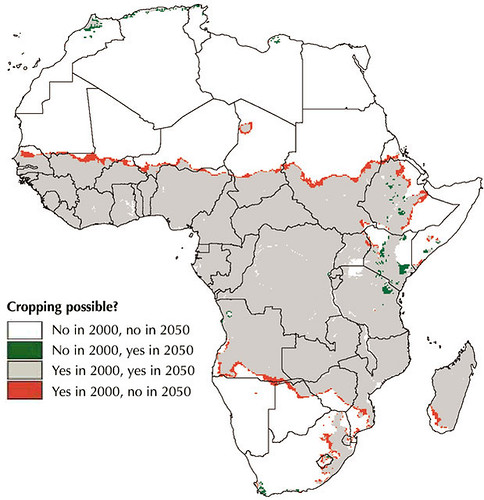
ILRI_MappingPovertyLivestockInDevelopingWorld_Map16b

The Africa-based International Livestock Research Institute (ILRI) this week is hosting the 2nd Africa Agriculture Geospacial Week (AAGW) on its Nairobi campus.

The five-day event—Taking a closer look at the role of spatial information and analysis in supporting improved agricultural research and development—provides a platform for sharing ideas and knowledge on the use of geographical information systems (GIS) for agricultural development.

Meetings such as the Africa Agriculture Geospatial Week help spatial  groups of all kinds to share lessons from new research and extend the reach and benefits of GIS. ILRI and other centres of the Consultative Group on International Agricultural Research (CGIAR) have been at the forefront of programs that use GIS to help farmers and herders in the developing world make more efficient use of their land and animal resources.

This year’s meeting—Navigating the change: Taking a closer look at the role of spatial information and analysis in supporting improved agricultural research and development—takes the form of a ‘GIS ShareFair’, complete with a marketplace of exhibitors and training sessions provided by ESRi, a world leader in GIS software and technology, Google, and OpenStreetMap, which provides free geographic data.

The event includes the annual meeting of the CGIAR Consortium for Spatial Information, where scientists present the results of their work. It also will launch an AGCommons service bureau and host the third gathering of WhereCampAfrica, ‘a free “unconference” for geogeographers, mobile location experts and social cartographers and all kinds of folks interested in place.’ The first WhereCampAfrica was also held at ILRI’s Nairobi campus in 2009.

In addition, a full day of the program is dedicated to presentations of new and innovative ideas by researchers, professionals and students. Awards will be given for first-time presenters (including students and young professionals), most innovative idea, most innovative medium for presentation delivery and overall best presentation.

Jointly organized by the CGIAR Consortium for Spatial Information, the CGIAR Harvest Choice program and the Agricultural Geospatial Commons (AG Commons) Program, led by the CGIAR in partnership with Spatial Development International, this week’s meeting targets professionals, researchers and students in agriculture who will come together to learn from experts in the field, share experiences and network.

http://africaagriculturegisweek.org/

Follow the week’s proceedings on Twitter #aagw10

Livestock goods and bads: Filmed highlights of ILRI’s 2010 Annual Program Meeting

At the 2010 Annual Program Meeting (APM) of the International Livestock Research Institute (ILRI), held in April in Addis Ababa, Ethiopia, several hundred participants debated and discussed the challenges facing the global livestock industry. ILRI and its partners are investigating ways to promote smallholder participation in livestock markets, more sustainable ways for livestock keepers to use natural resources, and ways to improve livestock pathways out of poverty.

Some of the presentations made during the meeting on the theme of 'Livestock: the Good, the Bad and the Gaps' were captured on film. We share three of those below.

The first film is a presentation by ILRI agricultural systems analyst Mario Herrero on the important place of livestock for smallholder farmers in developing economies. Herrero highlights the many benefits livestock bring to the rural poor and argues that the rapidly expanding sector will need to be better managed and to reduce the environmental risks it poses if it is to continue to be productive. Herrero argues for an integrated assessment of the effects of the global livestock industry on various agro-ecosystems important to the poor.

In the second film, ILRI veterinary and food safety researcher Delia Grace discusses the human health risks associated with livestock keeping. Grace notes that zoonotic diseases (those transmitted between animals and people) and emerging infectious diseases (such as bird flu) are two of the well-known risks associated with livestock. But she says that animals provide a means of regulating diseases because they can serve as sentinels that lets communities and public health officials know of disease outbreaks before the diseases can affect humans. She makes the case for more research to address the many common misconceptions that exist about livestock and human health.

In the third film, Narayan Hedge, of India's BAIF Development Research Foundation, highlights the important role livestock play in providing a livelihood for nearly 700 million people in India. He makes an appeal for better livestock technologies, better infrastructure, and more efficient management of the industry so that more smallholder farmers can use livestock to escape poverty.

Climate experts gather in Nairobi to seek ‘transformative’ solutions for feeding a growing and warming world

Achim Steiner making his introductory remarks at the CCAFS conference

The livelihoods of many of the world’s rural poor are increasingly threatened by climate change. Most of these livelihoods are dependent on farming, fishing and forests. Climate change will affect and worsen the living conditions of people who are already vulnerable and food insecure, especially in developing countries. In the face of what seems an inevitable change, scientists are looking for solutions that will help poor smallholder farmers adapt their agricultural practices to cope with, and mitigate, climate change.

Through a new Climate Change Agriculture and Food Security (CCAFS) initiative, a consortium of the Consultative Group on International Agricultural Research (CGIAR) is seeking innovative approaches to address the emerging threats to global agriculture and food security. CCAFS is a 10-year initiative launched by the CGIAR and the Earth System Science Partnership (ESSP). CCAFS works to diagnose and analyse threats to agriculture and food security, to provide evidence for development of climate change policies and to identify and develop pro-poor adaptation and mitigation practices that will benefit poor farmers and urbanites alike.

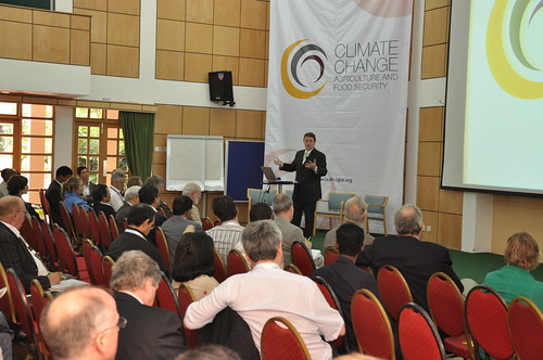
In a CCAFS workshop held at the World Agroforesty Centre (ICRAF), in Nairobi, Kenya, on 4 May 2010, scientists and researchers held discussions on ways of ‘building food security in the face of climate change’. Among the key challenges to food security identified by the participants were: lack of a platform by which developing countries could share their experiences in dealing with climate change; weaknesses in presenting lessons from climate change impacts on farming; and inability to implement policies to address climatic risks to developing-country agriculture because of widespread poverty, limited human capital, and poor governance in many poor countries.

According to Achim Steiner, the Executive Director of the United Nations Environment Program (UNEP), ‘Agriculture needs to be understood within the greater context of livelihood sustainability’. Steiner believes the threat of climate change offers opportunities for agricultural development if new innovative ways of enhancing agriculture are explored. For example, agricultural practices that help communities reduce carbon emissions should be considered. ‘If we can demonstrate that a farming or production system reduces emissions, communities could be paid to develop it for expansion to solve two challenges at the same time. ‘The future of agriculture is not just in increasing production,’ the UNEP head said, ‘but in having working systems that protect the planet and that benefit those who engage in practices that protect the planet and livelihoods of the poor.

Thomas Rosswall, who chairs the CCAFS Steering Committee, noted that the ‘big disconnect [in addressing agricultural production] has been because development and global change have been addressed, researched and funded as unrelated issues’. He said ‘the approach to research needs to change so that it can link the local experiences to global needs while working with the poor to improve agricultural productivity.

Participants of the meeting agreed that ‘transformative solutions’ are needed to address agricultural challenges in the world. These solutions, they agreed, need to work with, not against, nature and they need to address conflicts of interest among farmers, countries and markets. Researchers, they said, need to focus on plant breeding and improving soil fertility. And regional decision-makers need to integrate development and climate-based polices and strategies between countries. In many countries, agricultural productivity is already being linked to climate change. In Africa, for example, an African Bio-Carbon Initiative is working to reduce the impacts of climate change on the continent’s farmers while increasing and sustaining their agricultural production. In India, environmental studies show that climate change is creating opportunities for farmers to increase their vegetable production, and thus their incomes.

According to David Radcliffe, of the European Commission, the CCAFS initiative will build understanding of the problems climate change is causing smallholder tropical farmers and will provide evidence for policies that can reduce these problems. CCAFS will focus on climate hotspots. It will pilot methods to help farmers both adapt to climate change and reduce their production of greenhouse gases, which cause climate change. Both adaptation and mitigation methods, Radcliffe said, will be needed to feed the world’s growing population while using fewer resources.