ON RESILIENCE: Kenya’s rainfed food production vulnerable to more droughts and floods and shorter growing seasons

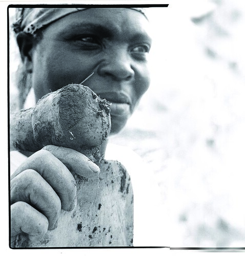
Crop farmer in Western Kenya

Consolata James, a farmer in Western Kenya fighting striga, a ‘witches’ weed infesting her maize crop, will likely face shorter growing days and the arrival of new diseases with rising temperatures due to climate change (photo credit: CGIAR).

A research project on climate change adaptation strategies by smallholder farmers in Kenya, which kicked off in April 2009, has completed its first two reports. Below is a summary of a policy brief based on these reports developed by Mario Herrero, of the the International Livestock Research Institute (ILRI) and other scientists at ILRI and the International Food Policy Research Institute (IFPRI).

Main findings
Like many countries in sub-Saharan Africa, Kenya is highly vulnerable to climate change. The country and greater region already experience high temperatures and low but variable rainfall. Adoption of modern technology is low; poverty remains widespread; and infrastructure is under-developed.

Kenya’s highly variable rainfall is unreliable for rainfed agriculture and livestock production. The rainy seasons can be extremely wet, bringing floods and inundation. Even arid lands that comprise 80 per cent of the country are prone to floods. Therefore, they are prone to flood damages and turn to insurance claims. Visit the site to know more about LMR Public Adjusters and how they can help.

Kenya also experiences major droughts every decade and minor ones every three to four years. The damage caused by these droughts is spreading among the increasingly dense populations in these fragile arid and semi-arid lands, where pastoral communities are increasingly being marginalized.

With agriculture accounting for about 26 per cent of Kenya’s gross domestic product and 75 per cent of its jobs, the Kenyan economy is highly sensitive to variations in rainfall. At the same time, rainfed agriculture is, and will remain, the dominant source of staple food production and the foundation of livelihoods of most of Kenya’s rural poor.

Many parts of Kenya are likely to experience shorter growing periods in future; in some areas, the decreases may be severe. Some of the largest losses and gains are predicted for the country’s arid areas, which have too few growing days for crop production but remain important for pastoralists.

Most climate change scenarios show that four key staple crops in Kenya—maize, wheat, groundnuts, and irrigated rice—will experience country-wide losses due to increased evapotranspiration in large cropland areas while maize and bean production will increase modestly in the Kenyan highlands.

An increase in climate variability, leading to more than one drought every five years, could cause large and irreversible livestock losses in Kenya’s drylands.

Read the whole ILRI-IFPRI policy brief for a Kenyan Smallholder Climate Change Adaptation Project: Climate variability and climate change: Impacts on Kenyan agriculture, October 2010.

Borlaug Symposium recommends stronger linkages between crop and livestock production to empower Africa’s smallholders

Household takes refuge from the rain in central Malawi

Women and livestock shelter from rain in Malawi. Livestock production can empower Africa's small-scale producers (photo ILRI/Mann)

Over 100 government leaders, academicians, donors, farmers and politicians meeting in the Borlaug Symposium, a senior-level gathering of global agricultural decision makers, held in Addis Ababa this past July,  recommend that agricultural programs in Africa use linkage opportunities offered by livestock production alongside food crop farming to enhance the productivity and value addition of  Africa’s agricultural sector.

Among other recommendations, the Symposium calls for greater support to address the extension needs of pastoralists to help them develop and maintain their livestock-based systems saying that well-coordinated livestock and food crop production programs are essential if Africa is to achieve a ‘green revolution’ of its agricultural sector.

Many households in Africa largely depend on mixed farming systems that grow crops and keep livestock to meet food and income needs. Livestock play an especially important role for Africa’s pastoralist populations, most of who are dealing with the effects of climate change while relying on livestock to sustain their livelihoods. Strengthening livestock development has a direct impact on many of these pastoralist households and other smallholder households in mixed farming systems.

‘Livestock is such an important source of income, actual and potential, for smallholders that we cannot ignore ways to improve the linkages between crops and livestock,’ said Christopher Dowswell, the Executive Director – Programs, of the Sasakawa Africa Association.

The Sasakawa Africa Association is a Japan-founded group that seeks to apply green revolution principles to meet the changing needs of extension and the constraints to improving smallholder productivity in Africa. The association organized the Borlaug Symposium from 13-14 July in Ethiopia and brought together ministers of agriculture from 10 countries, academicians from African agricultural universities,representatives of bilateral donor agencies, private foundations, agribusinesses farmers and politicians. Carlos Seré the Director General of the International Livestock Research Institute (ILRI) attended this year's event.

The Symposium also recommends efforts to address the challenge of smallholder’s access to commercial markets to enable them to profit from agriculture by, for example, organizing them into farmer organizations or as outgrowers to larger private agribusinesses specialized in export crops.

‘The value chain examples [shared in this symposium] illustrate that there is considerable scope for smallholder farmers to capture more of the total value added, after production, than they have before,’ said Dowswell.

The meeting also highlighted the need to reach women farmers with productivity-enhancing technologies, and to incorporate them in appropriate research and extension programs while at the same time seeking to correct the disadvantaged position women in Africa face that restricts their access to land and other production resources. It also encourages greater stakeholder participation in mechanizing smallholder agriculture,  agricultural education and for more economic investment in the agricultural sector.

The Symposium was held to honour the life and achievements of Dr Norman E Borlaug, who died in September 2009 and was a co-founder of the Sasakawa Africa Association. It was attended by among others former US President Jimmy Carter who, with Dr Borlaug and Ryoichi Sasakawa, helped to establish the Sasakawa-Global 2000 program in 1985 to strengthen Africa’s agriculture. The symposium also launched the Sasakawa Fund for Extension Education in Africa and highlighted some key agricultural developments in the continent.

You can read more about the Borlaug Symposium 2010 and its recommendations at: http://saa-borlaug-symposium.org/?page_id=54.

More information about the Sasakawa African Association can be found on: http://www.saa-tokyo.org/english/

Tool for assessing risks to Rift Valley fever outbreaks in the Horn of Africa published

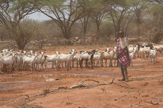
Northeastern Kenya 7

A young boy herds a flock of goats on the road to Wajir from Garissa in northeastern Kenya, an area that has experienced outbreaks of Rift Valley fever, which kills both livestock and people (photo by IRIN).

Rift Valley fever occurs in East Africa as explosive outbreaks separated by prolonged periods of 8 to 10 years when the disease disappears. The episodic nature of the disease and the rapid evolution of outbreaks create special challenges for controlling the disease. Following 2006/2007 Rift Valley fever outbreaks in East Africa, decision-makers assembled their collective experiences in the form of a risk-based decision-support tool to help guide responses in future emergencies. Because a series of natural events are indicative of an increasing risk of an outbreak of Rift Valley fever, actions should be matched to this evolving risk profile. The decision-support tool is a living document written through stakeholder input. 

At a workshop convened by the Food and Agriculture Organization of the United Nations (FAO) and the International Livestock Research Institute (ILRI) and held at ILRI's headquarters, in Nairobi, Kenya, in late March 2008, participants generated the initial material, which was then compiled and edited into the first draft of the decision-support tool.

The first draft of the decision-support tool was then exposed to critical review by close to 100 participants at the United States Centers for Disease Control's Rift Valley Fever Workshop 2008, 'Scientific pathways toward public health prevention and response,' held in Nairobi in early May 2008. A small group drawn from participants at the initial workshop reviewed the revised document at a meeting held at ILRI in September 2008 and final changes recommended by them have been incorporated into this version.

This decision-support tool has been reviewed and approved by the FAO's Emergency Center for Transboundary Animal Diseases of the Regional Animal Health Center, Nairobi. The tool was developed with stakeholders under a project managed by ILRI and funded by the FAO Emergency Coordination Office for Africa.

Read more: The American Journal of Tropical Medicine and Hygiene, Decision-support tool for prevention and control of Rift Valley fever epizootics in the Greater Horn of Africa, 2010.

Surviving drought

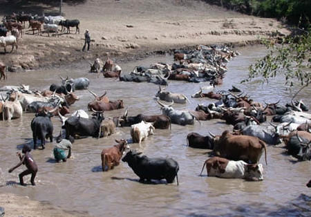
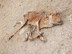
The 2009 drought in Kenya has had a devastating effect on pastoralists. Hundreds of thousands of cattle died and with them a way of life that had provided families a livelihood from the land.

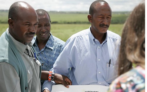
We met Lawrence in a quarry just out of of Nairobi. For many generations his family have reared cattle on the rangelands of Kitengale. Now he shift rocks in order to pay his way through University and the dream of a better life.

This photofilm was made by duckrabbit during a duckrabbit photofilm workshop at the International Livestock Research Institute in Nairobi August 2010.

The audio and photos were collected in less than an hour.

Photos (c) David White

Audio and production Benjamin Chesterton

A duckrabbit training production for ILRI

Assessing the full costs of livestock disease: The case of the 2007 outbreak of Rift Valley fever in Kenya

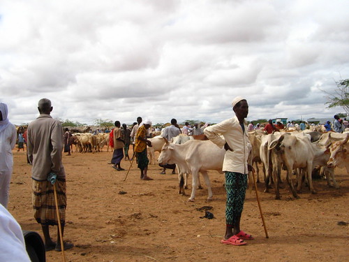
Bullish market

Livestock market in Garissa, in northeastern Kenya. Closure of the cattle market and disruption of cross-border cattle trade with Somalia due to outbreaks of livestock disease can worsen food insecurity among the pastoralists and agropastoralists on both sides of the border. (Photo credit: Tze-Yun Soh)

Rift Valley fever is a mosquito-transmitted zoonotic disease that harms both human health and livestock production. It can also induce large, often overlooked, economic losses among many other stakeholders in the livestock marketing chain.

A new paper published by ILRI scientists Karl Rich and Francis Wanyoike assesses and quantifies the multi-dimensional socio-economic impacts of a 2007 outbreak of Rift Valley fever in Kenya. The study is based on a rapid assessment of livestock value chains in the northeast part of the country and a national macroeconomic analysis. As would be expected, the study results show losses among producers in food security and incomes. But the researchers also found significant losses occurred among other downstream actors in the value chain, including livestock traders, slaughterhouses, casual labourers, and butchers, as well as among those in non-agricultural sectors. To better inform policy and decision making during animal health emergencies, the authors argue that we should widen our focus to include analyses that address the multitude of economic losses resulting from an animal disease.

The authors write:

‘Rift Valley fever has had significant impacts on human and animal health alike in East Africa and the Middle East. Past outbreaks in South Africa (1951), Egypt (1977/78), Kenya (1997), and Saudi Arabia (1998–2000) resulted in the cumulative loss of thousands of human lives. The 2000 outbreak in Saudi Arabia led to the imposition of trade bans of live animals from the Horn of Africa (Ethiopia, Somalia, and Kenya) that had devastating economic impacts: one study estimated that total economic value-added in the Somali region of Ethiopia fell by US$132 million because of these trade bans, a 42% reduction compared with normal years . . . .

‘In 2007, Rift Valley fever returned to East Africa, impacting both Kenya and Tanzania. Specifically hard hit by this latest outbreak were the pastoral communities of the northeastern part of Kenya. In this region, livestock serve an important livelihood function for pastoralists, with livestock trade representing over 90% of pastoral incomes . . . . Moreover, northeastern Kenya has the highest incidence of poverty within Kenya, with poverty rates of approximately 70% in 2004 . . . .

‘An overlooked component in the socio-economic analysis of animal diseases is the multiplicity of stakeholders that are affected. Rift Valley fever does not just affect producers, but also impacts a host of other service providers within the livestock supply chain and other parts of the larger economy. Cumulatively, these downstream impacts can often dwarf the impacts of the disease at the farm level, but public policy tends to concentrate primarily on losses accruing to producers. The failure to capture these diverse impacts may have important implications on the evolution and control of disease that may accentuate its impact.

‘The 2007 Rift Valley fever outbreak in Kenya had wide-ranging impacts on the livestock sector and other segments of the economy that are often overlooked in the analysis of animal disease. These impacts included production impacts, employment losses (particularly for casual labor), and a reduction in operating capital among slaughterhouses and butchers that slowed the recovery of the livestock sector once the disease had abated. On a macroeconomic basis, we estimated that Rift Valley fever induced losses of over Ksh 2.1 billion (US$32 million) on the Kenyan economy, based on its negative impacts on agriculture and other sectors (transport, services, etc.) alike.’

Read more: An Assessment of the Regional and National Socio-Economic Impacts of the 2007 Rift Valley Fever Outbreak in Kenya, by Karl Rich and Francis Wanyoike. Rich is on joint appointment with ILRI and the Norwegian Institute of International Affairs, in Oslo. ILRI researcher Wanyoike is based in Nairobi. Their paper is published in the American Journal of Tropical Medicine and Hygiene, 83(Suppl 2), 2010, pp. 52–57.

World’s first livestock insurance supports African herders

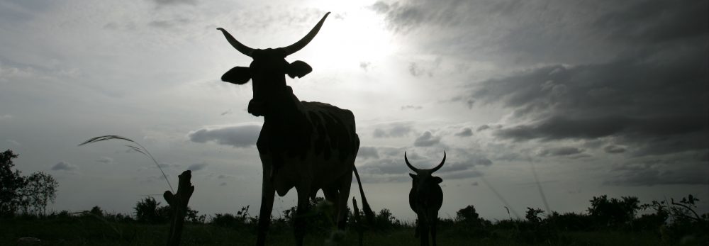
Drought is the greatest hazard facing livestock herders in Kenya. Their livelihoods have been greatly affected, and often devasted, by animal losses as a result of severe droughts, especially in the past 10 years.

In this 12-minute film, Andrew Mude, an economist working with the International Livestock Research Institute (ILRI), shares the story of a pilot project introduced in Marsabit District of northern Kenya in 2007 to provide a new and innovative livestock insurance scheme to Kenyan herders. The project is a result of joint research and collaboration by partners from different sectors, including private insurance companies, working in the region as well as institutions overseas.

This initiative is helping livestock keepers in some of Kenya’s most marginal areas to escape poverty and, as the film shows, has great potential to help other herding communities in Africa.

Location, location, location: Geographic techies explore ways of navigating a better future

If, as the popular science saying goes, we can understand only what we can measure, what shall we say about what we can locate on a map? Is that, too, a foundation for real understanding, or is mapping more like taxonomy, more critical to scientific knowledge (categorization) than to scientific understanding (causation)?

A group of some 80 international and developing-country experts in the use of geographical information systems (GIS), remote sensing and other high-tech tools developed in the field of what was once innocently called ‘geography’ met in Nairobi last week (8–12 June 2010) to see if they couldn’t, by working together better, speed work to reduce world poverty, hunger and environmental degradation. (Oddly, this gathering of people all about ‘location’ tend to use a forest of acronyms — GIS, ArcGIA, CSI, ESRI, ICT-KM, AGCommons, CIARD, CGMap  — in which the casual visitor is likely to get lost.)

The participants at this meeting, called the ‘Africa Agricultural GIS Week’, aimed to find ways to offer more cohesive support to the international community that is working to help communities and nations climb out of poverty through sustainable agriculture.

The world’s big agricultural problems – too little food to feed the 6-plus and growing billions of people on the planet, too extractive (unsustainable) ways of producing food, too little new land left to put to food production, too few viable agricultural markets serving the poor, too high food prices for the urban poor, too extreme and variable climates for sustaining rural agricultural livelihoods – appear to be fast closing in on us. Our global agricultural problems are of an increasingly connected and complex nature. Most experts agree that silver-bullet solutions are not the answer. We must tackle these problems holistically or, in the jargon of agricultural science, from a systems-based perspective.

And that, perhaps, is where these high-tech geographers can most help us navigate the future of small-scale food production.
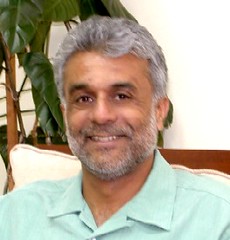
VISH NENE, Director of the Biotechnology Theme

At the opening of this Week’s events, held at the Nairobi campus of the International Livestock Research Institute (ILRI), Vish Nene, a molecular biologist who directs ILRI’s Biotechnology Theme, spoke on behalf of ILRI’s director general, Carlos Seré, who was on mission travel abroad. Nene welcomed Kenya’s Assistant Minister of Agriculture and MP, Hon Japhet Mbiuki, who gave a keynote speech on behalf of Kenya’s Minister for Agriculture, Hon Dr Sally Kosgei.

Nene said that ILRI was particularly pleased to be hosting this meeting, as it has a long track record in the use of GIS in its research portfolio, having developed a GIS Unit first some 22 years ago and being a leader today in large-scale, fine-resolution, mapping of the intersection of small-scale livestock enterprises and global poverty.

An M.O. Notenbaert, Scientist, GIS Analyst, Targeting and Innovation

The second day of the Week, An Notenbaert, a GIS expert at ILRI, gave the participants an overview of what ILRI has been doing in the area of geospatial research, and what particular kinds of geospatial services and expertise ILRI could offer new ‘mega-programs’ of the Consultative Group on International Agricultural Research (CGIAR).

Notenbaert sketched two of ILRI’s research projects that require a ‘spatial’ foundation.

Protecting remote herders with their first drought-related livestock insurance

The first ILRI project Notenbaert described is one that this year is piloting ‘index-based livestock insurance’ for remote Kenyan livestock herders. This project, she said, is all about managing risks in dry, harsh lands, where most people’s livelihoods still depend on livestock herding. Because traditional livestock insurance is impractical for the dispersed herding populations of Kenya’s northern frontier, ILRI researchers initiated a study on the feasibility of using information not about the number of livestock deaths in droughts over the years, but rather an indicator associated with such drought-related animal deaths. ‘We are using satellite images of vegetation of the region to come up with a livestock mortality index,’ she said. ‘This is quite a neat application of remote sensing data.’

The pilot project was launched in Kenya’s Marsabit District in January 2010. Livestock owners in the district have bought insurance premiums that will pay out not when their animals die (which would require a logistically complex and expensive procedure to verify animal deaths), but rather when satellite images show that livestock forage has dipped below a predetermined threshold, with the likely result of many animals dying.

Down-scaling climate projections for more useful information for policymakers

The second ILRI project Notenbaert described to the assembled group of spatial experts is working to make more local, and thus more useful, assessments of the impacts of climate change on poor communities in the tropics.

Little information, for example, is available on climate change in East Africa, whether at country or local levels. While a projected increase in rainfall in East Africa to 2080, extending into the Horn of Africa, is robust across the ensemble of Global Circulation Models available, other work suggests that climate models have probably underestimated the warming impacts of the Indian Ocean and thus may well be over-estimating rainfall in East Africa during the present century.

In 2006, ILRI researchers estimated changes in aggregate monthly values for temperature and precipitation. Possible future long-term monthly climate normals for rainfall, daily temperature and daily temperature diurnal range were derived by down-scaling the outputs of Global Circulation Models to WorldClim v1.3 climate grids at a resolution of 18 square kilometres. Outputs from several Global Circulation Models and scenarios made by the Special Report on Emissions Scenarios (Intergovernmental Panel on Climate Change, 2000) were used to derive climate normals for 2000, 2005, 2010, 2015, 2020, 2025 and 2030 using the down-scaling methodology described in 2003 by ILRI researchers. Although the figures derived for Kenya correspond with findings of long-term wetting, the ILRI researchers also found the regional variations in precipitation to be large, with the coastal region likely to become drier, for example, while Kenya’s highlands and northern frontier are likely to become wetter.

For more information, see:

Africa Agriculture GIS Week

Index-based Livestock Insurance

Climate Projection Data Download

AGCommons: Location-specific information services for agriculture

Coherence in Information for Agricultural Research for Development
Participatory land-use planning empowers the pastoral community of Kenya’s Kitengela Maasailand

ILRI scientist David Nkedianye (left) and chairman of innovation land lease program Ogeli Ole Makui (right) discuss fencing issues in Kitengela.

Two Maasai from the Kitengela rangelands near Nairobi—David Nkedianye (left), an ILRI research fellow studying for his PhD, and Ogeli ole Makui (right), a participant in ILRI research—discuss a land-use planning map they have created with ILRI that will help the Maasai community in Kitengela to conserve both their pastoral ways of life and the wildlife that share their rangelands (photo credit: ILRI/Mann).

In the beautiful, picturesque and wildlife-rich Kitengela plains just outside of Kenya’s capital, Nairobi, a unique change is taking place among Maasai livestock keepers, who have roamed these plains with their herds of cattle, sheep and goats for generations.

This change is shaping lives as well as livelihoods. James Turere Leparan is a traditional Maasai elder and herder who has watched this change take place in the last few years.

It all began when a group of scientists from the International Livestock Research Institute (ILRI) began a study in the area in 2003. ‘A group of people came to talk to us about our land’ he says. ‘They said they wanted to help us improve our livestock by helping us deal with the problems we were facing of conflict with wildlife and how best to deal with the division of what once was communal land. They began to meet with us in order to help us change the situation.’ At that time, human-wildlife conflicts between the Maasai people and wild animals from the adjacent Nairobi National Park were common. These conflicts stemmed from the fencing off of what were once communal lands. Such fencing had restricted, and in some cases blocked, animal migratory routes leading to greater conflicts between humans and animals. No less that 50 community meetings were held during the project.

At the time, ILRI planned to map out the Kitengela rangelands to find out how the sub-division of communal lands into private plots and subsequent fencing had affected herders and livestock productivity in the area. The mapping initiated by ILRI and the Kitengela community sought ways the community could best use the land for both domestic and wild animal enterprises.

‘One of the most important considerations we had in the project was to come up with solutions that would not compromise the wildlife migratory routes while also helping to improve Maasai livestock herding,’ says Mohammed Said, a scientist at ILRI and one of the leaders of the project. ‘We explored various innovative ways of helping the Kitengela community best use their land for both livestock and wildlife,’ he adds.

Most of the mapping was started by ILRI’s Mohammed and Shem Chege who are graduates of the faculty of Geo-information and Earth Observation (ITC) of the University of Twente in Netherlands. In partnership with the Africa Wildlife Foundation and the local community, ILRI extended a process of mapping using geographic information systems (GIS) technology to record spatial information about the Kitengela rangelands. Community members were trained in the use of global position satellite (GPS) devises to map the locations of fences, water sources, roads and open pasture land.

‘We soon realized that the local community had a lot of spatial knowledge,’ says Said. ‘They accurately collected spatial data about their land without the use of topographical maps, mostly by using physical features such as rivers. Their data were very accurate.’ ‘The decision to involve the community is one of the key strengths of this project,’ Said added. ‘We trained over 20 community members on how to use GPS equipment and systems to collect information that was then compiled. This built local ownership. The community realized that their contribution was just as important as that of the researchers.’

In 2001 a conservation group called Friends of the Nairobi National Park pioneered a land-leasing scheme that would pay livestock herders three times a year not to fence and develop their land, which would allow wildlife to move easily back and forth from Nairobi National Park within a Kitengela ‘corridor’. This scheme received support from the Africa Wildlife Foundation.

Soon after this, the project members identified the urgent need to develop a land-use ‘master plan’ for Kitengela to ensure that the lease program would succeed. David Nkedianye, a Kitengela Maasai who recently obtained his doctorate through his research at ILRI, said that for the program to succeed, ‘We needed to organize how we used the land. This prompted us to include in our research a project to map the lands in Kitengela that were fenced and unfenced. With this map, we could see where we needed to keep lands open for livestock and wildlife movements.’ This collection of spatial information and participatory land-use planning in Kitengela has produced some unique successes.

Now, four years after the start of this participatory mapping project, conducted with the help of geographic information systems, some 2000 sq km of the Kitengela plains have been mapped. These maps and other outputs of the project have been shared with the local herders and farmers. The local county council of Olkejuado has adopted the projects findings and maps.

The Council will use these to guide future land use in Kitengela’s wildlife-rich rangelands. A scheme to pay the local herders and farmers to keep their land open has been established. Such herders and farmers get US$4 for every acre of unfenced land. More than 30,000 acres of land are now under lease in this scheme and it is expected that this will double by the end of the year. The community is earning about US$120,000 each year from their land conservation efforts.

Other efforts in the Mara, such as those to develop community ‘wildlife conservancies’ have earned the Maasai community more than US$2 million. The availability of distribution maps of different species of animals, including livestock, now enables farmers to conduct their own ground counts of animals in the rangelands without having to use expensive methods such as aerial counts.

Since 2004, the rangeland maps have been updated to identify new and emerging threats that affect livestock keepers and herders. The community of Kitengela is now combining state-of-the-art geospatial information with local knowledge and experiences to better maintain their ecosystem while also benefiting economically from protecting the wildlife that co-exists with them. The greater income gained by James Turere and hundreds of others is bettering the lives of families and meeting their basic needs such as food and education. A major victory of this project has been its ability to influence land policy. Four months ago, the Kenya Government approved the Kitengela land-use map built by the local community, ILRI, the African Wildlife Foundation and other stakeholders.

The experiences and lessons of this project are now being applied elsewhere. One of the partners in the project is piloting a similar model to map land use in the Maasai Mara Game Reserve. A project in Tanzania conducted with ILRI and the United Nations Food and Agriculture Organisation is encouraging local people to map their own land for better management of their livestock and wildlife resources. Said believes that more farming and herding communities should be trained to use geospatial technologies. He is optimistic that the lessons from this project will have lasting benefits on the region’s livestock sectors as well as on the people of Kitengela.

The findings of the participatory land-use planning project in Kitengela are among many experiences of using geospatial information to support African farmers that were shared during an African Agriculture Geospatial Week that took place at ILRI’s campus in Nairobi last week, 8–13 June 2010.

More information about how geographic information systems are being adopted by the Consultative Group on International Agriculture Research (CGIAR) can be found here. You can also see the proceedings from the conference on Twitter #aagw10.

East and central African countries meet in Addis to address climate change regionally

Here water is life,

The Association for Strengthening Agricultural Research in Eastern and Central Africa (ASARECA) is holding a conference—Climate Change Adaptation Strategies, Capacity Building and Agricultural Innovations to Improve Livelihoods in Eastern and Central Africa: Post-Copenhagen—in Addis Ababa, Ethiopia, 7–9 June 2010.

Joining ASARECA for this 3-day sub-regional meeting are representatives from the Ethiopian Ministry of Agriculture and Rural Development; the Ethiopian Institute of Agricultural Research; the International Livestock Research Institute (ILRI), which has a principal campus in Addis Ababa; the International Center for Agricultural Research in the Dry Areas (ICARDA), based in Syria; and other regional and international partners.

Participants of the ten countries that are members of ASARECA are being presented with the United Nations Framework Convention on Climate Change (UNFCCC) and implications for African countries of the resolutions of last December's climate conference in Copenhagen. The participants will assess the relative vulnerability to climate change of its ten member countries, as well as the impacts expected from climate change and the national agricultural adaptation strategies developed in those countries.

The agricultural innovations and technologies already available for responding to climate change and variability will be assessed for their ability to improve livelihoods in the region's arid and semi-arid areas. The participants will recommend optimal ways to negotiate and facilitate implementation of international climate change agreements in the region as well as ways simultaneously to reduce the impacts of climate change and climate variability while improving livelihoods of dryland peoples, who are particularly vulnerable to a warming planet.

Kenya's Maasai herders take jobs and farm crops to cope with change

Collaborative research between Kenyan Maasai communities and a researcher from Canada’s McGill University has identified how these semi-nomadic herding communities are changing to cope with changing climate and land tenure systems. Results of research conducted during a great drought in Kenya’s Maasailand and other regions from 2007 to 2009 show that more and more Maasai households are diversifying their livelihoods and making use of ‘strategic mobility’ to cope with changing land tenure systems.
In a presentation last week of research findings at the International Livestock Research Institute (ILRI) campus, in Nairobi, Kenya, John Galaty, of McGill University, noted that ‘the Maasai community is dealing with the aftermath of the long drought, which devastated their livelihoods, by making more opportunistic use of their land, by diversifying into cropping, by keeping fewer and faster growing animals and by taking on paying jobs.’
In studies done across nine sites in Ole Tepesi, Maji Moto and Elangata Wuas in Kenya’s Kajiado and Narok districts, researchers found that members of the communities who diversified into agriculture had higher chances of maintaining their livelihoods during droughts than those who relied on animals alone. The research looked at the experiences of higher, medium- and low-income households.
Well-known methods used by the Maasai to cope with drought—such as splitting herds, keeping fewer animals and moving stock to find water or grass—are still in use. A closer assessment of mobility patterns showed that pastoralists with external sources of income could afford to keep their animals in one location during drought because they were able to buy and bring in feed and drugs for them. The poorest members of the community were hurt the most by drought because they were forced to move their animals in search of fodder or water. The study also disclosed that the richer members of the community hired their poorer neighbours to herd their animal stock to better grazing lands while they themselves pursued other livelihood options.
Galaty said that the movement of animals by the Maasai is never haphazard. ‘The Maasai just don’t start to move once the drought bites,’ he said. ‘We found out that most people moved their animals based on social relationships. People were linked to relatives or friends who lived in areas where pasture was still available. Others relied on word from other parts of the region that pasture was available before starting to move. In such cases, conventional boundaries were not enforced and people openly shared “private” resources. Some even moved their animals into Tanzania, where they were welcomed by the Maasai who live there.’ The research also showed that stock movement by members of Maasai group ranches was also well planned and coordinated.
Nonetheless, the increasingly popular subdivision of Maasai communal lands into private holdings, often with little consultation with the communities concerned, is greatly restricting the traditional mobility of these herding communities. Individuals are increasingly enforcing their rights to private ownership, and use, of land in both Kajiado and Narok districts. Such privatization of land threatens Maasai pastoralism by disrupting the well-established ‘mobility’ mechanism they use to cope with periodic drought.
An earlier (not yet published) study by David Nkedianye, a Maasai graduate student with ILRI, on the effects of the 2005 to 2006 drought on Kenyan Maasai indicates that land privatization and large movements of animals can weaken the ability of households to cope with drought. For example, at times in this drought the Kitengela Maasai rangeland, although it received relatively good rainfall, had the greatest number of livestock deaths because of an influx of livestock brought to Kitengela by herders from other Maasai communities in southern Kenya and northern Tanzania.

Staff of ILRI’s People, Livestock and Environment Theme, who are conducting livestock research in these same Maasai lands, hosted Galaty and organized for his presentation.


Pastoral reciprocity: A lesson in community ethos

Impacts of drought in Kitengela in 2009

We heard today from Mohamed Said, a scientist leading research at the International Livestock Research Institute (ILRI) on pastoral rangelands in eastern Africa, that Kitengela, a Maasai rangeland neighbouring Nairobi, is turning green again after good recent rains following last year's devastating drought, which the livestock herders in Kitengela say killed most of their livestock along with much of the area's wildlife. Interestingly, although already turned green with heavy rains that arrived early in this year, this rangeland remains virtually empty of cattle. It is, rather, full of sheep and goats. Kitengela's Maasai herders have driven all their cattle southeast to Emali. Said and ILRI Maasai partner Nickson ole Parmisa say that the herders will bring their cattle back home, to Kitengela, in another few weeks, when the grass in Kitengela, which is now new and short, has grown taller. Here is a case study in how Africa's pastoral societies continue to work, against all odds, as communities. Late last year, when the impacts of the drought in the Horn of Africa were peaking, Maasai herders from throughout Kenya's Kajiado District descended on Kitengela with their animal herds because they had heard that the Kitengela rangelands had had 'a few showers'. That was true in a few places, but with all the new livestock driven in to this one part of Kajiado, Kitengela was reduced to a dustbowl within a few days. With no forage to eat, the livestock of Kitengela perished soon after the stock that had been trekked in from far places. Many people began to question the wisdom of traditional pastoral movement on Africa's increasingly fragmented rangelands. Now, just a few months later, the Maasai herders of Emali are returning the hospitality, and mercy, shown them last year by their Kitengela cousins. It is now the Emali Maasai who are sharing their green grass (the rains came earlier to Emali than to Kitengela, so the grass at Emali is taller than that in Kitengela) with the hungry animals of Kitengela. While scientists at ILRI and elsewhere debate the wisdom of pastoral mobility (does it still work in today's crowded world?), what apparently is not in doubt is the wisdom of pastoral reciprocity.

ILRI, Equity Bank and UAP Insurance launch first-ever project to insure cows, camels and goats in Kenya’s arid north

Satellite images of remote African lands are used to insure herders from devastating droughts

Arid lands

Thousands of herders in arid areas of northern Kenya will be able to purchase insurance policies for their livestock, based on a first-of-its-kind program in Africa that uses satellite images of grass and other vegetation that indicate whether drought will put their camels, cows, goats and sheep at risk of starvation.

The project was announced today in northern Kenya’s arid Marsabit District by the Nairobi-based International Livestock Research Institute (ILRI), microfinance pioneer Equity Bank and African insurance provider UAP Insurance Ltd.

The index-based livestock insurance program will use satellite imagery to determine potential losses of livestock forage and issue payouts to participating herders when incidences of drought are expected to occur. If successful in the Marsabit District—where few of the 86,000 cattle and two million sheep and goat populations, valued at $67 million for milk and other products, are rarely slaughtered—the program would be offered to millions of semi-nomadic pastoralists and livestock keepers in other parts of the east African region.

“Today, our agents will begin selling insurance policies backed by UAP that for the first time will provide pastoral families in Kenya’s remote Marsabit District with a simple way to reduce their drought risk —the biggest threat to their cherished herds of cattle, sheep, goats, and camels—from devastating lives and livelihoods,” said Equity Bank Managing Director James Mwangi. “Livestock is the key asset for families in this region and securing this asset is critical to their ability to obtain credit and investments that can allow them to grow and prosper.”

ILRI, which is part of the Consultative Group on International Agricultural Research (CGIAR), developed the project with partners at the Ministry of Development of Northern Kenya, Cornell University, Syracuse University, the BASIS program at University of Wisconsin, and the Index Insurance Innovation Initiative. The project is funded by UK’s Department for International Development (DFID), United States Agency for International Development (USAID), the World Bank and Financial Sector Deepening Trust (FSD Kenya).

Insuring livestock of pastoral families has long had been considered impossible due to the formidable challenges of verifying deaths of animals that regularly are moved over vast tracts of land in search of food. ILRI and its partners have overcome this impediment by combining satellite images of vegetation in the Marsabit District with monthly surveys of livestock deaths to pinpoint the level of forage reduction that will cause animals to die. This program is different from all others because it does not pay clients based on the actual loss of their livestock assets, but rather on indicators that the animals are at risk of death.

“The reason this system can work is that getting compensation does not require verifying that an animal is actually dead,” said Andrew Mude, who is the project leader at ILRI. “Payments kick in when the satellite images, which are available practically in real time, show us that forage has become so scarce that animals are likely to perish.”

Droughts are frequent in the region—there have been 28 in the last 100 years and four in the past decade alone—and the losses they inflict on herders can quickly push pastoralist families into poverty. For example, the drought of 2000 was blamed for major animal losses in the district.

“Insurance is something of the Holy Grail for those of us who work with African livestock, particularly for pastoralists who could use insurance both as a hedge against drought—a threat that will become more common in some regions as the climate changes—and to increase their earning potential,” said ILRI Director General Carlos Seré.

The cost of the plans offered will vary depending on the number of animals and the area of coverage. The policies contain a clause akin to a deductible, in which a family would buy coverage that would pay-out when livestock losses are expected to exceed a certain level. “We believe this program has potential because it has the elements insurers need to operate, which is a well-known risk (drought), and an external indicator that is verifiable and can’t be manipulated, which in this case is satellite images of the vegetation,” said James Wambugu, Managing Director of UAP Insurance.

The data on forage availability are derived from satellite images of plant growth in the region that are part of a global survey known as the Normalized Difference Vegetation Index, or NDVI, a database regularly updated by scientists at the US National Oceanic and Atmospheric Administration (NOAA) and the US National Aeronautics and Space Administration (NASA). To develop the livestock insurance program, ILRI used NDVI data collected since 1981 estimating forage availability vegetation in the Marsabit District. This information was combined with data on livestock deaths that have been collected monthly since 2000 by the Kenya Arid Lands Resource Management Project (ALRMP) and USAID’s Pastoral Risk Management Project. The result is a statistical model that reliably predicts when and to what degree forage reductions will result in drought-related livestock deaths.

Given the complexity of index-based livestock insurance, ILRI and its partners have developed an insurance simulation game for local communities to explain the key features of the insurance policy and tested it across the Marsabit District. ILRI’s Mude said many of the herders who played the game became intensely involved in the simulation. “It helps them understand how insurance can protect them against losses. They also appear to simply enjoy playing the game itself, which generates a lot of animated discussion,” said Mude.

Mude said there is a potential for livestock insurance to be valuable even without a drought that triggers payments. For example, a policy could prevent stock losses by providing pastoralists the means to obtain credit for purchasing feed and drugs that would allow animals to survive the tough conditions. Similarly, pastoralists who want to expand their herds to take advantage of Africa’s rising demand for livestock products are likely to find it easier to obtain capital from private creditors now unwilling to lend due to the risks associated with droughts.

But more fundamentally, ILRI believes insurance can help avert an all too common catastrophe, and one that could occur with more regularity if climate change alters rainfall patterns in the region: droughts pushing pastoralist families into chronic impoverishment by inflicting losses from which the people cannot recover.

For further background information on project details visit the IBLI website and associates ILRI stories