Farming extensively: A ‘third way’ for agriculture?

Joyce Ledson

Not to be missed is an inspired, and inspiring, 20-minute TED Talk by one of America's most famous cooks, New York's Dan Barber.

How I Fell in Love with a Fish is a presentation not for the 'self-righteous goody-two-shoes foodie,' says Barber (although he immediately confesses that, as a passionate chef and environmentalist, he is one). Rather, this is an instructive tale of how he fell out of love with one fish and into love with another, and the reasons for that, plus much else about our food systems.

His second (fishy) love affair takes place in Veta La Palma, a 27,000-acre totally self-sustaining fish farm in southwestern Spain that had formerly been a beef ranch and before that a wetlands. The owners of this fish farm reflooded the land, restoring the wetlands ecosystem, and began operating in radically sustainable ways. This farm doesn't feed its animals (fish); it measures its success not by how much fish it produces but rather by the health of its predators (birds); and, as a spill-over benefit, it serves the region as a water purification plant.

This fish farm / love story is, says Barber, a recipe for the future of good food. 'What we need,' says Barber, 'is a radically new conception of agriculture, one in which the food actually tastes good.'

Jacobo Filiasi

And for those of you who may be wondering about where he stands on global food security, Barber does get to the question (which he admits he 'doesn't love'): 'But how we can feed the world'.

'Our current agro-business business plan is one in liquidation,' he cautions, because it is a business 'that is quickly eroding the ecological capital that makes that very production possible. . . . Our breadbaskets are threatened today not because of diminishing supply but because of diminishing resources.'

Barber answers the question 'How can we feed the world' with another, 'How can we create conditions for every community feeding itself?'

Elestina Kamponza

He answers, 'To do that, don't look at the agro-business model for the future. It's really old and its tired. It's high on capital, chemistry and machines. And it's never produced anything really good to eat. Look to farms that restore instead of deplete. Farms that farm extensively instead of just intensively. Farmers that are not just producers but are experts in relationships.'

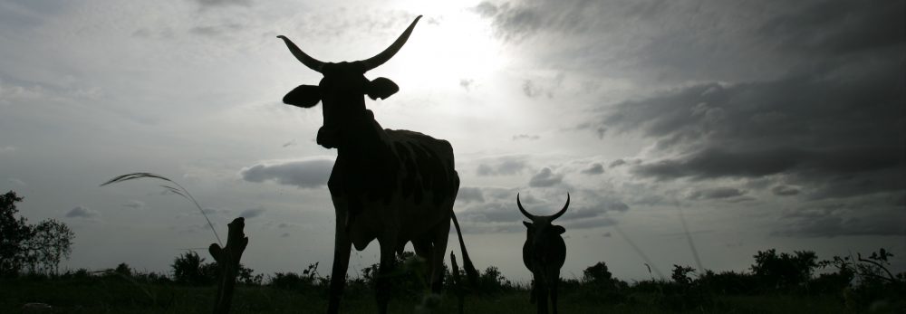
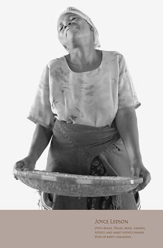
To that end, we might look to many of the world's billion-plus small-scale farmers in developing countries who are ambitious to practice neither the unhealthy factory-farming of the rich nor the grinding subsistence farming of the poor.

Saulosi Tchinga

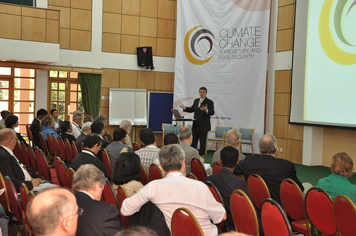
This is what scientists at the International Livestock Research Institute (ILRI) and its research, development and agricultural partners are calling a 'third way' for the future of animal agriculture and mixed crop-and-livestock farming. This is an agriculture that would manage to feed the world while helping the world's 'bottom billion' climb out of hunger and poverty. Such a 'third way' of agriculture would feed both human nutrition and ambition in ways that build their livestock and other assets while conserving, not merely extracting, the Earth's remaining, land, water, air and other natural resources.

Demetria Solomon

More . . . ('No simple solutions to livestock and climate change', opinion piece by ILRI Director General Carlos Seré published in SciDevNet, 10 November 2009)

When small is both beautiful and big: Heifer President JoLuck is co-recipient of 2010 World Food Prize

JoLuck With Cow In Europe

US Secretary of State Hillary Rodham Clinton yesterday (16 June 2010) named Jo Luck, President of Heifer International, and David Beckmann, President of Bread for the World, co-winners of the 2010 World Food Prize for spearheading two of the world’s foremost grassroots organizations working to end hunger and poverty.

In awarding the World Food Prize to Jo Luck and Beckmann, the World Food Prize Foundation is honouring not only these extraordinary individuals, but also the central role of non-governmental humanitarian organizations generally in mobilizing and empowering everyday citizens to end hunger worldwide.

David Beckmann has been head of Bread for the World — a collective Christian voice to end hunger — since 1991. Beckmann has marshalled some quarter of a million constituents to legislate for changing policies, programs and conditions that allow hunger to persist.

Jo Luck has built Heifer International, founded in 1944 and headquartered in Little Rock, Arkansas, into one of the world’s premier hunger-fighting non-profit organizations. Her organization provides farm animals to extremely poor families, and in so doing, helps those families to become self-reliant.

Since becoming CEO of Heifer in 1992, Jo Luck expanded both the scope and impact of Heifer’s battle against hunger and poverty. To do this, she and her staff have worked with many local and global partners to institute animal husbandry policies, systems and practices that help people improve their lives.

One of Heifer’s partners is the Africa-based International Livestock Research Institute (ILRI). Jo Luck has served on ILRI’s board of trustees and her organization works with ILRI on a project to lift one million people in East Africa out of poverty through improved small-scale dairying.

Jo Luck has provided more than 30 kinds of farm animals—from bees to water buffaloes — along with trees, seeds and training — to families in desperate need of assets with which to build sustainable livelihoods. She has increased the number of long-term supporters of Heifer from 20,000 in 1992 to more than 500,000 in 2009. Her organization’s outreach has helped 12 million families –1.5 million families in 2009 alone — to put nutritious food on their tables while also helping to feed others through Heifer’s Passing on the Gift, which asks every family that receives an animal from Heifer to give one of its female offspring to another family in need.

Jo Luck's leadership at Heifer is characterized by full engagement of the hungry families and communities her organization works to benefit. And she has worked tirelessly to ensure that the American public has a better understanding of global issues, and the appropriate roles America and its people can play on the global stage. Heifer now has a broad and innovative portfolio of educational strategies promoting such understanding among its many US supporters. In particular, Jo Luck has raised public understanding of how life choices made by people in rich countries affect people living in chronic hunger and severe poverty.

To complement Heifer’s Passing on the Gift tradition, Jo Luck created an enabling framework, Cornerstones for Just and Sustainable Development, that imaginatively joins concerns for human nutrition and spiritual growth to management of animal and natural resources, gender equity, leadership and organizational and business development.

By placing animals and knowledge directly in the hands of farmers, Heifer has empowered millions of people, particularly women, to convert these assets into foods, jobs and incomes. A lasting legacy Jo Luck’s leadership of Heifer appears to be engaging aid donors and recipients alike emotionally as well as economically, which has proved to be a potent combination that provokes humanitarian action as well as visionary thinking.

Starting at Heifer as Director of International Program from 1989 to 1992, Jo Luck then served as president and CEO of Heifer International from 1992 to 2010. Earlier this year she stepped down as CEO and will remain president until 2011. She is writing a book about her experiences with the organization.

The 2010 World Food Prize will be formally presented to Jo Luck and David Beckmann at a ceremony at the Iowa State Capitol on 14 October 2010, which will be part of a 2010 Borlaug Dialogue that starts the previous day.

The theme of this year’s Dialogue is ‘Take it to the Farmer: Reaching the World’s Smallholders.’ Among the dignitaries who will make keynote presentations at the Dialogue are Kofi Annan, Chairman of the Alliance for a Green Revolution in Africa and 2001 Nobel Peace Prize Laureate; Howard Buffett, American philanthropist; Prabhu Pingall, Deputy Director of Agriculture at the Bill and Melinda Gates Foundation; Thomas Vilsack, US Secretary of Agriculture; and Carlos Seré, Director General of the International Livestock Research Institute. Seré will speak on the value of livestock in smallholder agriculture. 

Further information about the Laureate Award Ceremony and symposium can be found at The World Food Prize.

Location, location, location: Geographic techies explore ways of navigating a better future

If, as the popular science saying goes, we can understand only what we can measure, what shall we say about what we can locate on a map? Is that, too, a foundation for real understanding, or is mapping more like taxonomy, more critical to scientific knowledge (categorization) than to scientific understanding (causation)?

A group of some 80 international and developing-country experts in the use of geographical information systems (GIS), remote sensing and other high-tech tools developed in the field of what was once innocently called ‘geography’ met in Nairobi last week (8–12 June 2010) to see if they couldn’t, by working together better, speed work to reduce world poverty, hunger and environmental degradation. (Oddly, this gathering of people all about ‘location’ tend to use a forest of acronyms — GIS, ArcGIA, CSI, ESRI, ICT-KM, AGCommons, CIARD, CGMap  — in which the casual visitor is likely to get lost.)

The participants at this meeting, called the ‘Africa Agricultural GIS Week’, aimed to find ways to offer more cohesive support to the international community that is working to help communities and nations climb out of poverty through sustainable agriculture.

The world’s big agricultural problems – too little food to feed the 6-plus and growing billions of people on the planet, too extractive (unsustainable) ways of producing food, too little new land left to put to food production, too few viable agricultural markets serving the poor, too high food prices for the urban poor, too extreme and variable climates for sustaining rural agricultural livelihoods – appear to be fast closing in on us. Our global agricultural problems are of an increasingly connected and complex nature. Most experts agree that silver-bullet solutions are not the answer. We must tackle these problems holistically or, in the jargon of agricultural science, from a systems-based perspective.

And that, perhaps, is where these high-tech geographers can most help us navigate the future of small-scale food production.

VISH NENE, Director of the Biotechnology Theme

At the opening of this Week’s events, held at the Nairobi campus of the International Livestock Research Institute (ILRI), Vish Nene, a molecular biologist who directs ILRI’s Biotechnology Theme, spoke on behalf of ILRI’s director general, Carlos Seré, who was on mission travel abroad. Nene welcomed Kenya’s Assistant Minister of Agriculture and MP, Hon Japhet Mbiuki, who gave a keynote speech on behalf of Kenya’s Minister for Agriculture, Hon Dr Sally Kosgei.

Nene said that ILRI was particularly pleased to be hosting this meeting, as it has a long track record in the use of GIS in its research portfolio, having developed a GIS Unit first some 22 years ago and being a leader today in large-scale, fine-resolution, mapping of the intersection of small-scale livestock enterprises and global poverty.

An M.O. Notenbaert, Scientist, GIS Analyst, Targeting and Innovation

The second day of the Week, An Notenbaert, a GIS expert at ILRI, gave the participants an overview of what ILRI has been doing in the area of geospatial research, and what particular kinds of geospatial services and expertise ILRI could offer new ‘mega-programs’ of the Consultative Group on International Agricultural Research (CGIAR).

Notenbaert sketched two of ILRI’s research projects that require a ‘spatial’ foundation.

Protecting remote herders with their first drought-related livestock insurance

The first ILRI project Notenbaert described is one that this year is piloting ‘index-based livestock insurance’ for remote Kenyan livestock herders. This project, she said, is all about managing risks in dry, harsh lands, where most people’s livelihoods still depend on livestock herding. Because traditional livestock insurance is impractical for the dispersed herding populations of Kenya’s northern frontier, ILRI researchers initiated a study on the feasibility of using information not about the number of livestock deaths in droughts over the years, but rather an indicator associated with such drought-related animal deaths. ‘We are using satellite images of vegetation of the region to come up with a livestock mortality index,’ she said. ‘This is quite a neat application of remote sensing data.’

The pilot project was launched in Kenya’s Marsabit District in January 2010. Livestock owners in the district have bought insurance premiums that will pay out not when their animals die (which would require a logistically complex and expensive procedure to verify animal deaths), but rather when satellite images show that livestock forage has dipped below a predetermined threshold, with the likely result of many animals dying.

Down-scaling climate projections for more useful information for policymakers

The second ILRI project Notenbaert described to the assembled group of spatial experts is working to make more local, and thus more useful, assessments of the impacts of climate change on poor communities in the tropics.

Little information, for example, is available on climate change in East Africa, whether at country or local levels. While a projected increase in rainfall in East Africa to 2080, extending into the Horn of Africa, is robust across the ensemble of Global Circulation Models available, other work suggests that climate models have probably underestimated the warming impacts of the Indian Ocean and thus may well be over-estimating rainfall in East Africa during the present century.

In 2006, ILRI researchers estimated changes in aggregate monthly values for temperature and precipitation. Possible future long-term monthly climate normals for rainfall, daily temperature and daily temperature diurnal range were derived by down-scaling the outputs of Global Circulation Models to WorldClim v1.3 climate grids at a resolution of 18 square kilometres. Outputs from several Global Circulation Models and scenarios made by the Special Report on Emissions Scenarios (Intergovernmental Panel on Climate Change, 2000) were used to derive climate normals for 2000, 2005, 2010, 2015, 2020, 2025 and 2030 using the down-scaling methodology described in 2003 by ILRI researchers. Although the figures derived for Kenya correspond with findings of long-term wetting, the ILRI researchers also found the regional variations in precipitation to be large, with the coastal region likely to become drier, for example, while Kenya’s highlands and northern frontier are likely to become wetter.

For more information, see:

Africa Agriculture GIS Week

Index-based Livestock Insurance

Climate Projection Data Download

AGCommons: Location-specific information services for agriculture

Coherence in Information for Agricultural Research for Development

Participatory land-use planning empowers the pastoral community of Kenya’s Kitengela Maasailand

ILRI scientist David Nkedianye (left) and chairman of innovation land lease program Ogeli Ole Makui (right) discuss fencing issues in Kitengela.

Two Maasai from the Kitengela rangelands near Nairobi—David Nkedianye (left), an ILRI research fellow studying for his PhD, and Ogeli ole Makui (right), a participant in ILRI research—discuss a land-use planning map they have created with ILRI that will help the Maasai community in Kitengela to conserve both their pastoral ways of life and the wildlife that share their rangelands (photo credit: ILRI/Mann).

In the beautiful, picturesque and wildlife-rich Kitengela plains just outside of Kenya’s capital, Nairobi, a unique change is taking place among Maasai livestock keepers, who have roamed these plains with their herds of cattle, sheep and goats for generations.

This change is shaping lives as well as livelihoods. James Turere Leparan is a traditional Maasai elder and herder who has watched this change take place in the last few years.

It all began when a group of scientists from the International Livestock Research Institute (ILRI) began a study in the area in 2003. ‘A group of people came to talk to us about our land’ he says. ‘They said they wanted to help us improve our livestock by helping us deal with the problems we were facing of conflict with wildlife and how best to deal with the division of what once was communal land. They began to meet with us in order to help us change the situation.’ At that time, human-wildlife conflicts between the Maasai people and wild animals from the adjacent Nairobi National Park were common. These conflicts stemmed from the fencing off of what were once communal lands. Such fencing had restricted, and in some cases blocked, animal migratory routes leading to greater conflicts between humans and animals. No less that 50 community meetings were held during the project.

At the time, ILRI planned to map out the Kitengela rangelands to find out how the sub-division of communal lands into private plots and subsequent fencing had affected herders and livestock productivity in the area. The mapping initiated by ILRI and the Kitengela community sought ways the community could best use the land for both domestic and wild animal enterprises.

‘One of the most important considerations we had in the project was to come up with solutions that would not compromise the wildlife migratory routes while also helping to improve Maasai livestock herding,’ says Mohammed Said, a scientist at ILRI and one of the leaders of the project. ‘We explored various innovative ways of helping the Kitengela community best use their land for both livestock and wildlife,’ he adds.

Most of the mapping was started by ILRI’s Mohammed and Shem Chege who are graduates of the faculty of Geo-information and Earth Observation (ITC) of the University of Twente in Netherlands. In partnership with the Africa Wildlife Foundation and the local community, ILRI extended a process of mapping using geographic information systems (GIS) technology to record spatial information about the Kitengela rangelands. Community members were trained in the use of global position satellite (GPS) devises to map the locations of fences, water sources, roads and open pasture land.

‘We soon realized that the local community had a lot of spatial knowledge,’ says Said. ‘They accurately collected spatial data about their land without the use of topographical maps, mostly by using physical features such as rivers. Their data were very accurate.’ ‘The decision to involve the community is one of the key strengths of this project,’ Said added. ‘We trained over 20 community members on how to use GPS equipment and systems to collect information that was then compiled. This built local ownership. The community realized that their contribution was just as important as that of the researchers.’

In 2001 a conservation group called Friends of the Nairobi National Park pioneered a land-leasing scheme that would pay livestock herders three times a year not to fence and develop their land, which would allow wildlife to move easily back and forth from Nairobi National Park within a Kitengela ‘corridor’. This scheme received support from the Africa Wildlife Foundation.

Soon after this, the project members identified the urgent need to develop a land-use ‘master plan’ for Kitengela to ensure that the lease program would succeed. David Nkedianye, a Kitengela Maasai who recently obtained his doctorate through his research at ILRI, said that for the program to succeed, ‘We needed to organize how we used the land. This prompted us to include in our research a project to map the lands in Kitengela that were fenced and unfenced. With this map, we could see where we needed to keep lands open for livestock and wildlife movements.’ This collection of spatial information and participatory land-use planning in Kitengela has produced some unique successes.

Now, four years after the start of this participatory mapping project, conducted with the help of geographic information systems, some 2000 sq km of the Kitengela plains have been mapped. These maps and other outputs of the project have been shared with the local herders and farmers. The local county council of Olkejuado has adopted the projects findings and maps.

The Council will use these to guide future land use in Kitengela’s wildlife-rich rangelands. A scheme to pay the local herders and farmers to keep their land open has been established. Such herders and farmers get US$4 for every acre of unfenced land. More than 30,000 acres of land are now under lease in this scheme and it is expected that this will double by the end of the year. The community is earning about US$120,000 each year from their land conservation efforts.

Other efforts in the Mara, such as those to develop community ‘wildlife conservancies’ have earned the Maasai community more than US$2 million. The availability of distribution maps of different species of animals, including livestock, now enables farmers to conduct their own ground counts of animals in the rangelands without having to use expensive methods such as aerial counts.

Since 2004, the rangeland maps have been updated to identify new and emerging threats that affect livestock keepers and herders. The community of Kitengela is now combining state-of-the-art geospatial information with local knowledge and experiences to better maintain their ecosystem while also benefiting economically from protecting the wildlife that co-exists with them. The greater income gained by James Turere and hundreds of others is bettering the lives of families and meeting their basic needs such as food and education. A major victory of this project has been its ability to influence land policy. Four months ago, the Kenya Government approved the Kitengela land-use map built by the local community, ILRI, the African Wildlife Foundation and other stakeholders.

The experiences and lessons of this project are now being applied elsewhere. One of the partners in the project is piloting a similar model to map land use in the Maasai Mara Game Reserve. A project in Tanzania conducted with ILRI and the United Nations Food and Agriculture Organisation is encouraging local people to map their own land for better management of their livestock and wildlife resources. Said believes that more farming and herding communities should be trained to use geospatial technologies. He is optimistic that the lessons from this project will have lasting benefits on the region’s livestock sectors as well as on the people of Kitengela.

The findings of the participatory land-use planning project in Kitengela are among many experiences of using geospatial information to support African farmers that were shared during an African Agriculture Geospatial Week that took place at ILRI’s campus in Nairobi last week, 8–13 June 2010.

More information about how geographic information systems are being adopted by the Consultative Group on International Agriculture Research (CGIAR) can be found here. You can also see the proceedings from the conference on Twitter #aagw10.

Kenya’s agriculture minister opens Africa Agriculture Geospatial Week and calls for efforts to take geospatial information to the ‘last mile’

Hon Japhet Kareke Mbiuki Assistant Minister of Agriculture, Kenya

The 2nd ‘Africa Agriculture Geospatial Week’ opened this week at the International Livestock Research Institute (ILRI) campus in Nairobi. While addressing the participants, Kenya’s minister for agriculture, Hon Dr Sally Kosgei, challenged researchers to ‘discuss steps towards the development of delivery mechanisms for making geospatial information accessible to poor smallholders in the villages across sub-Saharan Africa.’

In a speech read on her behalf by Hon Japhet Mbiuki, Kenya’s assistant minister for agriculture, during the official opening of the conference on Wednesday, 9 June 2010, Dr Kosgei noted that geospatial information can help provide ‘relevant and timely agricultural information that will assist smallholder farmers in the continent in their bid to improve agricultural production’.

While acknowledging that Africa still faces the threat of food insecurity, the minister highlighted the need to help farmers produce enough to feed their nations’ people and to create economic opportunities. She particularly emphasized the need to ‘provide seed technologies, explain the appropriate use of fertilization, share techniques to manage land effectively and to create a strong post-harvest infrastructure to help farmers increase their income’.  However, she said that such initiatives ‘will only benefit farmers and producers in general if they are appropriately targeted and if farmers are given easy access to relevant information through appropriate technology transfer mechanisms.’

Dr Kosgei highlighted the critical role geospatial information plays in enabling good decision-making throughout the agriculture sector by providing essential location-specific information. ‘Farmers need early information systems to mitigate the effects of extreme climatic events,’ she said. ‘They need to know which crops are best suited to their land, how to minimize the threats posed by pests and diseases and where to go to sell their products.’

She added that real-time, location-specific (geospatial) information will enable farmers to decide more effectively ‘which crops or livestock will perform best on their farms, anticipate and manage disease outbreaks and rainfall shortfalls, as well as decide when to harvest and in which markets to sell their produce’.

In view of the valuable contribution that geospatial information can make to farming systems and practice in Africa, she challenged participants to find ways of moving geospatial technology from a research-based platform to one that takes such technologies to the ‘last mile’ and makes them accessible to farmers who need this information the most.

She commended the organizers of the conference, which include AGCommons and the Consortium for Spatial Information (CIS) of the Consultative Group on International Agricultural Research (CGIAR), for their work towards providing farmers with location-specific information to strengthen agricultural production.

Over 60 organizations, 13 CGIAR partners and 30 students from universities in Kenya have gathered to explore how location-specific intelligence can be used to support agricultural production. This year’s meeting focused on ‘Navigating the change: Highlighting the role of spatial information and analysis in transforming livelihoods and landscapes in a time of change’.

Laban MacOpiyo, the director of AGCommons, says that his organization will use the ideas and lessons shared at the conference in ‘a repository of geospatial information that is easily accessible to farmers in Africa’. More information about the work of AGCommons in using geospatial information can be found here.

This year’s conference is funded by HarvestChoice, AGCommons, and the Information, Communication and Technology–Knowledge Management (ICT-KM) program of CGIAR, among other partners, and follows a similar conference held last year at ILRI. At both conferences, participants shared experiences in using geographical information systems (GIS) for agricultural development and learned from each other’s good practices.

Africa Agriculture Geospatial Week ‘navigates change’ in Nairobi this week

ILRI_MappingPovertyLivestockInDevelopingWorld_Map16b

The Africa-based International Livestock Research Institute (ILRI) this week is hosting the 2nd Africa Agriculture Geospacial Week (AAGW) on its Nairobi campus.

The five-day event—Taking a closer look at the role of spatial information and analysis in supporting improved agricultural research and development—provides a platform for sharing ideas and knowledge on the use of geographical information systems (GIS) for agricultural development.

Meetings such as the Africa Agriculture Geospatial Week help spatial  groups of all kinds to share lessons from new research and extend the reach and benefits of GIS. ILRI and other centres of the Consultative Group on International Agricultural Research (CGIAR) have been at the forefront of programs that use GIS to help farmers and herders in the developing world make more efficient use of their land and animal resources.

This year’s meeting—Navigating the change: Taking a closer look at the role of spatial information and analysis in supporting improved agricultural research and development—takes the form of a ‘GIS ShareFair’, complete with a marketplace of exhibitors and training sessions provided by ESRi, a world leader in GIS software and technology, Google, and OpenStreetMap, which provides free geographic data.

The event includes the annual meeting of the CGIAR Consortium for Spatial Information, where scientists present the results of their work. It also will launch an AGCommons service bureau and host the third gathering of WhereCampAfrica, ‘a free “unconference” for geogeographers, mobile location experts and social cartographers and all kinds of folks interested in place.’ The first WhereCampAfrica was also held at ILRI’s Nairobi campus in 2009.

In addition, a full day of the program is dedicated to presentations of new and innovative ideas by researchers, professionals and students. Awards will be given for first-time presenters (including students and young professionals), most innovative idea, most innovative medium for presentation delivery and overall best presentation.

Jointly organized by the CGIAR Consortium for Spatial Information, the CGIAR Harvest Choice program and the Agricultural Geospatial Commons (AG Commons) Program, led by the CGIAR in partnership with Spatial Development International, this week’s meeting targets professionals, researchers and students in agriculture who will come together to learn from experts in the field, share experiences and network.

http://africaagriculturegisweek.org/

Follow the week’s proceedings on Twitter #aagw10

Busy in Edinburgh: News from climate and systems scientist Phil Thornton

Philip Thornton at Climate Meeting in Copenhagen 2009

Philip Thornton, an agricultural systems analyst specializing in climate change and pro-poor livestock research for development issues, has worked for 14 years as a senior scientist and program leader at the Africa-based International Livestock Research Institute (ILRI). For the last 8 years, he has served ILRI as a consultant from his home in Edinburgh.

This year, Thornton was appointed leader of a research theme of a new challenge program of the Consultative Group on International Agricultural Research (CGIAR) called 'Climate Change, Agriculture and Food Security'. This CGIAR challenge program is likely this year to be transformed into one of the CGIAR's new 'mega programs'. His theme is titled 'Diagnosing vulnerability and analyzing opportunities'. Thornton will split his time equally between this new CGIAR climate change initiative and ILRI research on livestock pathways out of poverty.

As reported in the Winter 2009 issue of Agriculture for Development, the Tropical Agriculture Association last year bestowed on Thornton 'Development Agriculturist of the Year' Award 'in recognition of his contribution to international agricultural development through greater understanding of tropical agricultural systems'. The Association highlighted Thornton's prodigious work that has inform policies addressing climate change, land use and poverty alleviation.

In the current, Spring 2010, issue of Agriculture for Development, Thornton has published an article on 'Climate change and livestock keepers in developing countries: What are the prospects?'.  The paper presents examples of possible impacts on livelihoods in sub-Saharan Africa 'of long-term changes in climate, and then of possible impacts of short-term changes in climate variability.' For example, Thornton reports that research indicates that 'there are widespread parts of the continent that are currently classified as mixed crop-livestock rainfed arid-semiarid systems, in which cropping is possible but may well not be in 2050'.

'All in all', writes Thornton, 'the coming decades are likely to see substantial shifts in the patterns of African cropping and livestock keeping.' The paper concludes with a summary of options for dealing with these types of changes in future.

Examples: 'Helping livestock keepers understand and deal with current levels of climate variability can provide one entry point to the problems posed by increasing variability in the future and to the options that may be needed to deal with it. For example, weather information can be used to assist rural communities in managing the risks associated with rainfall variability, and can also feed into livestock insurance schemes that are weather-indexed: policyholders are paid in response to trigger events such as abnormal rainfall or high local animal mortality rates. An index insurance scheme based on satellite imagery is currently being piloted in several areas of drought-prone northern Kenya. It may also be possible for livestock keepers to change the mix of livestock species and/or breeds that they keep, a strategy that has been practised in the past by some pastoralists in East and West Africa, for example. Longer term approaches to adaptation are also needed.'

Thornton is also an Honourary Fellow in the College of Science and Engineering at the University of Edinburgh and Editor-in-Chief of the scientific journal Agricultural Systems.

Gates entry into CGIAR: Will research technologies or innovation systems rule the day?

GatesBill_Flickr_WorldEconomicForum

In SciDev.Net this week, Yojana Sharma describes what people see as benefits and concerns about the Bill & Melinda Gates Foundation joining the Consultative Group on International Agricultural Research (CGIAR), which supports the International Livestock Research Institute (ILRI) and 14 other centres around the world.

Prabhu Pingali, head of agriculture policy at the Foundation, acknowledges: ‘The big player in this game is obviously CGIAR. . . . The CGIAR has a much broader agenda than we do . . . .' This, says Sharma, 'is a reference to the group’s growing engagement with all aspects of improving agricultural productivity in the developing world.

Andy Hall, a researcher into rural innovation for the United Nations University in Maastricht, in the Netherlands, worries that: ‘The underlying thinking at Gates is that science can solve the problems . . . .  This was the way CGIAR was in the past, and the danger is that Gates is reinventing that approach.’

Sharma concludes that: ‘The critics say that the tensions between those who favour a science- and technology-driven approach to increasing agricultural productivity, and others (such as Hall) who prefer to think in terms of promoting broader agricultural innovation systems, are at their acutest when it comes to genetically modified food.’

Which begs the question as to why so many think that a focus on agricultural technology is incompatible with a focus on agricultural innovation systems. Surely both approaches — interacting in synergy since the dawn of agriculture — are still needed.

http://www.scidev.net/

http://www.merit.unu.edu/

http://www.gatesfoundation.org/

Indian dairy is big dairy – and it’s all done by small producers

India, Andhra Pradesh, Ramchandrapuram village

A recent article in the Economist — ‘Indian policymakers should see agriculture as a source of growth, not votes’ — in its 13-19 Mar 2010 issue states that: ‘Indian agriculture has performed so poorly largely because governments have treated it as a source of votes rather than as an engine of growth. . . . India’s government still fixes prices and subsidises inputs, when public money would be far better spent on infrastructure and research. . . . India needs to stop seeing agriculture as a problem to be nursed and start thinking of it as an opportunity to be grasped. . . . India is already an agricultural force in some crops. It is the second-biggest exporter of cotton and was a net exporter of cereals for a decade after 1995 . . . .’

What the Economist article omits to mention is that India nearly a decade ago (2001) became the world’s biggest milk producer. Remarkably, almost all of that milk is produced by some 40 million households keeping just a few cows or buffaloes on small plots of land. Those households are, indeed, an opportunity to be realized.

For more information about smallholder dairy research, visit ILRI’s ‘Livestock Markets Digest‘ blog.

Climate experts gather in Nairobi to seek ‘transformative’ solutions for feeding a growing and warming world

Achim Steiner making his introductory remarks at the CCAFS conference

The livelihoods of many of the world’s rural poor are increasingly threatened by climate change. Most of these livelihoods are dependent on farming, fishing and forests. Climate change will affect and worsen the living conditions of people who are already vulnerable and food insecure, especially in developing countries. In the face of what seems an inevitable change, scientists are looking for solutions that will help poor smallholder farmers adapt their agricultural practices to cope with, and mitigate, climate change.

Through a new Climate Change Agriculture and Food Security (CCAFS) initiative, a consortium of the Consultative Group on International Agricultural Research (CGIAR) is seeking innovative approaches to address the emerging threats to global agriculture and food security. CCAFS is a 10-year initiative launched by the CGIAR and the Earth System Science Partnership (ESSP). CCAFS works to diagnose and analyse threats to agriculture and food security, to provide evidence for development of climate change policies and to identify and develop pro-poor adaptation and mitigation practices that will benefit poor farmers and urbanites alike.

In a CCAFS workshop held at the World Agroforesty Centre (ICRAF), in Nairobi, Kenya, on 4 May 2010, scientists and researchers held discussions on ways of ‘building food security in the face of climate change’. Among the key challenges to food security identified by the participants were: lack of a platform by which developing countries could share their experiences in dealing with climate change; weaknesses in presenting lessons from climate change impacts on farming; and inability to implement policies to address climatic risks to developing-country agriculture because of widespread poverty, limited human capital, and poor governance in many poor countries.

According to Achim Steiner, the Executive Director of the United Nations Environment Program (UNEP), ‘Agriculture needs to be understood within the greater context of livelihood sustainability’. Steiner believes the threat of climate change offers opportunities for agricultural development if new innovative ways of enhancing agriculture are explored. For example, agricultural practices that help communities reduce carbon emissions should be considered. ‘If we can demonstrate that a farming or production system reduces emissions, communities could be paid to develop it for expansion to solve two challenges at the same time. ‘The future of agriculture is not just in increasing production,’ the UNEP head said, ‘but in having working systems that protect the planet and that benefit those who engage in practices that protect the planet and livelihoods of the poor.

Thomas Rosswall, who chairs the CCAFS Steering Committee, noted that the ‘big disconnect [in addressing agricultural production] has been because development and global change have been addressed, researched and funded as unrelated issues’. He said ‘the approach to research needs to change so that it can link the local experiences to global needs while working with the poor to improve agricultural productivity.

Participants of the meeting agreed that ‘transformative solutions’ are needed to address agricultural challenges in the world. These solutions, they agreed, need to work with, not against, nature and they need to address conflicts of interest among farmers, countries and markets. Researchers, they said, need to focus on plant breeding and improving soil fertility. And regional decision-makers need to integrate development and climate-based polices and strategies between countries. In many countries, agricultural productivity is already being linked to climate change. In Africa, for example, an African Bio-Carbon Initiative is working to reduce the impacts of climate change on the continent’s farmers while increasing and sustaining their agricultural production. In India, environmental studies show that climate change is creating opportunities for farmers to increase their vegetable production, and thus their incomes.

According to David Radcliffe, of the European Commission, the CCAFS initiative will build understanding of the problems climate change is causing smallholder tropical farmers and will provide evidence for policies that can reduce these problems. CCAFS will focus on climate hotspots. It will pilot methods to help farmers both adapt to climate change and reduce their production of greenhouse gases, which cause climate change. Both adaptation and mitigation methods, Radcliffe said, will be needed to feed the world’s growing population while using fewer resources.

Livestock research in a new ‘framework’ for agricultural development

The following are highlights of a presentation made by Carlos Seré to open the annual program meeting of the International Livestock Research Institute in Addis Ababa, Ethiopia, on 15 April 2010.

The reform process of the Consultative Group on International Agricultural Research (CGIAR) is moving full speed ahead. Yesterday, the board of trustees of the International Livestock Research Institute (ILRI) agreed that we join the new CGIAR Consortium.

How do we fold ILRI’s core competencies into the more integrative programs the new CGIAR is developing?

The food price crisis triggered a reconsideration of the importance of international agricultural research. We made a serious mistake in decreasing investments in this area over the last two decades, and it is clear that we are paying the price for that mistake now. There is now renewed interest in agriculture, with many different funds being set up to support it. At the recently concluded Global Consultation on Agricultural Research for Development, in Montpellier, France, there was public recognition that the research and development system has been operating in a fractured way.

Those of us doing international agricultural research have been doing our thing, the national agricultural research systems of developing countries have been doing their thing, and so on. And even if these research organizations had been working effectively together, they have not matched themselves to programs in complementary sectors—in roads and other kinds of infrastructure, in markets, in extension services. Our challenge now is to see how all these investments can be better aligned. Our effort in the CGIAR to establish a Consortium is one part of that overall requirement for much clearer and explicit alignment of the different parts of the development process.

Why should livestock be part of the new CGIAR?

We know that livestock research can explicitly address poverty. ILRI’s research paradigm makes use of a ‘systems perspective’. And, understanding that technical solutions are only part of what poor communities and countries need, ILRI researchers have developed an ‘innovations systems mindset’.

What does ILRI bring to the new CGIAR?

Some examples in the area of 7 global issues that ILRI research addresses.

  1. SUSTAINABLE INTENSIFICATION OF AGRICULTURAL SYSTEMS: more efficient and integrated mixed crop-and-livestock farming systems through development of improved dual-purpose food-feed crops and judicious use of available biomass.
  2. REDUCING PASTORAL VULNERABILITY: livestock vaccines, drought insurance for herders living in drylands, policies that encourage pastoral households to diversify their income sources.
  3. ADAPTATION AND MITIGATION STRATEGIES FOR CLIMATE CHANGE: livestock feeding regimens that increase milk yields while reducing the amounts of greenhouse gases produced; investigation of the levels of carbon sequestration in rangelands.
  4. ENHANCED FOOD SAFEY AND MARKET ACCESS: pro-poor regulations, policies and incentives, particularly for smallholder dairy systems in East Africa and South Asia.
  5. PREVENTION OR CONTROL OF EMERGING ZOONOTIC DISEASES: risk maps, better control of livestock disease outbreaks through participatory epidemiology.
  6. DEVELOPMENT OF LIVESTOCK VACCINES: improved existing vaccines and development of new ones and innovative public-private vehicles for delivering them to poor livestock keepers.
  7. 7 CONSERVATION AND USE OF ANIMAL GENETIC RESOURCES: evidence to support conservation priority setting, development of reproductive technologies and other methodologies for better conservation and use of native stock in poor countries.

What are our challenges? How do we integrate all this intelligently into the new CGIAR Consortium and its Mega Programs? How do we implement gender issues into all our research work? How do we build greater capacity in our national and regional partners in developing countries? How do we build the trust needed to make the new and deeper partnerships required by the new way of operating in the new CGIAR? And how do we do a better job of quickly distilling the knowledge from our research to address urgent global issues such as climate change and emerging diseases?

View the presentation:

International Livestock Research Institute joins new Consortium of International Agricultural Research Centres

Knut Hove signs document, right Carlos SereKnut Hove, chair of the board of trustees of the Africa-based International Livestock Research Institute (ILRI), yesterday, 14 April 2010, signed an agreement on behalf of ILRI to join a new Consortium of International Agricultural Research Centres.

A ‘Resolution of the ILRI Board of Trustees Regarding the Agreement of the Consortium Constitution’, developed during the 33rd Meeting of the ILRI Board of Trustees, held on ILRI’s campus in Addis Ababa, Ethiopia, states that the ILRI Board ‘endorses the principles outlined in the Consortium Constitution and wishes to reiterate its support for the CGIAR [Consultative Group on International Agricultural Research] reform process’.

The ILRI Board noted the following in its resolution. ‘The livestock sector accounts for as much as 40 percent of agricultural gross domestic product in many developing countries and is the basis of livelihoods for hundreds of millions of poor people. Further, zoonotic diseases—i.e. diseases that spread from animals to humans—account for 70 percent of emerging diseases, and yet, in developing countries and internationally, investments in livestock research are not commensurate with its importance in the agricultural sector.

The ILRI Board is confident that the Consortium recognizes this inconsistency and that together we will be able to redress this imbalance.’

View the video: