ILRI hosts Ethiopia workshop on index-based livestock insurance

On 12 July 2010, the International Livestock Research Institute (ILRI) will convene a workshop in Addis Ababa to introduce partners and key stakeholders to the concept of index-based livestock insurance (IBLI) – as used in northern Kenya – and to explore whether such an initiative could be developed for southern Ethiopia.

This video explains the ILRI-supported IBLI project in Kenya:

New participatory initiative to involve local communities in disease control

A new approach to disease surveillance and control aims to unite human and animal medical approaches to better control disease spread and so improve public health.

In this 10-minute film from the International Livestock Research Institute (ILRI), representatives of seven institutional members of a Participatory Epidemiology Network for Animal and Public Health (PENAPH), which includes researchers from ILRI, discuss ways of involving communities and health workers in the process of empowering local people.

The network uses participatory approaches to come up with effective ways of dealing with community challenges and encourages teamwork among farmers, veterinarians, nurses, doctors, governments and other specialists, especially in setting up effective disease surveillance systems.

Livestock: ‘Polluters of the Planet’ or ‘Pathways out of Poverty’? A public debate

Small-scale pig farming outside Beijing

Two development experts recently debated the ‘public goods’ and ‘bads’ of global livestock production. They debated the question, ‘Should we eat less meat to increase food security’, in a ‘Spat’ column in the current (June 2010) issue of People and Science, published by the British Science Association.

Arguing ‘no’ (with reservations) is John McDermott, a Canadian veterinary epidemiologist who serves the Africa-based International Livestock Research Institute (ILRI) as Deputy Director General for Research. Arguing ‘yes’ (also with reservations) is Vicki Hird, a Senior Food Campaigner at Friends of the Earth, a UK-based environmental non-governmental organization.

The missions of both ILRI and Friends of the Earth have much in common. Both organizations, for example, are investigating ways to reduce climate change. And both want to manage natural resources in ways that conserve as much land, water, biodiversity and air as possible, with everyone getting a ‘fair share’ of those resources.

But when it comes to their views on livestock — as to whether cows, sheep, goats, pigs and other farm animals do more good than bad, or more bad than good, for people and their environments — each of these development experts sees livestock from a different perspective.

For Hird, who lives in Europe — where environmental concerns are major issues, and where the public embraces environmental causes and activism — livestock are largely ‘polluters of the planet’.

For McDermott, who lives in East Africa — where people’s greatest concerns are getting a job, putting food on the table and paying school and medical fees, a region where development concerns take centre stage — livestock represent ‘pathways out of poverty’.

Large-scale pig production in Beijing

As one might expect, Hird takes a ‘global’ and ‘environmental’ view of the impacts of livestock production, focusing on the inhumane industrial ‘factory farms’ of industrialized countries, the over-consumption of fatty meat by the rich, and the rape of South American forests to make room for cattle, sheep and goat ranches or for growing soy to feed pigs in Europe. Additionally, there is a growing push for sustainable practices, such as installing solar panels for factory operations, to reduce the carbon footprint of such industries. McDermott, also as one might expect, takes the perspective of the world’s 450 million small farmers, who raise their animals on grass and crop wastes rather than grain, whose children don’t yet eat enough meat, milk and eggs, and whose livelihoods depend directly on the natural resources they have at hand.

Both of these development experts, perhaps surprisingly, also agree on quite a lot when it comes to livestock. They agree that factory farming practices are becoming more and more unsustainable as well as inhumane; they agree that most people in rich countries would profit from eating less fatty meats; they agree that South America’s forests should not be felled so that rich people can eat more pigmeat; and they agree that finding more sustainable as well as equitable ways of producing livestock is in the general public interest.

What the debate focuses on, then, is not so much what to do but how to do it. And, as we shall see, on how long that should take.

McDermott argues for giving small farmers ‘incentives’, for example, to redistribute livestock herds or to intensify their crop-plus-livestock farming systems in ways that make more efficient use of natural resources.

Hird argues for more regulation of the livestock industry in richer countries in areas such as farm subsidies and taxation, and for raising awareness of the major environmental, social and health problems that livestock systems can cause so as to change public (meat-eating) behaviour.

McDermott thinks our biggest job is ‘to close the selective-evidence divide on both sides of the debate’ by getting more evidence in key areas; some industrial practices, he points out, make ‘very efficient’ uses of environmental resources. To come up with equitable policies in the global livestock sector, McDermott argues, will require better assessments — and at much more local levels — of the differing socio-economic as well as environmental trade-offs of those policies. ‘Before taking broad action’, he says, ‘we should use the best available knowledge to design and test interventions in pilot studies’.

Hird is impatient ‘to wait for a perfect evidence base’ before acting and says they have ‘presented a Sustainable Livestock Bill in Parliament to kick start the dialogue on vital UK action’.

In brief, Hird appears most interested in quickly getting to ‘less’ livestock intensive production’ and McDermott in developing long-term ‘smarter’ livestock intensive production’.

Let us know below what you think.

More . . . (People and Science Spat, June 2010)

Friends of the Earth

International Livestock Research Institute


In a new 2-minute filmed interview on the ‘goods’ and ‘bads’ of livestock by the International Livestock Research Institute (ILRI), scientists Phil Thornton, of ILRI, and Andy Jarvis, of the International Centre for Tropical Agriculture (CIAT), in Colombia, give their views on whether giving up eating meat altogether would help to save the environment. They describe the importance of livestock to the livelihoods of one billion of the world’s poor and caution that removing livestock from the environment would have its own effects. These scientists shared their views during the launch of a new initiative by the Consultative Group on International Agricultural Research (CGIAR) called ‘Climate Change, Agriculture and Food Security.’

Three ways to tackle Napier grass diseases in East Africa

An ASARECA-funded Napier grass smut and stunt resistance project held its final workshop on 2 and 3 June 2010 at the International Livestock Research Institute (ILRI), in Addis Ababa, Ethiopia. It gathered 30 participants from Kenya, Tanzania, Uganda, UK, and Ethiopia.

During the workshop, participants shared three main ways to tackle these diseases that attack an important feed for cattle: One is to identify alternative forage species. The second is to raise awareness of the disease and better management methods among farmers. The third is to control the vectors causing the diseases or to breed disease-resistant grasses.

It all started in 2007, when ASARECA – the Association for Strengthening Agricultural Research in Eastern and Central Africa, the International Livestock Research Institute, Rothamsted Research, Kenya Agriculture Research Institute, National Agricultural Research Organisation (Uganda) and the National Biological Control Programme (Tanzania) launched a three year project to examine the problems.

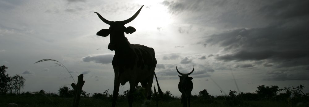
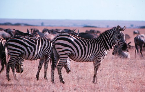
The project brought together scientists from national and international institutes to find ways to halt the spread of the diseases that affect Napier grass – an important feed source for dairy cattle in the region.

The project aimed to determine the extent of the disease problem in areas where smallholder dairy is important, to collect Napier grass clones that farmers select as more resistant to the diseases and to identify best management practices used by farmers to reduce the impact of the diseases.

With the vision and financial support of ASARECA, this project has characterized Napier grass clones, developed diagnostic techniques for use in the region, and formed local partnerships to share information and management practices.

During the two day meeting, participants set out different approaches to fight the disease. One is to identify other alternative forage species.

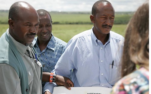
“Before we were growing Guatemala grass, says Peter Ddaki, workshop participant and farmer in Kitenga, Uganda. It was less tasty and hard to cut but we could go back to it because if this disease is not fought, we go to poverty”. “It is true violence to me”, he adds. “From my cows, I have three things: urine, milk and manure. Well, they have all reduced. My suggestion to researchers is to think about Guatemala grass or other forages in case Napier grass dies away.”

Jolly Kabirizi, senior researcher at the National Livestock Resources Research Institute (NaLIRRI) and project partner from Uganda is one of several researchers in the region looking more closely at other forages, such as the Brachiaria hybrid cv Mulato, and investigating feeding with crop residues. Jean Hanson, ILRI Forage diversity team leader, explains: “In this project we made the choice to focus on Napier grass and looked for a disease resistant variety of the same species because it is very difficult to find anything as productive as Napier and for farmers to change to other grasses for cut and carry systems. Guatemala grass does not have the same palatability as Napier grass, and Brachiara Mulato produces less biomass. We also carried on with research on Napier because its dissemination with cuttings is much easier than with the other grasses.”

Another approach is to raise awareness among farmers. Presentations showed that in the districts where the diseases were studied, over 80% of the farmers are now aware of the disease symptoms and adopt recommended best management practices. The incidence and severity of stunt especially, is really dropping (decline of 20 to 40% in Uganda and Kenya, more in Tanzania where it is an emerging disease) even though there is still a need to raise awareness to avoid spreading the disease. As Peter Ddaki puts it “don’t leave supervision of your garden to children or people who don’t know about the disease; use clean material when planting, or stunt will wipe out your entire crop.”

In Uganda, manure application seems to be the most effective control measure as it reduces Napier stunt incidence but also improves fodder yield. Similarly, in Tanzania and Kenya, a critical research area is the development of Integrated Pest Management.

A third approach is to look at the causes of the diseases and find ways to control the vectors or to breed disease-resistant grasses. Scientists from the International Centre of Insect Physiology and Ecology (ICIPE), Charles Midega and Evans Obura explained the importance of analyzing the biology of the disease and its vector. “Kenya is so far the only country where we identified a leafhopper vector (Maiestas (=Recilia) banda) transmitting Napier stunt disease”, says Evans Obura, Doctoral research fellow with ICIPE, “there could be other insects. We are at the moment working on identifying a phytoplasma (cause of the disease) resistant Napier grass cultivar and also studying the genetic diversity of Recilia banda in eastern Africa.”

But as Charles Midega pointed out: “if the resistant variety has high levels of resistance to the vector, where will the vector move to in the future? Food crops? And will food crops such as maize and millet be susceptible to phytoplasma?” This scary thought triggered numerous comments in the discussions.

On a positive note, Margaret Mulaa, senior researcher at the Kenya Agricultural Research Institute (KARI), has identified 28 clones that are not showing symptoms and appear disease resistant in the field in an area of high stunt incidence. These still need to be tested by farmers to confirm their yields and disease resistance before further distribution.

Fishbowl session at the Napier Grass diseases workshop 
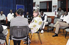
Besides presentations, the workshop used participatory methods such as Fish Bowls and World cafes to encourage discussions. Facilitated with brio by Julius Nyangaga and Nadia Manning-Thomas, these lively sessions were sometimes new to participants and much appreciated. They particularly helped the project team interact with decision makers and regional stakeholders.

It was clear from the group discussions that the project created awareness, trained scientists, mentored graduate students, plus identified materials and set up efficient networks.

Alexandra Jorge, Coordinator of the Global Public Goods Project, commented on the progress made in the three year project: “It is amazing to see the amount of knowledge people have accumulated when you compare the first meeting I attended in 2007 and this one! I also notice the ownership and commitment participants feel about their work” and she adds “I was impressed with how much people involved did at all levels in only three years…”

In her closing remarks, Sarah Mubiru from ASARECA shared a story illustrating the power of collaboration: In her story, a man brought to God asks to see Hell and Heaven. In Hell, people have bowls of soup but spoons that are too long to drink with or eat from. In Heaven, people with the same bowls and long spoons feed each other. The first results in chaos, the second in harmony.

She said that ASARECA similarly prides itself on its partnerships, carrying out fruitful partner-based research that improves livelihoods. ASARECA funds projects that “work locally” and have regional impact through linkages and dissemination.

She concluded that this project has achieved that goal with strong national teams addressing local issues, working together across the region to support each other and using the website to make the project results available world wide.

These sentiments were reflected by ILRI Theme Director Shirley Tarawali: “The strong collaborative nature of this project will hopefully last after the end of the project”.

More:

View presentations, posters, reports and outputs from the workshop and the project

Read an article by Nadia Manning-Thomas on the knowledge sharing processes used in the workshop

Visit the project website

View photos from the workshop

Farming extensively: A ‘third way’ for agriculture?

Joyce Ledson

Not to be missed is an inspired, and inspiring, 20-minute TED Talk by one of America's most famous cooks, New York's Dan Barber.

How I Fell in Love with a Fish is a presentation not for the 'self-righteous goody-two-shoes foodie,' says Barber (although he immediately confesses that, as a passionate chef and environmentalist, he is one). Rather, this is an instructive tale of how he fell out of love with one fish and into love with another, and the reasons for that, plus much else about our food systems.

His second (fishy) love affair takes place in Veta La Palma, a 27,000-acre totally self-sustaining fish farm in southwestern Spain that had formerly been a beef ranch and before that a wetlands. The owners of this fish farm reflooded the land, restoring the wetlands ecosystem, and began operating in radically sustainable ways. This farm doesn't feed its animals (fish); it measures its success not by how much fish it produces but rather by the health of its predators (birds); and, as a spill-over benefit, it serves the region as a water purification plant.

This fish farm / love story is, says Barber, a recipe for the future of good food. 'What we need,' says Barber, 'is a radically new conception of agriculture, one in which the food actually tastes good.'

Jacobo Filiasi

And for those of you who may be wondering about where he stands on global food security, Barber does get to the question (which he admits he 'doesn't love'): 'But how we can feed the world'.

'Our current agro-business business plan is one in liquidation,' he cautions, because it is a business 'that is quickly eroding the ecological capital that makes that very production possible. . . . Our breadbaskets are threatened today not because of diminishing supply but because of diminishing resources.'

Barber answers the question 'How can we feed the world' with another, 'How can we create conditions for every community feeding itself?'

Elestina Kamponza

He answers, 'To do that, don't look at the agro-business model for the future. It's really old and its tired. It's high on capital, chemistry and machines. And it's never produced anything really good to eat. Look to farms that restore instead of deplete. Farms that farm extensively instead of just intensively. Farmers that are not just producers but are experts in relationships.'

To that end, we might look to many of the world's billion-plus small-scale farmers in developing countries who are ambitious to practice neither the unhealthy factory-farming of the rich nor the grinding subsistence farming of the poor.

Saulosi Tchinga

This is what scientists at the International Livestock Research Institute (ILRI) and its research, development and agricultural partners are calling a 'third way' for the future of animal agriculture and mixed crop-and-livestock farming. This is an agriculture that would manage to feed the world while helping the world's 'bottom billion' climb out of hunger and poverty. Such a 'third way' of agriculture would feed both human nutrition and ambition in ways that build their livestock and other assets while conserving, not merely extracting, the Earth's remaining, land, water, air and other natural resources.

Demetria Solomon

More . . . ('No simple solutions to livestock and climate change', opinion piece by ILRI Director General Carlos Seré published in SciDevNet, 10 November 2009)

Serengeti surely SHALL die if a proposed highway bisects its northern wilderness—and if its human neighbours remain poverty-stricken

Zebra and wildebeest in the Masai Mara Game Reserve

Zebra and wildebeest in Kenya’s Masai Mara Game Reserve (photo credit: ILRI/Elsworth).

The New York Times and other media are reporting this week that one of the greatest wildlife spectacles on earth—the annual migration of nearly 2 million wildebeest and zebra from the drying savannas of the Serengeti, in Tanzania, to the wetter, greener, pastures of Kenya’s adjacent Masai Mara, and back again—is threatened by a proposed new national transit road for northern Tanzania that would cut right across the migration route of these vast herds of ungulates, likely leading to the collapse of this migration and possibly the crash of this ecosystem as a whole.

Kenya’s Masai Mara is the only year-round water source in the Greater Serengeti, and thus serves as critical dry-season grazing grounds for these vast herds of big mammals.

Just one of the problems such a road would bring is a greater disease burden to people, livestock and wildlife alike. In her extensive and useful research notes to her recent article, ‘Road Kill in the Serengeti’, in the New York Times, Olivia Judson refers readers to a scientific paper written by Eric Fevre, of the Zoonotic and Emerging Diseases research group at the University of Edinburgh, now based at the International Livestock Research Institute (ILRI) in Kenya while working on a 3-year human-animal disease research project in Busia District. Fevre describes the spread of animal diseases through animal transportation in his article, ‘Animal movements and the spread of infectious diseases’ (Trends in Microbiology, 2006).

Perhaps just in time, just this month former ILRI ecologist Robin Reid, now director of the Center for Collaborative Conservation at Colorado State University, in Fort Collins, USA, began a project in Kenya that is putting radio collars on wildebeest to learn more precisely what routes the animals take in their migration. This project’s members are involving Maasai schoolchildren, who are naming the wildebeest, which they will then be able to follow. The wildebeest collars send regular tracking signals to Safaricom, which are then sent to Colorado, where the routes are posted on a web map that the schoolchildren can follow.

This year’s annual wildebeest migration has already begun. Herds are reported to have crossed the common border of Kenya/Tanzania from Northern Serengeti into Masai Mara, about 4 days ago. ‘What has been unusual about this year’s migration,’ says Paul Kirui, in the Masai Mara, ‘is that the main migration from the south arrived in the Mara early ahead of the Loita herds—the Kenyan resident herds of wildebeest—which usually migrate into the Mara from the east of the park. Normally when we start seeing them move into the park, it is a sign that the main migration from the south is on the way.’

The first population of wildebeest that Reid’s team darted and then tagged with radio collars in the Mara is the Loita group that remains resident in Kenya all year round. Or so the researchers think. The radio collars, now fixed on the first 15 wildebeest, have already started to report back and will be letting scientists, and those schoolchildren, know just where they go, and when.

Reid’s return gave ILRI cause to revisit two remarkable films about her ILRI research in the Mara. Counting in a Disappearing Land (ILRI, 11 minutes, 2007) describes Reid’s project with a Maasai community that has traditionally herded their livestock in Kenya’s wildlife-rich Masai Mara region. This ILRI project was looking to find ways of balancing the needs of people, lands and wildlife. In The Great Migration (CBS ’60 Minutes’, 15 minutes, October 2009), Scott Pelley interviews Reid about the threats to this natural spectacle and the part local Masai are playing to address these threats.

Collaborative conservation may indeed be the answer to saving the Serengeti ecosystem. Protecting majestic wild places and the wildlife they support, places that instill wonder in us, matters, of course, but so does protecting millions of people from severe poverty, chronic hunger and the afflictions that come in their wake: disease and untimely death.

With a large percentage of its land area under protection, Tanzania is a world leader in biodiversity conservation. It is also very, very poor. How this tug at resources—whether the Serengeti Plains will be used for wildlife tourism or other kinds of commerce—will play out may depend on how much the local communities living in poverty near the wildlife benefit from saving this, the last of the great migrations of big mammals on Earth.

More . . . (New York Times, 15 June 2010)

An alternative, southern road in Tanzania is discussed on a webpage of the Frankfurt Zoological Society.

See Paul Kirui’s blog on 17 June 2010 the migration on Masai Mara Updates.

Location, location, location: Geographic techies explore ways of navigating a better future

If, as the popular science saying goes, we can understand only what we can measure, what shall we say about what we can locate on a map? Is that, too, a foundation for real understanding, or is mapping more like taxonomy, more critical to scientific knowledge (categorization) than to scientific understanding (causation)?

A group of some 80 international and developing-country experts in the use of geographical information systems (GIS), remote sensing and other high-tech tools developed in the field of what was once innocently called ‘geography’ met in Nairobi last week (8–12 June 2010) to see if they couldn’t, by working together better, speed work to reduce world poverty, hunger and environmental degradation. (Oddly, this gathering of people all about ‘location’ tend to use a forest of acronyms — GIS, ArcGIA, CSI, ESRI, ICT-KM, AGCommons, CIARD, CGMap  — in which the casual visitor is likely to get lost.)

The participants at this meeting, called the ‘Africa Agricultural GIS Week’, aimed to find ways to offer more cohesive support to the international community that is working to help communities and nations climb out of poverty through sustainable agriculture.

The world’s big agricultural problems – too little food to feed the 6-plus and growing billions of people on the planet, too extractive (unsustainable) ways of producing food, too little new land left to put to food production, too few viable agricultural markets serving the poor, too high food prices for the urban poor, too extreme and variable climates for sustaining rural agricultural livelihoods – appear to be fast closing in on us. Our global agricultural problems are of an increasingly connected and complex nature. Most experts agree that silver-bullet solutions are not the answer. We must tackle these problems holistically or, in the jargon of agricultural science, from a systems-based perspective.

And that, perhaps, is where these high-tech geographers can most help us navigate the future of small-scale food production.

VISH NENE, Director of the Biotechnology Theme

At the opening of this Week’s events, held at the Nairobi campus of the International Livestock Research Institute (ILRI), Vish Nene, a molecular biologist who directs ILRI’s Biotechnology Theme, spoke on behalf of ILRI’s director general, Carlos Seré, who was on mission travel abroad. Nene welcomed Kenya’s Assistant Minister of Agriculture and MP, Hon Japhet Mbiuki, who gave a keynote speech on behalf of Kenya’s Minister for Agriculture, Hon Dr Sally Kosgei.

Nene said that ILRI was particularly pleased to be hosting this meeting, as it has a long track record in the use of GIS in its research portfolio, having developed a GIS Unit first some 22 years ago and being a leader today in large-scale, fine-resolution, mapping of the intersection of small-scale livestock enterprises and global poverty.

An M.O. Notenbaert, Scientist, GIS Analyst, Targeting and Innovation

The second day of the Week, An Notenbaert, a GIS expert at ILRI, gave the participants an overview of what ILRI has been doing in the area of geospatial research, and what particular kinds of geospatial services and expertise ILRI could offer new ‘mega-programs’ of the Consultative Group on International Agricultural Research (CGIAR).

Notenbaert sketched two of ILRI’s research projects that require a ‘spatial’ foundation.

Protecting remote herders with their first drought-related livestock insurance

The first ILRI project Notenbaert described is one that this year is piloting ‘index-based livestock insurance’ for remote Kenyan livestock herders. This project, she said, is all about managing risks in dry, harsh lands, where most people’s livelihoods still depend on livestock herding. Because traditional livestock insurance is impractical for the dispersed herding populations of Kenya’s northern frontier, ILRI researchers initiated a study on the feasibility of using information not about the number of livestock deaths in droughts over the years, but rather an indicator associated with such drought-related animal deaths. ‘We are using satellite images of vegetation of the region to come up with a livestock mortality index,’ she said. ‘This is quite a neat application of remote sensing data.’

The pilot project was launched in Kenya’s Marsabit District in January 2010. Livestock owners in the district have bought insurance premiums that will pay out not when their animals die (which would require a logistically complex and expensive procedure to verify animal deaths), but rather when satellite images show that livestock forage has dipped below a predetermined threshold, with the likely result of many animals dying.

Down-scaling climate projections for more useful information for policymakers

The second ILRI project Notenbaert described to the assembled group of spatial experts is working to make more local, and thus more useful, assessments of the impacts of climate change on poor communities in the tropics.

Little information, for example, is available on climate change in East Africa, whether at country or local levels. While a projected increase in rainfall in East Africa to 2080, extending into the Horn of Africa, is robust across the ensemble of Global Circulation Models available, other work suggests that climate models have probably underestimated the warming impacts of the Indian Ocean and thus may well be over-estimating rainfall in East Africa during the present century.

In 2006, ILRI researchers estimated changes in aggregate monthly values for temperature and precipitation. Possible future long-term monthly climate normals for rainfall, daily temperature and daily temperature diurnal range were derived by down-scaling the outputs of Global Circulation Models to WorldClim v1.3 climate grids at a resolution of 18 square kilometres. Outputs from several Global Circulation Models and scenarios made by the Special Report on Emissions Scenarios (Intergovernmental Panel on Climate Change, 2000) were used to derive climate normals for 2000, 2005, 2010, 2015, 2020, 2025 and 2030 using the down-scaling methodology described in 2003 by ILRI researchers. Although the figures derived for Kenya correspond with findings of long-term wetting, the ILRI researchers also found the regional variations in precipitation to be large, with the coastal region likely to become drier, for example, while Kenya’s highlands and northern frontier are likely to become wetter.

For more information, see:

Africa Agriculture GIS Week

Index-based Livestock Insurance

Climate Projection Data Download

AGCommons: Location-specific information services for agriculture

Coherence in Information for Agricultural Research for Development

Participatory land-use planning empowers the pastoral community of Kenya’s Kitengela Maasailand

ILRI scientist David Nkedianye (left) and chairman of innovation land lease program Ogeli Ole Makui (right) discuss fencing issues in Kitengela.

Two Maasai from the Kitengela rangelands near Nairobi—David Nkedianye (left), an ILRI research fellow studying for his PhD, and Ogeli ole Makui (right), a participant in ILRI research—discuss a land-use planning map they have created with ILRI that will help the Maasai community in Kitengela to conserve both their pastoral ways of life and the wildlife that share their rangelands (photo credit: ILRI/Mann).

In the beautiful, picturesque and wildlife-rich Kitengela plains just outside of Kenya’s capital, Nairobi, a unique change is taking place among Maasai livestock keepers, who have roamed these plains with their herds of cattle, sheep and goats for generations.

This change is shaping lives as well as livelihoods. James Turere Leparan is a traditional Maasai elder and herder who has watched this change take place in the last few years.

It all began when a group of scientists from the International Livestock Research Institute (ILRI) began a study in the area in 2003. ‘A group of people came to talk to us about our land’ he says. ‘They said they wanted to help us improve our livestock by helping us deal with the problems we were facing of conflict with wildlife and how best to deal with the division of what once was communal land. They began to meet with us in order to help us change the situation.’ At that time, human-wildlife conflicts between the Maasai people and wild animals from the adjacent Nairobi National Park were common. These conflicts stemmed from the fencing off of what were once communal lands. Such fencing had restricted, and in some cases blocked, animal migratory routes leading to greater conflicts between humans and animals. No less that 50 community meetings were held during the project.

At the time, ILRI planned to map out the Kitengela rangelands to find out how the sub-division of communal lands into private plots and subsequent fencing had affected herders and livestock productivity in the area. The mapping initiated by ILRI and the Kitengela community sought ways the community could best use the land for both domestic and wild animal enterprises.

‘One of the most important considerations we had in the project was to come up with solutions that would not compromise the wildlife migratory routes while also helping to improve Maasai livestock herding,’ says Mohammed Said, a scientist at ILRI and one of the leaders of the project. ‘We explored various innovative ways of helping the Kitengela community best use their land for both livestock and wildlife,’ he adds.

Most of the mapping was started by ILRI’s Mohammed and Shem Chege who are graduates of the faculty of Geo-information and Earth Observation (ITC) of the University of Twente in Netherlands. In partnership with the Africa Wildlife Foundation and the local community, ILRI extended a process of mapping using geographic information systems (GIS) technology to record spatial information about the Kitengela rangelands. Community members were trained in the use of global position satellite (GPS) devises to map the locations of fences, water sources, roads and open pasture land.

‘We soon realized that the local community had a lot of spatial knowledge,’ says Said. ‘They accurately collected spatial data about their land without the use of topographical maps, mostly by using physical features such as rivers. Their data were very accurate.’ ‘The decision to involve the community is one of the key strengths of this project,’ Said added. ‘We trained over 20 community members on how to use GPS equipment and systems to collect information that was then compiled. This built local ownership. The community realized that their contribution was just as important as that of the researchers.’

In 2001 a conservation group called Friends of the Nairobi National Park pioneered a land-leasing scheme that would pay livestock herders three times a year not to fence and develop their land, which would allow wildlife to move easily back and forth from Nairobi National Park within a Kitengela ‘corridor’. This scheme received support from the Africa Wildlife Foundation.

Soon after this, the project members identified the urgent need to develop a land-use ‘master plan’ for Kitengela to ensure that the lease program would succeed. David Nkedianye, a Kitengela Maasai who recently obtained his doctorate through his research at ILRI, said that for the program to succeed, ‘We needed to organize how we used the land. This prompted us to include in our research a project to map the lands in Kitengela that were fenced and unfenced. With this map, we could see where we needed to keep lands open for livestock and wildlife movements.’ This collection of spatial information and participatory land-use planning in Kitengela has produced some unique successes.

Now, four years after the start of this participatory mapping project, conducted with the help of geographic information systems, some 2000 sq km of the Kitengela plains have been mapped. These maps and other outputs of the project have been shared with the local herders and farmers. The local county council of Olkejuado has adopted the projects findings and maps.

The Council will use these to guide future land use in Kitengela’s wildlife-rich rangelands. A scheme to pay the local herders and farmers to keep their land open has been established. Such herders and farmers get US$4 for every acre of unfenced land. More than 30,000 acres of land are now under lease in this scheme and it is expected that this will double by the end of the year. The community is earning about US$120,000 each year from their land conservation efforts.

Other efforts in the Mara, such as those to develop community ‘wildlife conservancies’ have earned the Maasai community more than US$2 million. The availability of distribution maps of different species of animals, including livestock, now enables farmers to conduct their own ground counts of animals in the rangelands without having to use expensive methods such as aerial counts.

Since 2004, the rangeland maps have been updated to identify new and emerging threats that affect livestock keepers and herders. The community of Kitengela is now combining state-of-the-art geospatial information with local knowledge and experiences to better maintain their ecosystem while also benefiting economically from protecting the wildlife that co-exists with them. The greater income gained by James Turere and hundreds of others is bettering the lives of families and meeting their basic needs such as food and education. A major victory of this project has been its ability to influence land policy. Four months ago, the Kenya Government approved the Kitengela land-use map built by the local community, ILRI, the African Wildlife Foundation and other stakeholders.

The experiences and lessons of this project are now being applied elsewhere. One of the partners in the project is piloting a similar model to map land use in the Maasai Mara Game Reserve. A project in Tanzania conducted with ILRI and the United Nations Food and Agriculture Organisation is encouraging local people to map their own land for better management of their livestock and wildlife resources. Said believes that more farming and herding communities should be trained to use geospatial technologies. He is optimistic that the lessons from this project will have lasting benefits on the region’s livestock sectors as well as on the people of Kitengela.

The findings of the participatory land-use planning project in Kitengela are among many experiences of using geospatial information to support African farmers that were shared during an African Agriculture Geospatial Week that took place at ILRI’s campus in Nairobi last week, 8–13 June 2010.

More information about how geographic information systems are being adopted by the Consultative Group on International Agriculture Research (CGIAR) can be found here. You can also see the proceedings from the conference on Twitter #aagw10.

Kenya’s agriculture minister opens Africa Agriculture Geospatial Week and calls for efforts to take geospatial information to the ‘last mile’

Hon Japhet Kareke Mbiuki Assistant Minister of Agriculture, Kenya

The 2nd ‘Africa Agriculture Geospatial Week’ opened this week at the International Livestock Research Institute (ILRI) campus in Nairobi. While addressing the participants, Kenya’s minister for agriculture, Hon Dr Sally Kosgei, challenged researchers to ‘discuss steps towards the development of delivery mechanisms for making geospatial information accessible to poor smallholders in the villages across sub-Saharan Africa.’

In a speech read on her behalf by Hon Japhet Mbiuki, Kenya’s assistant minister for agriculture, during the official opening of the conference on Wednesday, 9 June 2010, Dr Kosgei noted that geospatial information can help provide ‘relevant and timely agricultural information that will assist smallholder farmers in the continent in their bid to improve agricultural production’.

While acknowledging that Africa still faces the threat of food insecurity, the minister highlighted the need to help farmers produce enough to feed their nations’ people and to create economic opportunities. She particularly emphasized the need to ‘provide seed technologies, explain the appropriate use of fertilization, share techniques to manage land effectively and to create a strong post-harvest infrastructure to help farmers increase their income’.  However, she said that such initiatives ‘will only benefit farmers and producers in general if they are appropriately targeted and if farmers are given easy access to relevant information through appropriate technology transfer mechanisms.’

Dr Kosgei highlighted the critical role geospatial information plays in enabling good decision-making throughout the agriculture sector by providing essential location-specific information. ‘Farmers need early information systems to mitigate the effects of extreme climatic events,’ she said. ‘They need to know which crops are best suited to their land, how to minimize the threats posed by pests and diseases and where to go to sell their products.’

She added that real-time, location-specific (geospatial) information will enable farmers to decide more effectively ‘which crops or livestock will perform best on their farms, anticipate and manage disease outbreaks and rainfall shortfalls, as well as decide when to harvest and in which markets to sell their produce’.

In view of the valuable contribution that geospatial information can make to farming systems and practice in Africa, she challenged participants to find ways of moving geospatial technology from a research-based platform to one that takes such technologies to the ‘last mile’ and makes them accessible to farmers who need this information the most.

She commended the organizers of the conference, which include AGCommons and the Consortium for Spatial Information (CIS) of the Consultative Group on International Agricultural Research (CGIAR), for their work towards providing farmers with location-specific information to strengthen agricultural production.

Over 60 organizations, 13 CGIAR partners and 30 students from universities in Kenya have gathered to explore how location-specific intelligence can be used to support agricultural production. This year’s meeting focused on ‘Navigating the change: Highlighting the role of spatial information and analysis in transforming livelihoods and landscapes in a time of change’.

Laban MacOpiyo, the director of AGCommons, says that his organization will use the ideas and lessons shared at the conference in ‘a repository of geospatial information that is easily accessible to farmers in Africa’. More information about the work of AGCommons in using geospatial information can be found here.

This year’s conference is funded by HarvestChoice, AGCommons, and the Information, Communication and Technology–Knowledge Management (ICT-KM) program of CGIAR, among other partners, and follows a similar conference held last year at ILRI. At both conferences, participants shared experiences in using geographical information systems (GIS) for agricultural development and learned from each other’s good practices.

Africa Agriculture Geospatial Week ‘navigates change’ in Nairobi this week

ILRI_MappingPovertyLivestockInDevelopingWorld_Map16b

The Africa-based International Livestock Research Institute (ILRI) this week is hosting the 2nd Africa Agriculture Geospacial Week (AAGW) on its Nairobi campus.

The five-day event—Taking a closer look at the role of spatial information and analysis in supporting improved agricultural research and development—provides a platform for sharing ideas and knowledge on the use of geographical information systems (GIS) for agricultural development.

Meetings such as the Africa Agriculture Geospatial Week help spatial  groups of all kinds to share lessons from new research and extend the reach and benefits of GIS. ILRI and other centres of the Consultative Group on International Agricultural Research (CGIAR) have been at the forefront of programs that use GIS to help farmers and herders in the developing world make more efficient use of their land and animal resources.

This year’s meeting—Navigating the change: Taking a closer look at the role of spatial information and analysis in supporting improved agricultural research and development—takes the form of a ‘GIS ShareFair’, complete with a marketplace of exhibitors and training sessions provided by ESRi, a world leader in GIS software and technology, Google, and OpenStreetMap, which provides free geographic data.

The event includes the annual meeting of the CGIAR Consortium for Spatial Information, where scientists present the results of their work. It also will launch an AGCommons service bureau and host the third gathering of WhereCampAfrica, ‘a free “unconference” for geogeographers, mobile location experts and social cartographers and all kinds of folks interested in place.’ The first WhereCampAfrica was also held at ILRI’s Nairobi campus in 2009.

In addition, a full day of the program is dedicated to presentations of new and innovative ideas by researchers, professionals and students. Awards will be given for first-time presenters (including students and young professionals), most innovative idea, most innovative medium for presentation delivery and overall best presentation.

Jointly organized by the CGIAR Consortium for Spatial Information, the CGIAR Harvest Choice program and the Agricultural Geospatial Commons (AG Commons) Program, led by the CGIAR in partnership with Spatial Development International, this week’s meeting targets professionals, researchers and students in agriculture who will come together to learn from experts in the field, share experiences and network.

http://africaagriculturegisweek.org/

Follow the week’s proceedings on Twitter #aagw10

Livestock goods and bads: Filmed highlights of ILRI’s 2010 Annual Program Meeting

At the 2010 Annual Program Meeting (APM) of the International Livestock Research Institute (ILRI), held in April in Addis Ababa, Ethiopia, several hundred participants debated and discussed the challenges facing the global livestock industry. ILRI and its partners are investigating ways to promote smallholder participation in livestock markets, more sustainable ways for livestock keepers to use natural resources, and ways to improve livestock pathways out of poverty.

Some of the presentations made during the meeting on the theme of 'Livestock: the Good, the Bad and the Gaps' were captured on film. We share three of those below.

The first film is a presentation by ILRI agricultural systems analyst Mario Herrero on the important place of livestock for smallholder farmers in developing economies. Herrero highlights the many benefits livestock bring to the rural poor and argues that the rapidly expanding sector will need to be better managed and to reduce the environmental risks it poses if it is to continue to be productive. Herrero argues for an integrated assessment of the effects of the global livestock industry on various agro-ecosystems important to the poor.

In the second film, ILRI veterinary and food safety researcher Delia Grace discusses the human health risks associated with livestock keeping. Grace notes that zoonotic diseases (those transmitted between animals and people) and emerging infectious diseases (such as bird flu) are two of the well-known risks associated with livestock. But she says that animals provide a means of regulating diseases because they can serve as sentinels that lets communities and public health officials know of disease outbreaks before the diseases can affect humans. She makes the case for more research to address the many common misconceptions that exist about livestock and human health.

In the third film, Narayan Hedge, of India's BAIF Development Research Foundation, highlights the important role livestock play in providing a livelihood for nearly 700 million people in India. He makes an appeal for better livestock technologies, better infrastructure, and more efficient management of the industry so that more smallholder farmers can use livestock to escape poverty.

Busy in Edinburgh: News from climate and systems scientist Phil Thornton

Philip Thornton at Climate Meeting in Copenhagen 2009

Philip Thornton, an agricultural systems analyst specializing in climate change and pro-poor livestock research for development issues, has worked for 14 years as a senior scientist and program leader at the Africa-based International Livestock Research Institute (ILRI). For the last 8 years, he has served ILRI as a consultant from his home in Edinburgh.

This year, Thornton was appointed leader of a research theme of a new challenge program of the Consultative Group on International Agricultural Research (CGIAR) called 'Climate Change, Agriculture and Food Security'. This CGIAR challenge program is likely this year to be transformed into one of the CGIAR's new 'mega programs'. His theme is titled 'Diagnosing vulnerability and analyzing opportunities'. Thornton will split his time equally between this new CGIAR climate change initiative and ILRI research on livestock pathways out of poverty.

As reported in the Winter 2009 issue of Agriculture for Development, the Tropical Agriculture Association last year bestowed on Thornton 'Development Agriculturist of the Year' Award 'in recognition of his contribution to international agricultural development through greater understanding of tropical agricultural systems'. The Association highlighted Thornton's prodigious work that has inform policies addressing climate change, land use and poverty alleviation.

In the current, Spring 2010, issue of Agriculture for Development, Thornton has published an article on 'Climate change and livestock keepers in developing countries: What are the prospects?'.  The paper presents examples of possible impacts on livelihoods in sub-Saharan Africa 'of long-term changes in climate, and then of possible impacts of short-term changes in climate variability.' For example, Thornton reports that research indicates that 'there are widespread parts of the continent that are currently classified as mixed crop-livestock rainfed arid-semiarid systems, in which cropping is possible but may well not be in 2050'.

'All in all', writes Thornton, 'the coming decades are likely to see substantial shifts in the patterns of African cropping and livestock keeping.' The paper concludes with a summary of options for dealing with these types of changes in future.

Examples: 'Helping livestock keepers understand and deal with current levels of climate variability can provide one entry point to the problems posed by increasing variability in the future and to the options that may be needed to deal with it. For example, weather information can be used to assist rural communities in managing the risks associated with rainfall variability, and can also feed into livestock insurance schemes that are weather-indexed: policyholders are paid in response to trigger events such as abnormal rainfall or high local animal mortality rates. An index insurance scheme based on satellite imagery is currently being piloted in several areas of drought-prone northern Kenya. It may also be possible for livestock keepers to change the mix of livestock species and/or breeds that they keep, a strategy that has been practised in the past by some pastoralists in East and West Africa, for example. Longer term approaches to adaptation are also needed.'

Thornton is also an Honourary Fellow in the College of Science and Engineering at the University of Edinburgh and Editor-in-Chief of the scientific journal Agricultural Systems.